MyTopo
Trinity Alabama US Topo Map
Couldn't load pickup availability
Also explore the Trinity Forest Service Topo of this same quad for updated USFS data
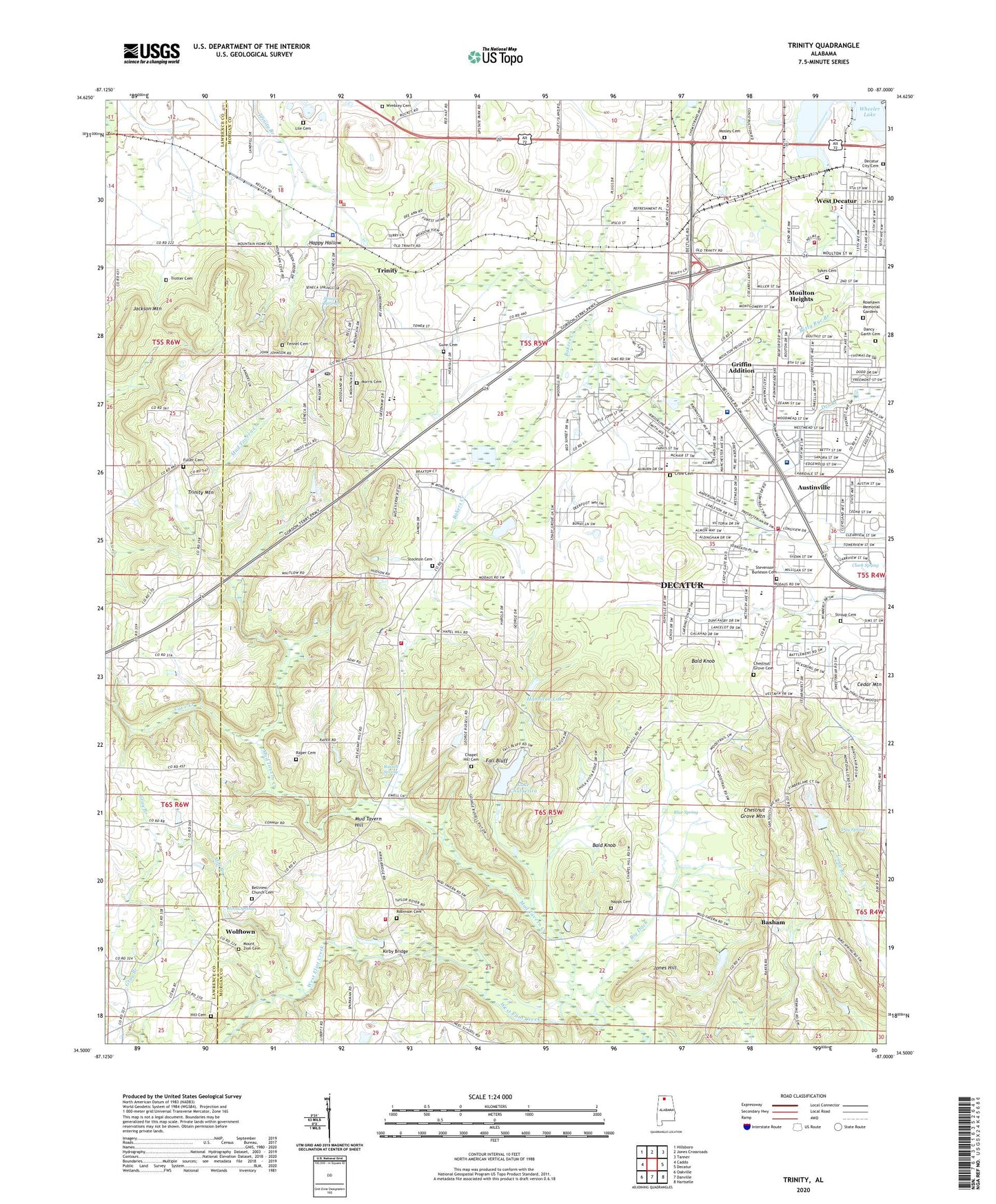
2024 topographic map quadrangle Trinity in the state of Alabama. Scale: 1:24000. Based on the newly updated USGS 7.5' US Topo map series, this map is in the following counties: Morgan, Lawrence. The map contains contour data, water features, and other items you are used to seeing on USGS maps, but also has updated roads and other features. This is the next generation of topographic maps. Printed on high-quality waterproof paper with UV fade-resistant inks.
Quads adjacent to this one:
West: Caddo
Northwest: Hillsboro
North: Jones Crossroads
Northeast: Tanner
East: Decatur
Southeast: Hartselle
South: Danville
Southwest: Oakville
This map covers the same area as the classic USGS quad with code o34087e1.
Contains the following named places: Austin High School, Austinville, Austinville Church of Christ, Austinville Church of God, Austinville Methodist Church, Bakers Creek, Bald Knob, Basham, Basham Chapel Methodist Church, Bears Ham School, Bellview Church, Beltline Mall Shopping Center, Beltline Plaza Shopping Center, Betty Rye Branch, Big Ditch, Blue Spring, Brookhaven Baptist Church, Brookhaven Church, C B S Trailer Court, Calvary Baptist Church, Calvary Christian Academy, Cave Creek, Cedar Mountain, Cedar Ridge Golf Course, Chapel Hill Cemetery, Chapel Hill Methodist Church, Chestnut Grove Cemetery, Chestnut Grove Church, Chestnut Grove Mountain, Christian Dells Bible Camp, Clark Spring, Clark Spring Fish Hatchery, County Line Church, Cow Ford, Crow Cemetery, Curtis Well, Dancy - Garth Cemetery, Dancy Chapel, Day Spring, Decatur City Cemetery, Decatur Division, Decatur Fire and Rescue Station 5, Decatur Fire and Rescue Station 7, Decatur General West Hospital, Decatur Municipal Landing Field, Emmanuel Baptist Church, Fall Bluff, Fellowship Church, Fennel Cemetery, Fuller Cemetery, Glendale Farms, Griffin Addition, Gunn Cemetery, Hamilton Lake, Happy Hollow, Heritage Estates, Hill Cemetery, Hood Spring, Jackson Mountain, Jones Hill, Kirby Bridge, Lake Chulavista, Lake Chulavista Dam, Lakeshore Marina, Lile Cemetery Number 2, Love Chapel, Macedonia Baptist Church, Means School, Mill Branch, Morris Cemetery, Mosley Cemetery, Moulton Heights, Moulton Heights Elementary School, Moulton Heights Junior High School, Mount Zion Cemetery, Mount Zion School, Mud Tavern Creek, Mud Tavern Hill, Mud Tavern Volunteer Fire and Rescue Station 2, Mud Tavern Volunteer Fire Rescue Station 1, Napps Cemetery, North Alabama Industrial Park, Old Moulton Road Baptist Church, Parkway Medical Center Hospital, Pleasant Hill Baptist Church, Pleasant Hill School, Raper Cemetery, Ratliff Industrial Park, Robinson Cemetery, Roselawn Memorial Gardens, Russell Spring, Seneca Springs, Shady Grove Church, Sherwood Estates, Simpson, Slab College School, Spring Hill Baptist Church, Stevenson - Burleson Cemetery, Stockton Cemetery, Stroup Cemetery, Summit School, Summitt Church, Sykes Cemetery, Thunderbird Drive-In, Town of Trinity, Tri-County Bible School, Trinity, Trinity Baptist Church, Trinity Fire Department Station 1, Trinity Fire Department Station 2, Trinity Methodist Church, Trinity Mountain, Trinity Police Department, Trinity Post Office, Trinity Quarry, Trinity School, Trotter Cemetery, Valley Stockyard, Walden Chapel, WBQM-FM (Decatur), WDRM-FM (Decatur), West Morgan High School, Westlawn Elementary School, Westmead Plaza Shopping Center, Westside Baptist Church, WHOS-AM (Decatur), Wimbley Cemetery, Wolftown, Woodmead Elementary School, ZIP Code: 35601


