MyTopo
Tanner Alabama US Topo Map
Couldn't load pickup availability
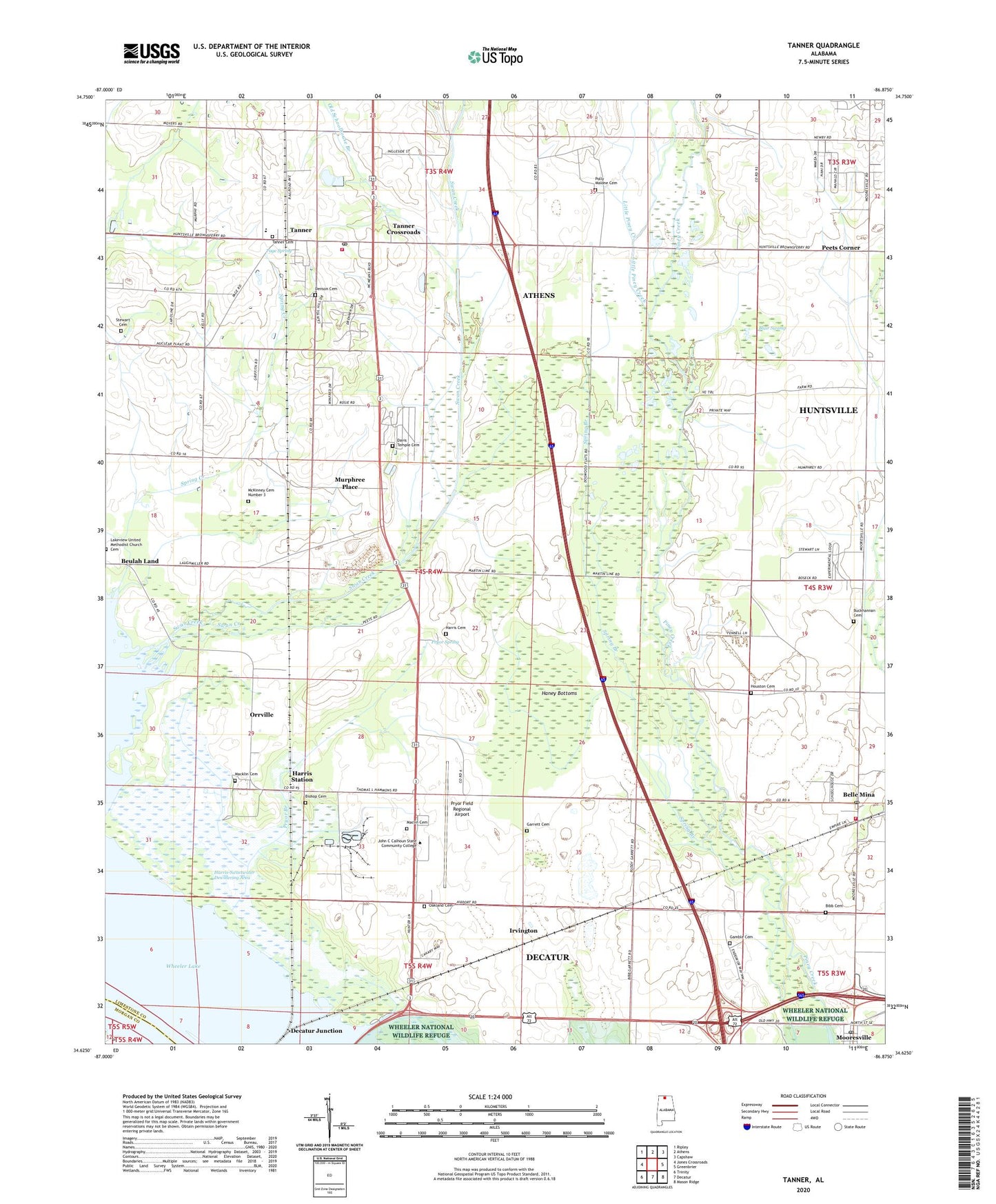
2024 topographic map quadrangle Tanner in the state of Alabama. Scale: 1:24000. Based on the newly updated USGS 7.5' US Topo map series, this map is in the following counties: Limestone, Morgan. The map contains contour data, water features, and other items you are used to seeing on USGS maps, but also has updated roads and other features. This is the next generation of topographic maps. Printed on high-quality waterproof paper with UV fade-resistant inks.
Quads adjacent to this one:
West: Jones Crossroads
Northwest: Ripley
North: Athens
Northeast: Capshaw
East: Greenbrier
Southeast: Mason Ridge
South: Decatur
Southwest: Trinity
This map covers the same area as the classic USGS quad with code o34086f8.
Contains the following named places: Anderson Plantation, Auburn Experimental Station, Belle Mina, Belle Mina Methodist Church, Belle Mina Post Office, Belmor Church, Bibb Cemetery, Blair Swamp, Blue Ridge School, Bright Hope Church, Bright Hope School, Davis Temple Baptist Church, Davis Temple Cemetery, Decatur Day Use Park, Decatur Junction, Dogwood Flats, Dogwood School, Flower Hill Farm, Gamble Cemetery, Garner, Garrett Cemetery, Haney Bottoms, Harris Cemetery, Harris School, Harris Station, Harris-Sweetwater Dewatering Area, Houston Cemetery, Irvington, Jerusalem Primitive Baptist Church, John C Calhoun State Community College, Little Piney Creek, Macklin Cemetery, Mooresville, Mooresville Church of Christ, Mooresville Post Office, Mooresville Union Church, Mooresville-Belle Mina School, Murphree Place, Nazaren Primeith Church, New Haven Church, New Hope Baptist Church, New Hopewell Church, New Zion Church, Oakland Cemetery, Oakland United Methodist Church, Old Schoolhouse Branch, OMNI Radio Tower, Orrville, Page Spring, Peets Corner, Polly Malone Cemetery, Pryor Branch, Pryor Chapel Baptist Church, Pryor Field Regional Airport, Pryor Spring, S and S Nurseries, Salem Church, Salem Corner, Solomons Temple, South Limestone Volunteer Fire Department, Southside Church of Christ, Spring Branch, Spring Creek, Stewart Cemetery, Stewarts Store, Swan Creek, Swan Creek Waterfowl Management Area, Sweetwater, Tanner, Tanner Cemetery, Tanner Church of Christ, Tanner Crossroads, Tanner First Baptist Church, Tanner First United Pentecostal Church, Tanner High School, Tanner Industrial Park, Tanner Methodist Church, Tanner Post Office, Tanner Volunteer Fire Department Station 1, Tanners Mill, The Church of Jesus Christ of Latter Day Saints, Town of Mooresville, Whiteside, ZIP Codes: 35615, 35671