
MyTopo
Knoxville Alabama US Topo Map
Couldn't load pickup availability
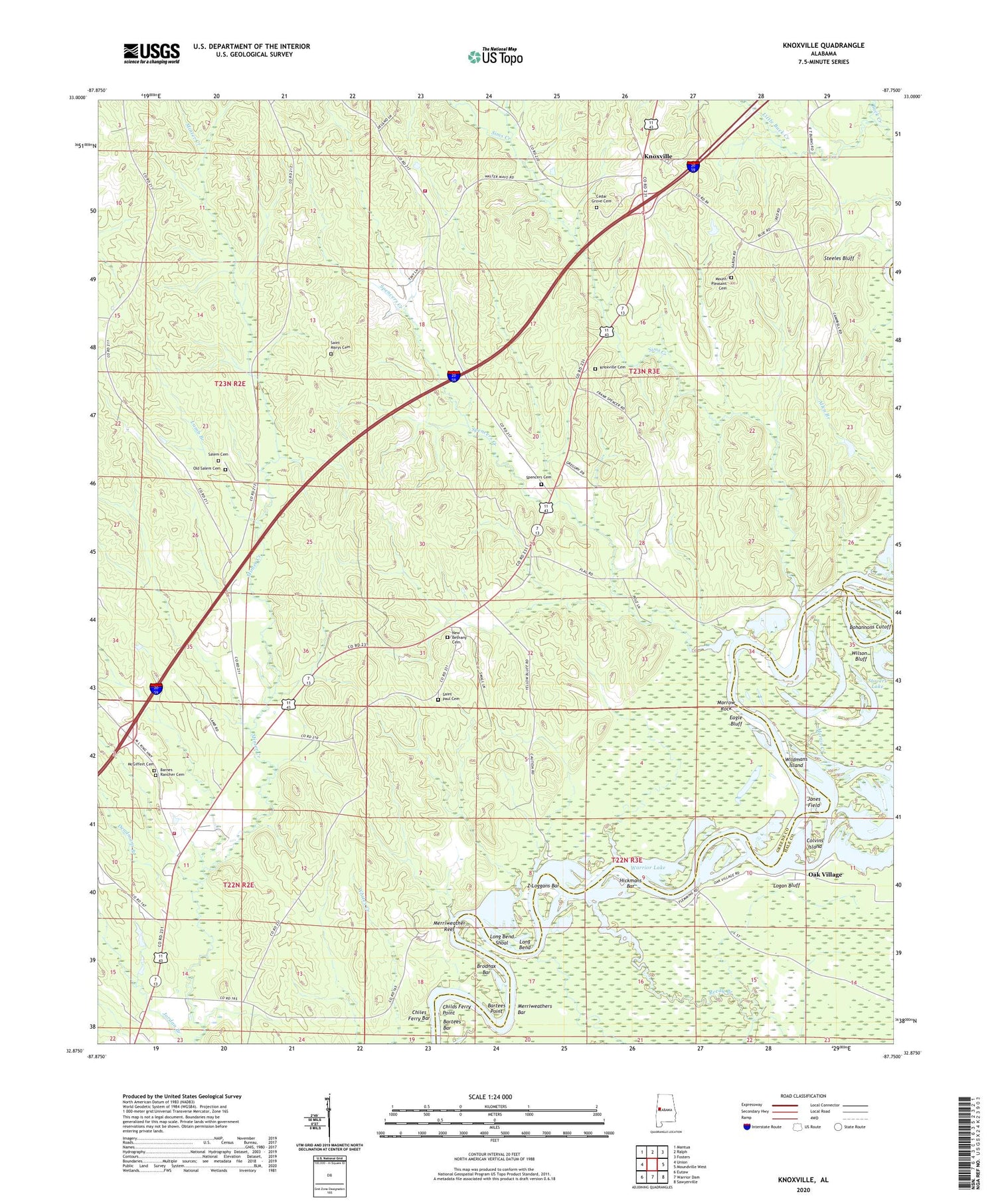
2024 topographic map quadrangle Knoxville in the state of Alabama. Scale: 1:24000. Based on the newly updated USGS 7.5' US Topo map series, this map is in the following counties: Greene, Hale. The map contains contour data, water features, and other items you are used to seeing on USGS maps, but also has updated roads and other features. This is the next generation of topographic maps. Printed on high-quality waterproof paper with UV fade-resistant inks.
Quads adjacent to this one:
West: Union
Northwest: Mantua
North: Ralph
Northeast: Fosters
East: Moundville West
Southeast: Sawyerville
South: Warrior Dam
Southwest: Eutaw
This map covers the same area as the classic USGS quad with code o32087h7.
Contains the following named places: Atkins Mill, Barnes Rancher Cemetery, Bartees Bar, Bartees Bluff Landing, Bartees Point, Belleview School, Bohannons Cutoff, Broadnax Landing, Brodnax Bar, Cedar Grove Baptist Church, Cedar Grove Cemetery, Childs Ferry Point, Chiles Ferry, Chiles Ferry Bar, Chiles Ferry Landing, Colvins Island, Deadmans Branch, Eagle Bluff, Eagle Bluff Landing, Fivemile Creek, Greenetrack, Gum School, Hamlin Branch, Hickmans Bar, Highway School, Jones Field, Knoxville, Knoxville Cemetery, Knoxville Plantation, Knoxville Volunteer Fire Department, Lamb Branch, Little Buck Creek, Lock Eight Public Use Area, Lock Number Eight, Logan Bluff, Long Bend, Long Bend Shoal, Martin Slough, Mayfield School, Mayos Mill, Mays Mill, McGiffert Cemetery, Merriweather Reef, Merriweathers Bar, Merriwethers Landing, Montgomery Recreation Center, Morrow Rock, Morrows Landing, Mount Pleasant Cemetery, Mount Pleasant Church, Mount Pleasant School, New Bethany Baptist Church, New Bethany Cemetery, New Hope Church, Oak Village, Old Salem Cemetery, Parhams Landing, Pine Grove School, Reedy Branch, Saint Marys Cemetery, Saint Marys Methodist Church, Saint Marys School, Saint Paul Cemetery, Saint Pauls Methodist Church, Salem Cemetery, Salem Methodist Church, Salem School, Sims Creek, Spencers Cemetery, Spencers Creek, Springfield, Springfield Church, Springfield School, Springfield Volunteer Fire Department, Starlight Baptist Church, Starlight School, Steeles Bluff, Storers Lake, Stovers Lake, Wildmans Island, Wilson Bluff, Yellow Bluff Landing, Z Loggans Bar, Z Loggans Landing, ZIP Code: 35469


