MyTopo
Sawyerville Alabama US Topo Map
Couldn't load pickup availability
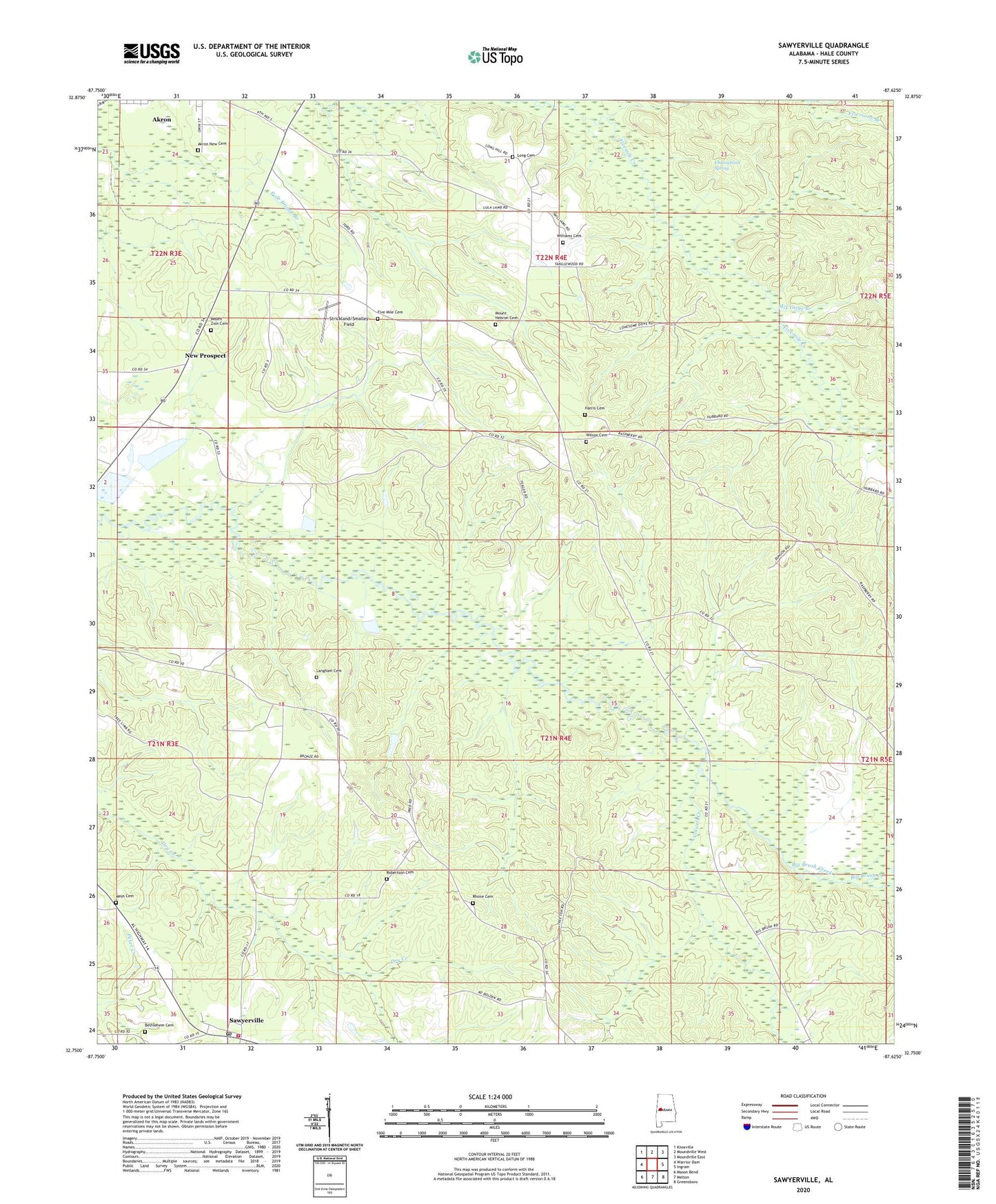
2024 topographic map quadrangle Sawyerville in the state of Alabama. Scale: 1:24000. Based on the newly updated USGS 7.5' US Topo map series, this map is in the following counties: Hale. The map contains contour data, water features, and other items you are used to seeing on USGS maps, but also has updated roads and other features. This is the next generation of topographic maps. Printed on high-quality waterproof paper with UV fade-resistant inks.
Quads adjacent to this one:
West: Warrior Dam
Northwest: Knoxville
North: Moundville West
Northeast: Moundville East
East: Ingram
Southeast: Greensboro
South: Melton
Southwest: Mason Bend
This map covers the same area as the classic USGS quad with code o32087g6.
Contains the following named places: Akron Community School, Akron High School, Akron New Cemetery, Baptist Retreat Church, Bethlehem Cemetery, Chalaybeate Spring, Church of God, Colwell Creek, Ellis School, Elwood Church, Elwood School, Estes School, Far View Plantation, Five Mile Cemetery, Five Mile Church, Fivemile Church, Greene Springs Academy, Hale County, Harris Cemetery, Hill Zion Church, Hobson School, Langham Cemetery, Long Cemetery, Mays Cemetery, McCrarys Branch, Mount Hebron Cemetery, Mount Hebron Church, Mount Zion Cemetery, Mount Zion Church, New Prospect, Rams Field, Rhone Cemetery, Robertson Cemetery, Saint Stephens Church, Sawyerville, Sawyerville Post Office, Sawyerville Volunteer Fire Department, Stewart-Akron Division, Strickland/Smalley Field, Tanglewood University of Alabama Biological Station, Wesley Church, Williams Cemetery, Wilson Cemetery