MyTopo
Lyeffion Alabama US Topo Map
Couldn't load pickup availability
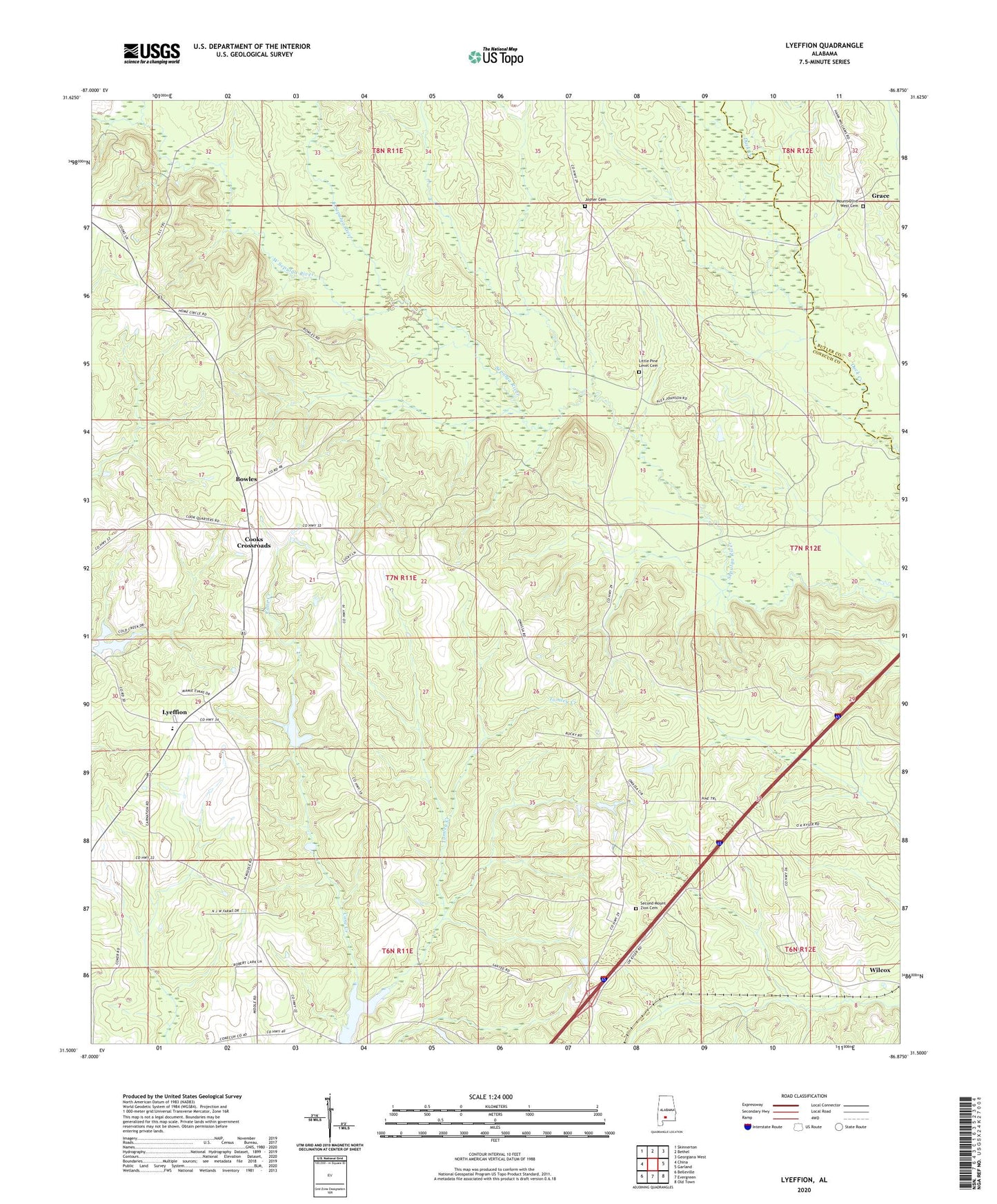
2024 topographic map quadrangle Lyeffion in the state of Alabama. Scale: 1:24000. Based on the newly updated USGS 7.5' US Topo map series, this map is in the following counties: Conecuh, Butler. The map contains contour data, water features, and other items you are used to seeing on USGS maps, but also has updated roads and other features. This is the next generation of topographic maps. Printed on high-quality waterproof paper with UV fade-resistant inks.
Quads adjacent to this one:
West: China
Northwest: Skinnerton
North: Bethel
Northeast: Georgiana West
East: Garland
Southeast: Old Town
South: Evergreen
Southwest: Belleville
This map covers the same area as the classic USGS quad with code o31086e8.
Contains the following named places: Antioch Church, Beasley School, Bowles, Bowles Church, Chestnut Grove Methodist Church, Conecuh County Lake, Cooks Crossroads, East Sepulga River, Grace, Hank Williams Memorial Park, Holiness Church, Joyner Cemetery, Lake Shirley, Little Pine Level Cemetery, Little Pine Level Church, Lyeffion, Lyeffion Baptist Church, Lyeffion Fire Department, Lyeffion High School, Millieville Church, Mount Olive West Baptist Church, Mount Olive West Cemetery, Mount Zion Church, New Home Church, Rogers School, Second Mount Zion Baptist Church, Second Mount Zion Cemetery, Sepulga Lookout Tower, Tomley Creek, West Sepulga River, Wilcox