MyTopo
Garland Alabama US Topo Map
Couldn't load pickup availability
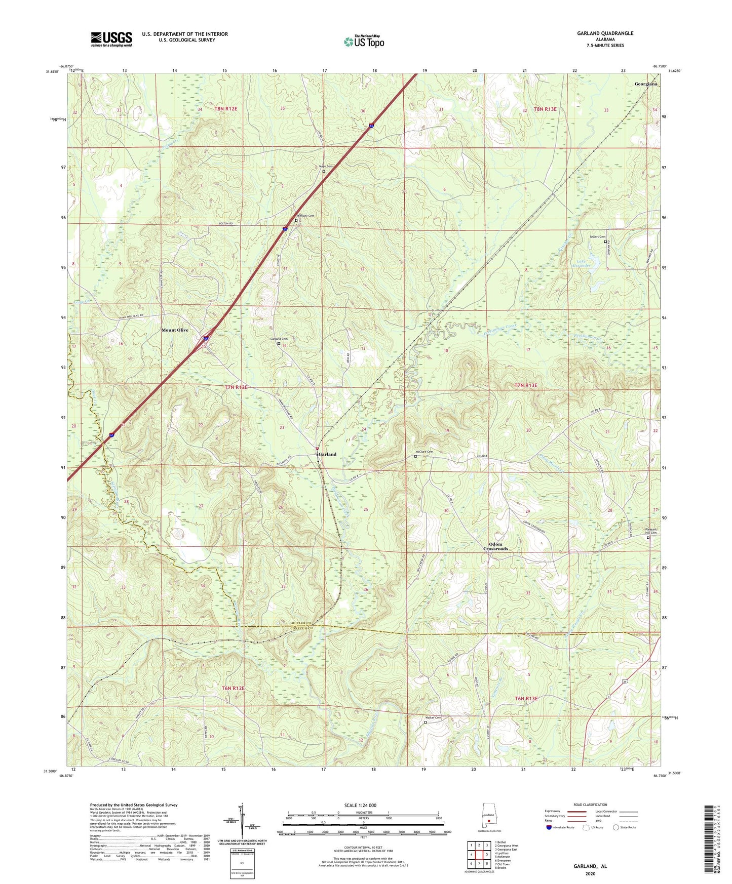
2024 topographic map quadrangle Garland in the state of Alabama. Scale: 1:24000. Based on the newly updated USGS 7.5' US Topo map series, this map is in the following counties: Butler, Conecuh. The map contains contour data, water features, and other items you are used to seeing on USGS maps, but also has updated roads and other features. This is the next generation of topographic maps. Printed on high-quality waterproof paper with UV fade-resistant inks.
Quads adjacent to this one:
West: Lyeffion
Northwest: Bethel
North: Georgiana West
Northeast: Georgiana East
East: McKenzie
Southeast: Brooks
South: Old Town
Southwest: Evergreen
This map covers the same area as the classic USGS quad with code o31086e7.
Contains the following named places: Belmont Number 1 Church, Belmont Number 2 Church, Duck Creek, Dunham, Garland, Garland Cemetery, Garland Church, Garland School, Garland Volunteer Fire Department, Lake Alexander, Lake Alexander Dam Number One, Long Church, Long Creek, Long Creek School, Long Creek Temple, Maye Cemetery, McClure Cemetery, Mount Olive, Odom Crossroads, Panther Creek, Persimmon Creek, Pleasant Hill Cemetery, Pleasant Home Church, Pressley Cemetery, Saint John Church, Salter, Sellers Cemetery, Walker Cemetery, Wiggins School, ZIP Code: 36456