MyTopo
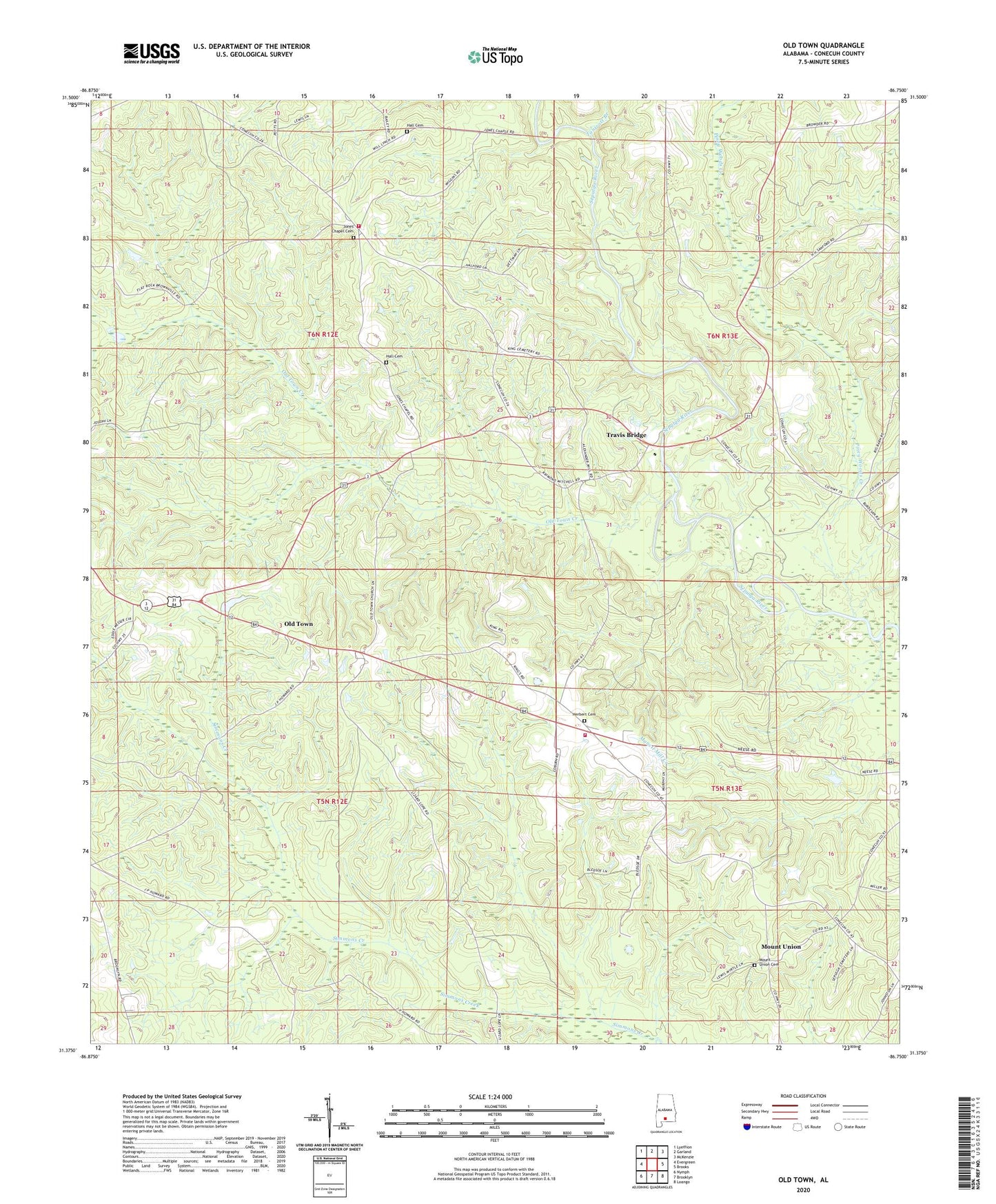
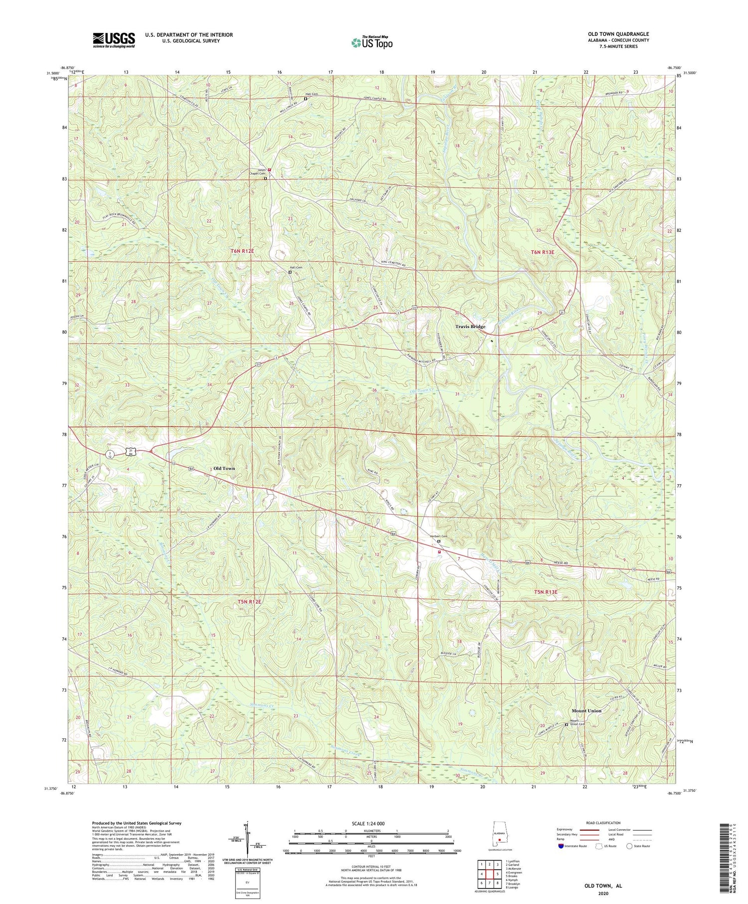
Old Town Alabama US Topo Map
Couldn't load pickup availability
2024 topographic map quadrangle Old Town in the state of Alabama. Scale: 1:24000. Based on the newly updated USGS 7.5' US Topo map series, this map is in the following counties: Conecuh. The map contains contour data, water features, and other items you are used to seeing on USGS maps, but also has updated roads and other features. This is the next generation of topographic maps. Printed on high-quality waterproof paper with UV fade-resistant inks.
Quads adjacent to this one:
West: Evergreen
Northwest: Lyeffion
North: Garland
Northeast: McKenzie
East: Brooks
Southeast: Loango
South: Brooklyn
Southwest: Nymph
This map covers the same area as the classic USGS quad with code o31086d7.
Contains the following named places: Cedar Grove African Methodist Episcopal Church, Evergreen Division, Evergreen-Shreve Division, Flat Rock, Flat Rock Church, Flat Rock Ford, Flat Rock School, Flat Rock Volunteer Fire Department, Grace Church, Hall Cemetery, Haw Ridge, Herbert Cemetery, Herbert Volunteer Fire Department, Jones Chapel Cemetery, Jones Chapel Church, Mount Union, Mount Union Cemetery, Mount Union Church, New Jerusalem Church, Old Town, Old Town Church, Old Town Creek, Pilgrims Rest Church, Piney Woods Creek, River Springs Campground, Saint John Church, Sepulga Baptist Church, Tantrott Branch, Travis Bridge, Welcome Church