MyTopo
Mitchell Dam Alabama US Topo Map
Couldn't load pickup availability
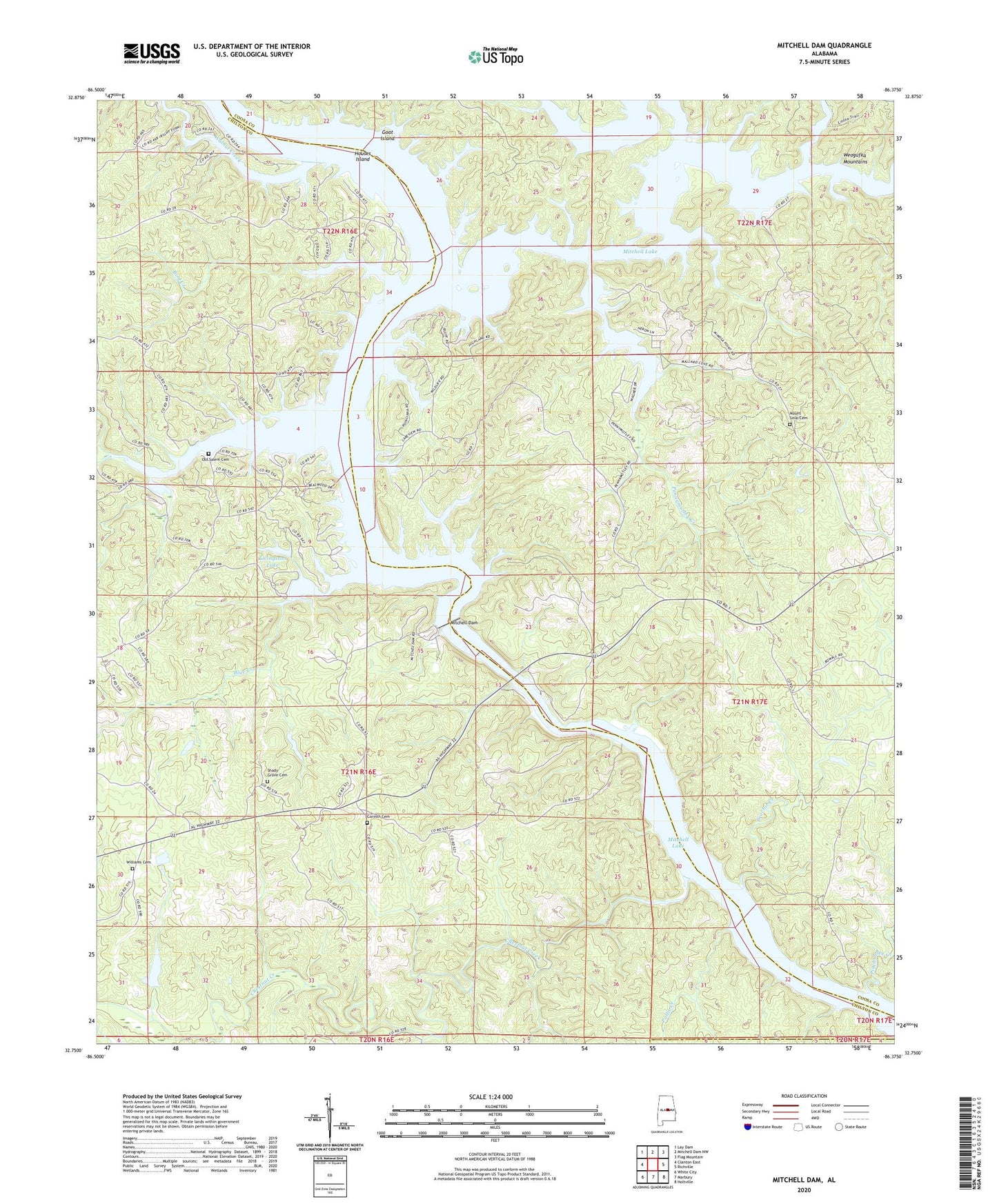
2024 topographic map quadrangle Mitchell Dam in the state of Alabama. Scale: 1:24000. Based on the newly updated USGS 7.5' US Topo map series, this map is in the following counties: Chilton, Coosa, Elmore. The map contains contour data, water features, and other items you are used to seeing on USGS maps, but also has updated roads and other features. This is the next generation of topographic maps. Printed on high-quality waterproof paper with UV fade-resistant inks.
Quads adjacent to this one:
West: Clanton East
Northwest: Lay Dam
North: Mitchell Dam NW
Northeast: Flag Mountain
East: Richville
Southeast: Holtville
South: Marbury
Southwest: White City
This map covers the same area as the classic USGS quad with code o32086g4.
Contains the following named places: Barretts Fish Camp, Big Island, Bird Creek, Blue Creek, Burwell, Cargle Creek, Chestnut Creek, Clanton Pumping Station, Corinth Baptist Church, Corinth Cemetery, Enid, Flint Hill Church, Goat Island, Hatchet Creek, Higgins Ferry, Houses Ferry, Houses Island, Knights, Knights Ferry, Livingston Lake, Livingston Lake Dam, Mitchell Dam, Mitchell Lake, Mount Sinai Cemetery, Mountain Creek, Old Salem Cemetery, Patella Gin, Pennymotley Creek, Pinchoulee Creek, Poken Tallassee Council House, Pollis Creek, Proctor Creek, Sandy Creek, Shady Grove Cemetery, Shady Grove Methodist Church, Walnut Creek, Weogufka Creek, Williams Cemetery, Woodward Lake, Woodward Lake Dam