MyTopo
Holtville Alabama US Topo Map
Couldn't load pickup availability
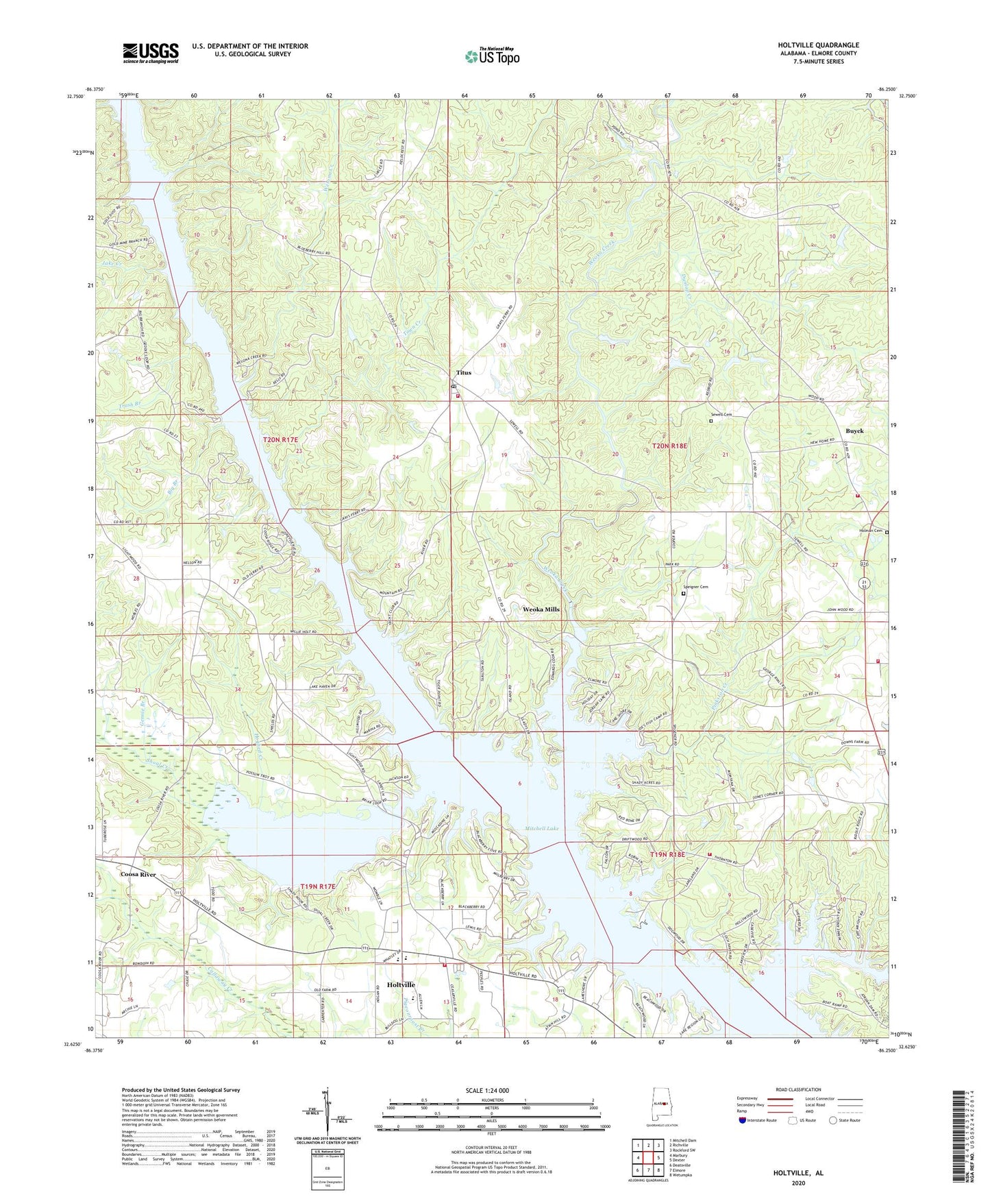
2024 topographic map quadrangle Holtville in the state of Alabama. Scale: 1:24000. Based on the newly updated USGS 7.5' US Topo map series, this map is in the following counties: Elmore. The map contains contour data, water features, and other items you are used to seeing on USGS maps, but also has updated roads and other features. This is the next generation of topographic maps. Printed on high-quality waterproof paper with UV fade-resistant inks.
Quads adjacent to this one:
West: Marbury
Northwest: Mitchell Dam
North: Richville
Northeast: Rockford SW
East: Dexter
Southeast: Wetumpka
South: Elmore
Southwest: Deatsville
This map covers the same area as the classic USGS quad with code o32086f3.
Contains the following named places: Bensons Mill, Big Branch, Buyck, Buyck Church, Buyck Volunteer Fire Department, Buyck Volunteer Fire Department Station 2, Camp Chandler, Coosa River, Coosa River Church, Deatsville Division, Dunlap Creek, Friendship Church, Gennie Branch, Harmony Church, Hogbed Creek, Holman Cemetery, Holtville, Holtville - Slapout Volunteer Fire and Rescue Department, Holtville Census Designated Place, Holtville High School, Holtville Park, Jake Creek, Lake Hill Church, Lebanon Baptist Church, Little York Post Office, Morris Ferry, Mount Pisgah Church, Mount Pisgah School, New Home Assembly of God Church, Nobles Ferry, Pinkston Creek, Providence Methodist Church, Rivers Chapel, Sewell Cemetery, Sewell Memorial Junior High School, Shoal Creek, Sofkahatchee Creek, Speigner Cemetery, Sykes Mill, Tan Trough Creek, Titus, Titus Post Office, Titus Volunteer Fire Department, Titus Volunteer Fire Department Station 2, Town Creek, Trash Branch, Wadsworths Old Ferry, Welona Creek, Weoka Creek, Weoka Mills, Woods Store, ZIP Code: 36080