MyTopo
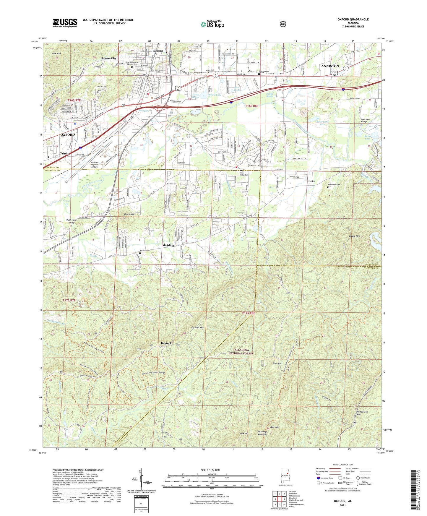
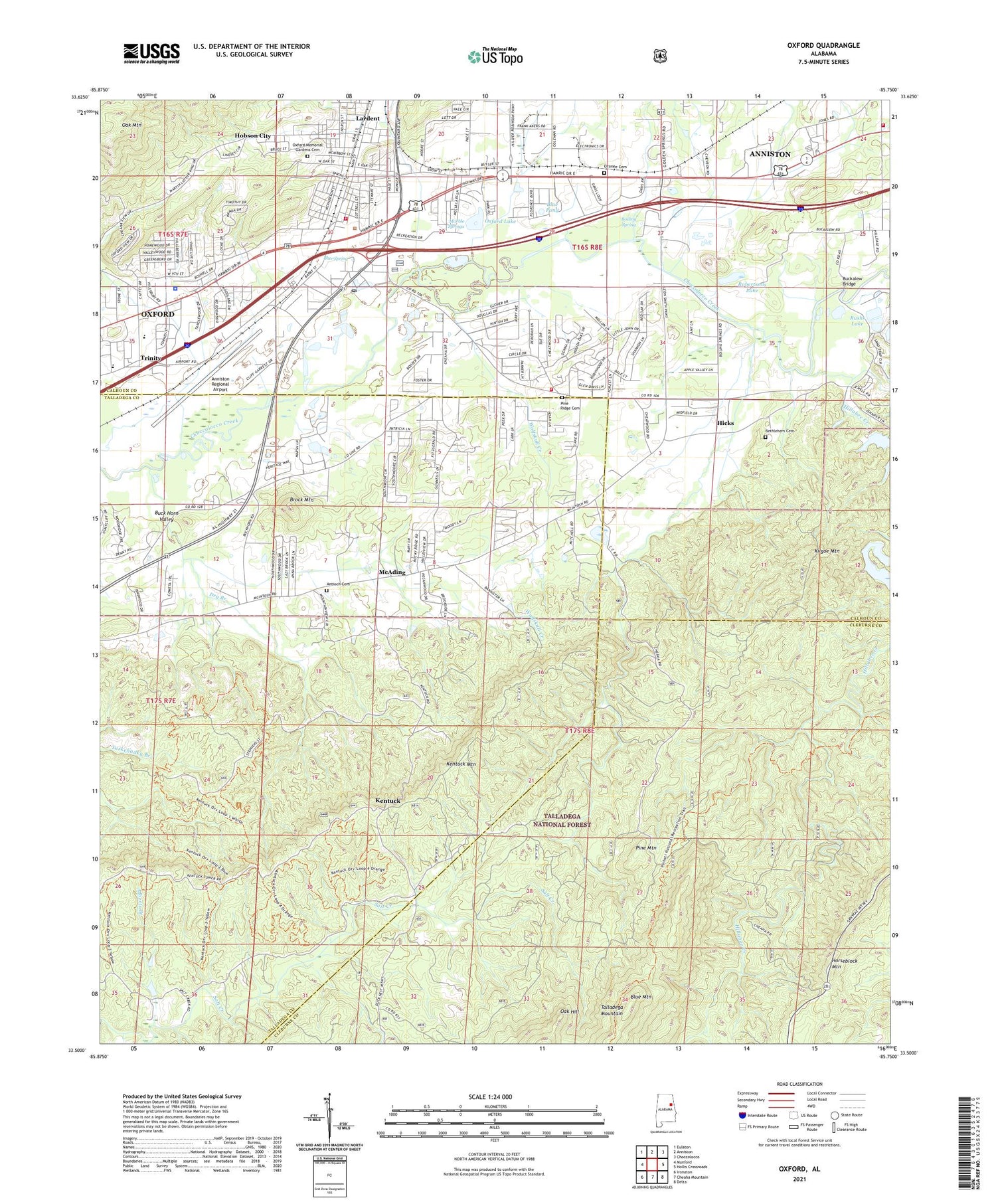
Oxford Alabama US Topo Map
Couldn't load pickup availability
Also explore the Oxford Forest Service Topo of this same quad for updated USFS data
2024 topographic map quadrangle Oxford in the state of Alabama. Scale: 1:24000. Based on the newly updated USGS 7.5' US Topo map series, this map is in the following counties: Talladega, Calhoun, Cleburne. The map contains contour data, water features, and other items you are used to seeing on USGS maps, but also has updated roads and other features. This is the next generation of topographic maps. Printed on high-quality waterproof paper with UV fade-resistant inks.
Quads adjacent to this one:
West: Munford
Northwest: Eulaton
North: Anniston
Northeast: Choccolocco
East: Hollis Crossroads
Southeast: Delta
South: Cheaha Mountain
Southwest: Ironaton
This map covers the same area as the classic USGS quad with code o33085e7.
Contains the following named places: Alberts Branch, Anniston Fire Department Station 6, Anniston Regional Airport, Anniston Speedway, Antioch Baptist Church, Antioch Baptist Church Cemetery Number 1, Bethlehem Baptist Church Cemetery, Bethlehem Missionary Baptist Church, Bible Baptist Church, Blue Mountain, Blue Pond, Blue Spring, Blue Spring Baptist Church, Boiling Spring, Boiling Springs Methodist Church, Brock Mountain, Buck Horn Valley, Buckalew Bridge, Calhoun County Training School, Calvary Baptist Church, Cheaha Acres, Chinnabee, Choccolocco Creek Sewage Treatment Plant, Church of God, City of Oxford, Dodson Memorial Presbyterian Church, Dry Branch, Duck Nest Hunten Camp, Duck Nest Springs, Faith Childrens Home Mission, First Baptist Church of Oxford, Forest Hills, Friendship, Friendship Elementary School, Grace Baptist Church, Grace Church, Harry M Ayres State Technical School, Hicks, Hillabee Creek, Hobson City, Hobson City Park, Horseblock Mountain, House, Jo Dell, Kentuck, Kentuck Lookout Tower, Kentuck Mountain, Kentuck Ranger Station, Kilgoe Mountain, Lakeview, Lakeview Church, Lardent, Little Hillabee Creek, Marble Springs, McAding, McKibben, McKibbon, Meadowbrook, Meadowbrook Baptist Church, New Hope Missionary Baptist Church, Oak Hill, Oak Hill Church, Oak Mountain, Oak Ridge Baptist Church, Oconee Baptist Church, Oconee Cemetery, Old Mill Mall Shopping Center, Oxford, Oxford Church of Christ, Oxford Civic Center, Oxford Elementary School, Oxford Fire Department Station 1, Oxford Fire Department Station 2, Oxford High School, Oxford Lake, Oxford Memorial Gardens Cemetery, Oxford Middle School, Oxford Police Department, Oxford Post Office, Oxford Stadium, Parker Mine, Pine Mountain, Pine Ridge Cemetery, Pine Ridge Church, Pure Holiness Church, Quintard Mall Shopping Center, Rising Star Methodist Church, Robertson Dam, Robertsons Lake, Rush Dam, Rushs Lake, Salt Creek Church, Sky City Shopping Center, Sunny Eve Baptist Church, Sweet Rock Baptist Church, Town of Hobson City, Trinity, Trinity Baptist Church, Trinity Christian Academy, Trinity School, Welcome Chapel Church, Wolfskull Creek, ZIP Code: 36203