MyTopo
Eulaton Alabama US Topo Map
Couldn't load pickup availability
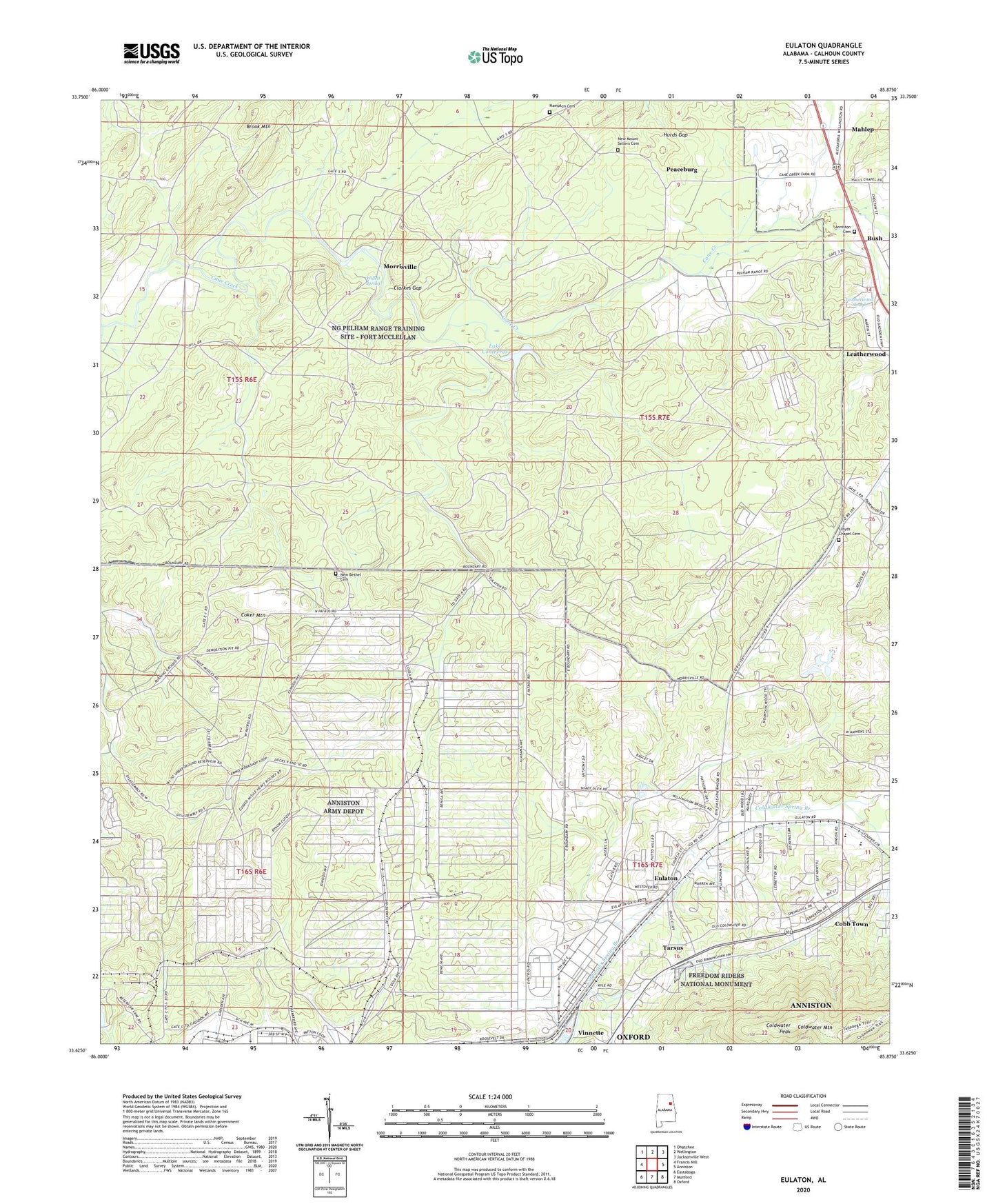
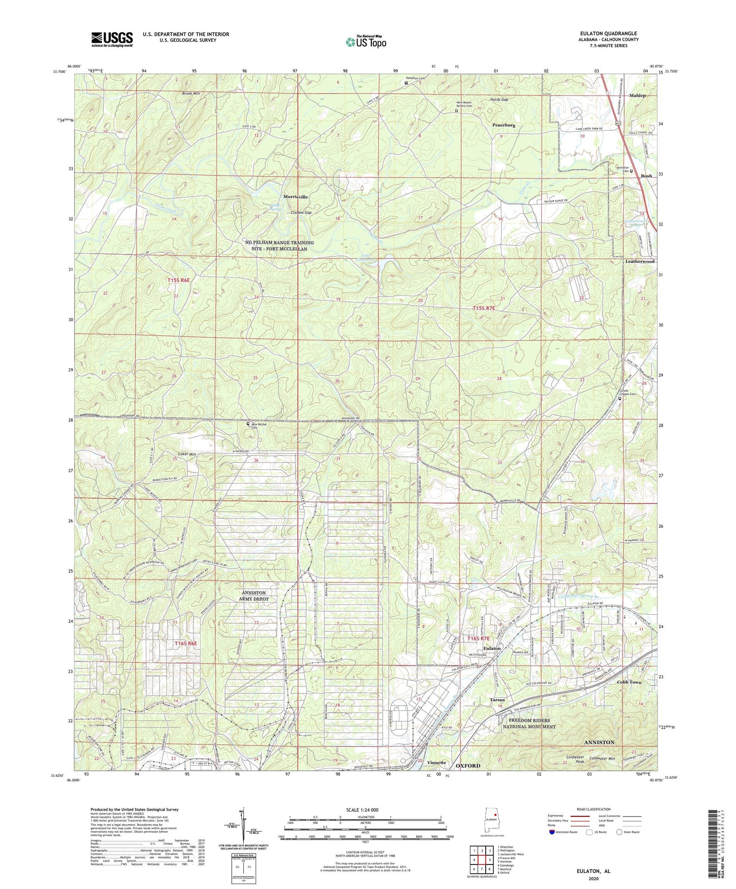
2024 topographic map quadrangle Eulaton in the state of Alabama. Scale: 1:24000. Based on the newly updated USGS 7.5' US Topo map series, this map is in the following counties: Calhoun. The map contains contour data, water features, and other items you are used to seeing on USGS maps, but also has updated roads and other features. This is the next generation of topographic maps. Printed on high-quality waterproof paper with UV fade-resistant inks.
Quads adjacent to this one:
West: Francis Mill
Northwest: Ohatchee
North: Wellington
Northeast: Jacksonville West
East: Anniston
Southeast: Oxford
South: Munford
Southwest: Eastaboga
This map covers the same area as the classic USGS quad with code o33085f8.
Contains the following named places: Aderhold Acres, Anniston Army Depot, Anniston Memorial Gardens, Bera, Bush, Camp Willett, Cane Creek, Canebreak Farms, Clarkes Gap, Cobb Town, Coker Mountain, Coldwater Mountain, Coldwater Peak, Cone Reservoir Dam, Eulaton, Eulaton Baptist Church, Eulaton Elementary School, Eulaton United Methodist Church, Four Square Church, Freedom Riders National Monument, Hampton Cemetery, Hurds Gap, Lake Contreras, Leatherwood, Leatherwood Baptist Church, Leatherwood Slough, Lloyds Chapel Baptist Church, Lloyds Chapel Cemetery, Lloyds School House, Mahlep, Meade, Morrisville, Morrisville Baptist Church, Mount Limited Church, New Bethel Cemetery, New Liberty Baptist Church, New Mount Sellers Cemetery, New Mount Silla Baptist Church, Peaceburg, Peaceburg School, Pelham Range Dam, Polkville, Polkville Post Office, Tarsus, Vinnette, Walter Wellborn High School, Wellborn, Wellborn Elementary School, West Park Heights Baptist Church, Willett Spring, Zula, ZIP Code: 36201