
MyTopo
Ironaton Alabama US Topo Map
Couldn't load pickup availability
Also explore the Ironaton Forest Service Topo of this same quad for updated USFS data
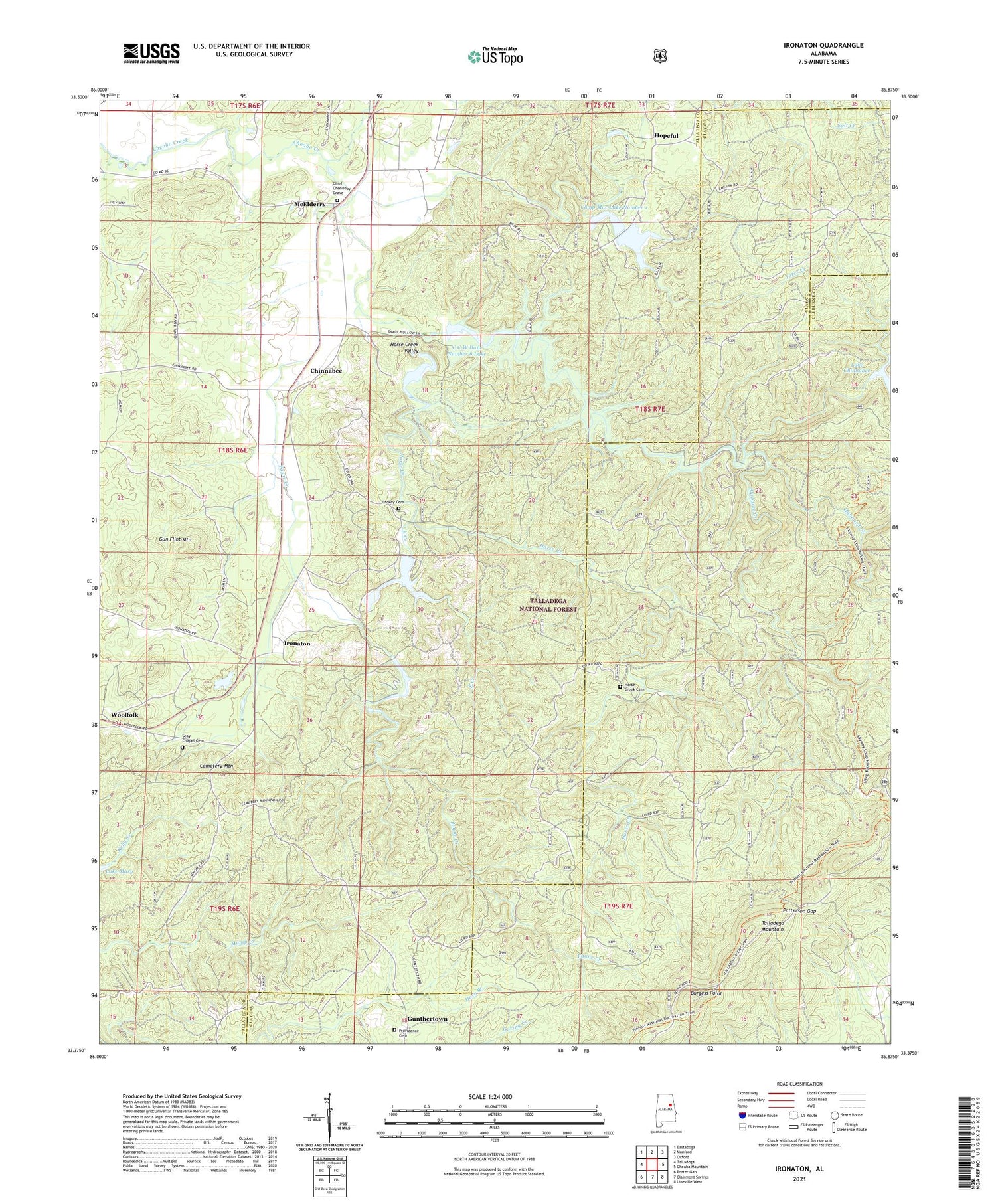
2024 topographic map quadrangle Ironaton in the state of Alabama. Scale: 1:24000. Based on the newly updated USGS 7.5' US Topo map series, this map is in the following counties: Talladega, Clay, Cleburne. The map contains contour data, water features, and other items you are used to seeing on USGS maps, but also has updated roads and other features. This is the next generation of topographic maps. Printed on high-quality waterproof paper with UV fade-resistant inks.
Quads adjacent to this one:
West: Talladega
Northwest: Eastaboga
North: Munford
Northeast: Oxford
East: Cheaha Mountain
Southeast: Lineville West
South: Clairmont Springs
Southwest: Porter Gap
This map covers the same area as the classic USGS quad with code o33085d8.
Contains the following named places: Antioch Church, Barbaree Creek, Burgess Point, C C W Dam Number 6 Lake, Camp Mac, Camp Mac Lake Number 1, Camp Mac Lake Number 2, Camp Mac Lakes, Cemetery Mountain, Cheaha Number 5 Dam, Chief Chenneby Grave, Chinnabee, Chinnabee Dam, Dam Number Five, Dam Number Four, Dam Number Six, Dry Creek, East Creek, Fayne Creek, Gun Flint Mountain, Hopeful, Horse Creek, Horse Creek Cemetery, Horse Creek Valley, Hubbard Creek, Ironaton, Ironaton Church of Christ, Ironaton Methodist Church, Lackey Cemetery, Lackeys Mill, Lake Chinnabee, Lake Robin, Lake Robin Dam, Mac Lake Lower Lake Dam, Mac Lake Upper Lake Dam, McElderry, Mount Calvary Baptist Church, Oakhurst Plantation, Patterson Gap, Providence Cemetery, Providence Church, Providence School, Seaton, Seaton Post Office, Seay Chapel, Seay Chapel Cemetery, Smith Chapel, Tater Creek, The Cedars, Union Church, White Cloud, White Cloud Post Office, Woolfolk, ZIP Code: 36268


