MyTopo
Palmetto Alabama US Topo Map
Couldn't load pickup availability
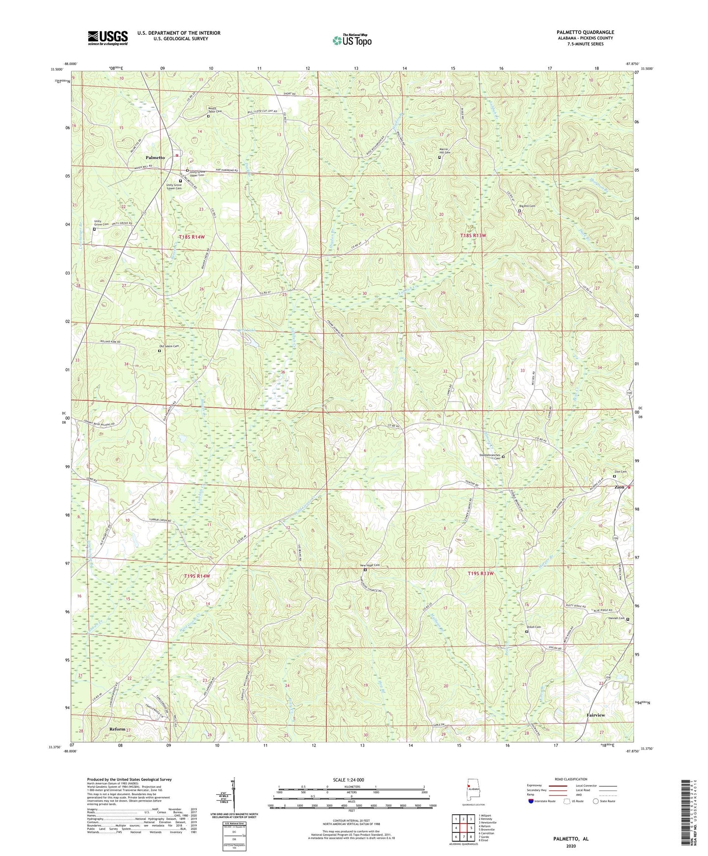
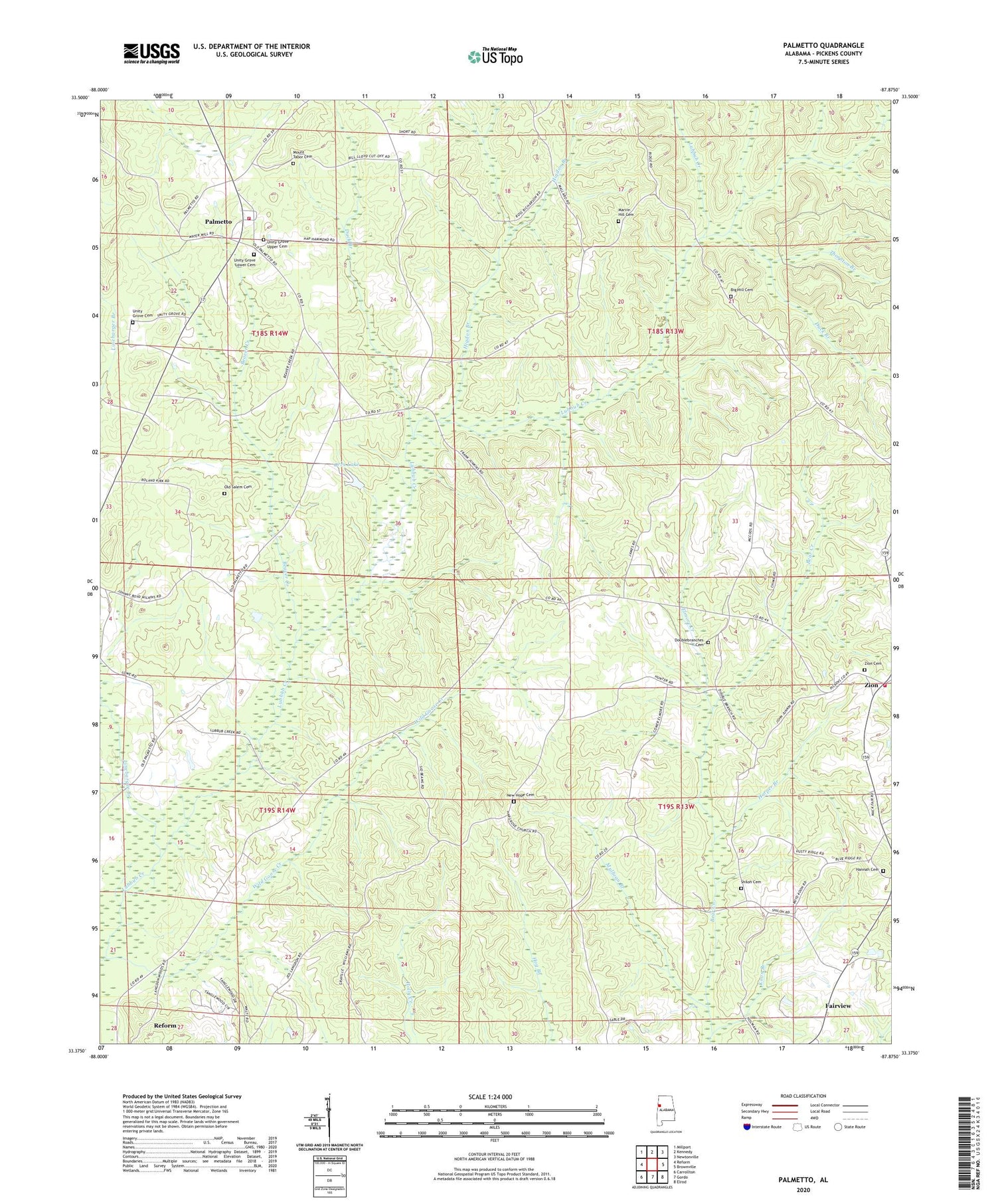
2024 topographic map quadrangle Palmetto in the state of Alabama. Scale: 1:24000. Based on the newly updated USGS 7.5' US Topo map series, this map is in the following counties: Pickens. The map contains contour data, water features, and other items you are used to seeing on USGS maps, but also has updated roads and other features. This is the next generation of topographic maps. Printed on high-quality waterproof paper with UV fade-resistant inks.
Quads adjacent to this one:
West: Reform
Northwest: Millport
North: Kennedy
Northeast: Newtonville
East: Brownville
Southeast: Elrod
South: Gordo
Southwest: Carrollton
This map covers the same area as the classic USGS quad with code o33087d8.
Contains the following named places: Beaver Creek, Big Hill Cemetery, Big Hill Church, Carroll School, Crossroads School, Double Branches Church, Doublebranches Cemetery, Duck Branch, Elmore Creek, Fairview, Gordo Division, Hannah Cemetery, Hannah Church, Harper Branch, Harpers Mill, Higdon Branch, Koon Branch, Linebarger Branch, Marvin Hill Cemetery, Marvin Hill Church, Mount Tabor Cemetery, Mount Tabor Church, Mullican Branch, New Hope Cemetery, New Hope Church, New Salem Church, Old Salem Cemetery, Orrs Lake, Orrs Lake Dam, Palmetto, Palmetto School, Palmetto Volunteer Fire Department, Shiloh Cemetery, Shiloh Church, Thornton Branch, Unity Grove Cemetery, Unity Grove Christian Methodist Episcopal Church, Unity Grove Lower Cemetery, Unity Grove Methodist Church, Unity Grove Upper Cemetery, Wild Goose Creek, Zion, Zion Cemetery, Zion Primitive Baptist Church, Zion Volunteer Fire Department