
MyTopo
Kennedy Alabama US Topo Map
Couldn't load pickup availability
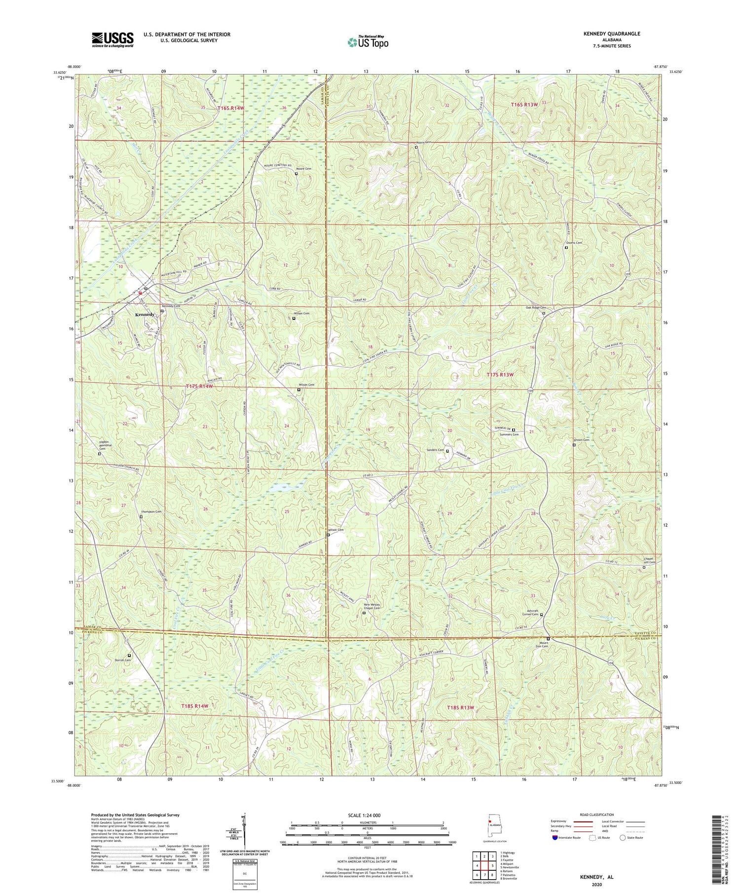
2024 topographic map quadrangle Kennedy in the state of Alabama. Scale: 1:24000. Based on the newly updated USGS 7.5' US Topo map series, this map is in the following counties: Fayette, Lamar, Pickens. The map contains contour data, water features, and other items you are used to seeing on USGS maps, but also has updated roads and other features. This is the next generation of topographic maps. Printed on high-quality waterproof paper with UV fade-resistant inks.
Quads adjacent to this one:
West: Millport
Northwest: Hightogy
North: Belk
Northeast: Fayette
East: Newtonville
Southeast: Brownville
South: Palmetto
Southwest: Reform
This map covers the same area as the classic USGS quad with code o33087e8.
Contains the following named places: Asbury Post Office, Ashcraft Corner, Ashcraft Corner Baptist Church, Ashcraft Corner Cemetery, Brown Cemetery, Chapel Hill Baptist Church, Chapel Hill Cemetery, Dorroh Cemetery, Harmony Primitive Baptist Church, Higdon Church, Higdon Memorial Cemetery, Kennedy, Kennedy Cemetery, Kennedy High School, Kennedy Post Office, Kennedy Volunteer Fire Department, Little Coal Fire Creek, Lubbub Creek Gas Field, Mill Creek, Moore Cemetery, Mount Zion Cemetery, Mount Zion Church, New Wesley Chapel Cemetery, Oak Ridge Baptist Church, Oak Ridge Cemetery, Owens Cemetery, Pilgrim Church, Riverside Church, Rock Curve Church, Sanders Cemetery, Summers Cemetery, Thompson Cemetery, Town of Kennedy, Wesley Chapel Methodist Church, WHKW-FM (Fayette), Wilson Cemetery, Wilson Church, ZIP Code: 35574


