
MyTopo
Reform Alabama US Topo Map
Couldn't load pickup availability
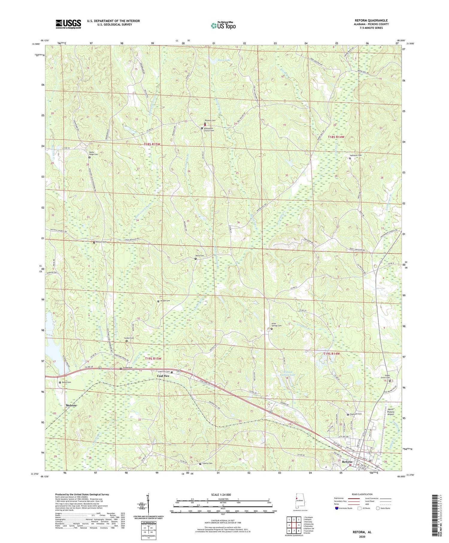
2024 topographic map quadrangle Reform in the state of Alabama. Scale: 1:24000. Based on the newly updated USGS 7.5' US Topo map series, this map is in the following counties: Pickens. The map contains contour data, water features, and other items you are used to seeing on USGS maps, but also has updated roads and other features. This is the next generation of topographic maps. Printed on high-quality waterproof paper with UV fade-resistant inks.
Quads adjacent to this one:
West: Ethelsville
Northwest: Fernbank
North: Millport
Northeast: Kennedy
East: Palmetto
Southeast: Gordo
South: Carrollton
Southwest: Reform SW
This map covers the same area as the classic USGS quad with code o33088d1.
Contains the following named places: Antioch Cemetery, Antioch Cumberland Presbyterian Church, Arbor Springs Cemetery, Arbor Springs Church, Arnold Cemetery, Baird Cemetery, Beard Cemetery, Bethlehem, Bethlehem Baptist Church, Bethlehem Church Cemetery, Bethlehem Volunteer Fire Department, Board Tree Branch, Board Tree Branch Gas Field, Buncomb Creek, Carden Cemetery, Chicken Swamp Branch, Christian Hope Church, Church of God, Coal Fire, Coal Fire Cemetery, Coal Fire Church, Coal Fire Creek Gas Field, Cocks Branch, David Dam, Davis Lake, Ewart Doughty Dam, Ewart Doughty Lake, Friendship Church, Funderburk Cemetery, Hamilton Cemetery, Hopewell Cemetery, Hopewell High School, John McShan Number 1 Dam, John McShan Number 2 Dam, Keasley School, Langdon Branch, Liberty Cemetery, Liberty Church, Little Coal Fire Creek, McShan Lake, McShan Lake Number Two, Melrose, North Pickens Airport, Phoenix Cemetery, Rawles Mill, Reform, Reform Division, Reform Police Department, Reform Post Office, Reform Volunteer Fire Department, Rocky Ridge Cemetery, Rocky Ridge Church, Shady Grove Cemetery, Town of Reform, William Latham Dam, William Latham Lake, ZIP Code: 35481


