
MyTopo
Panola Alabama US Topo Map
Couldn't load pickup availability
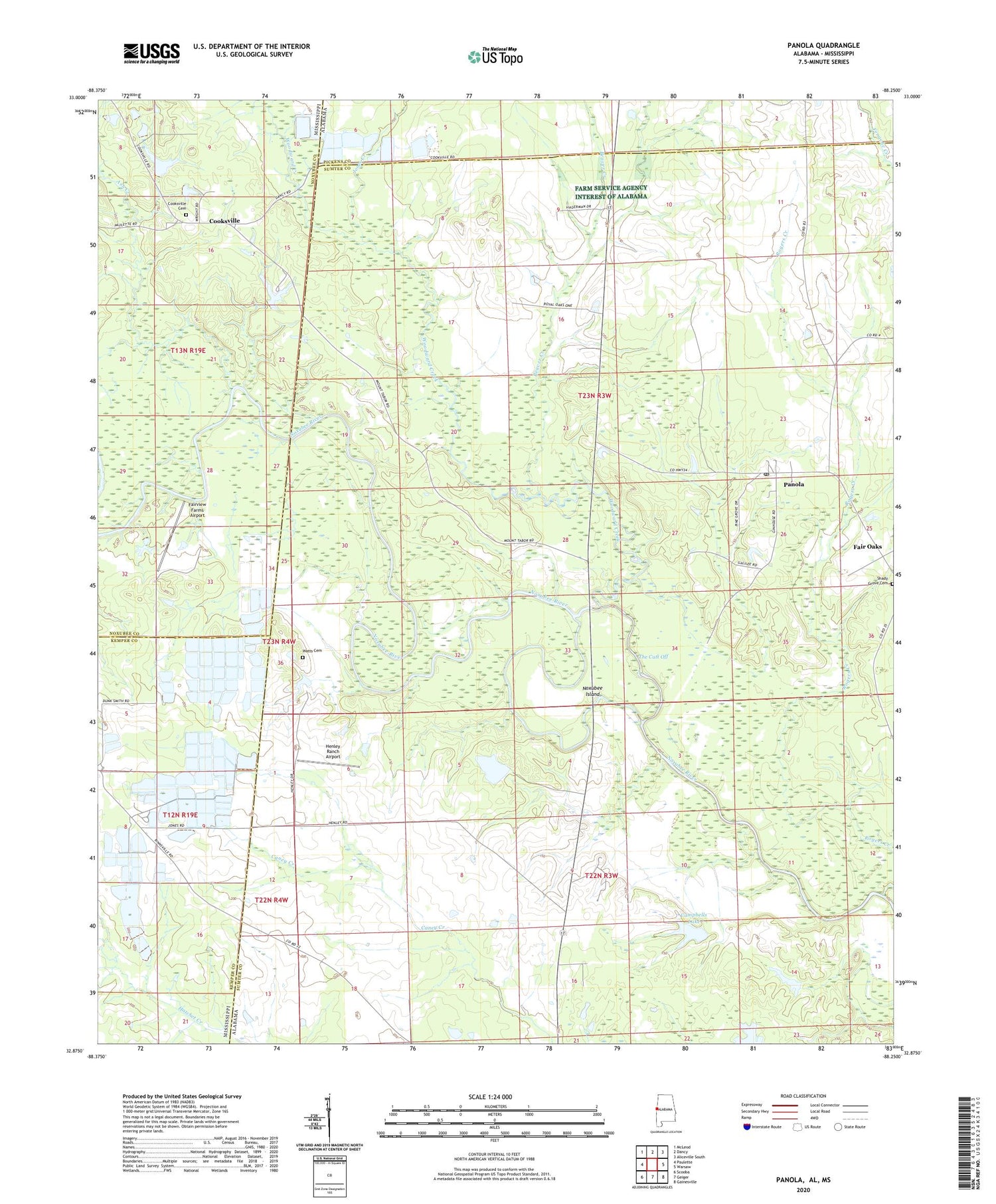
2024 topographic map quadrangle Panola in the states of Alabama, Mississippi. Scale: 1:24000. Based on the newly updated USGS 7.5' US Topo map series, this map is in the following counties: Sumter, Noxubee, Kemper, Pickens. The map contains contour data, water features, and other items you are used to seeing on USGS maps, but also has updated roads and other features. This is the next generation of topographic maps. Printed on high-quality waterproof paper with UV fade-resistant inks.
Quads adjacent to this one:
West: Paulette
Northwest: McLeod
North: Dancy
Northeast: Aliceville South
East: Warsaw
Southeast: Gainesville
South: Geiger
Southwest: Scooba
Contains the following named places: Allie McElroy School, Ash Creek, Beaver Creek, Campbells Lake, Cooksville, Cooksville Cemetery, Cooksville Methodist Church, Duck Pond Branch, Fair Oaks, Fairview Farms Airport, Galilee Baptist Church, Green Chapel, Henley Ranch Airport, Jones Creek, Mount Tabor Church, Mount Tabor School, Neville School, Noxubee Ferry, Noxubee Island, Panola, Panola Census Designated Place, Panola Post Office, Panola-Geiger Division, Pleasant Grove Church, Rogers Creek, Saint Luke Church, Saint Mark Baptist Church, Saint Marys Church, Salem, Salem Methodist Church, Shady Grove Cemetery, Shady Grove Church, Sherman, Sibley Pond, Sparkman Lake Dam, Sumter Farm and Stock Company Dam, Sumter Lake Number Four, The Cutt Off, Wall Ferry, Watts Cemetery, Whiten, Wild Horse Prairie, Woodward Creek


