MyTopo
Scooba Mississippi US Topo Map
Couldn't load pickup availability
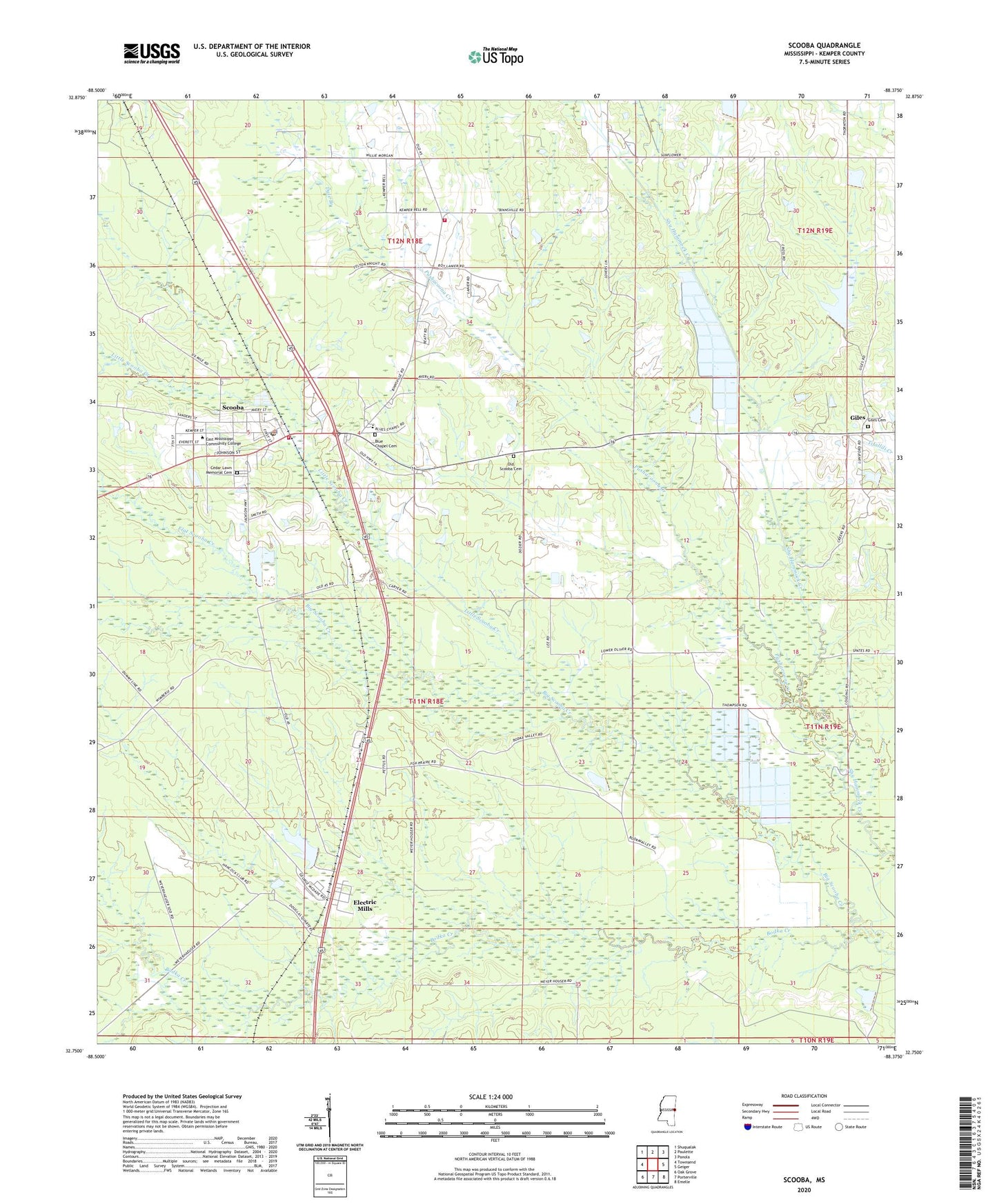
2024 topographic map quadrangle Scooba in the state of Mississippi. Scale: 1:24000. Based on the newly updated USGS 7.5' US Topo map series, this map is in the following counties: Kemper. The map contains contour data, water features, and other items you are used to seeing on USGS maps, but also has updated roads and other features. This is the next generation of topographic maps. Printed on high-quality waterproof paper with UV fade-resistant inks.
Quads adjacent to this one:
West: Townsend
Northwest: Shuqualak
North: Paulette
Northeast: Panola
East: Geiger
Southeast: Emelle
South: Porterville
Southwest: Oak Grove
This map covers the same area as the classic USGS quad with code o32088g4.
Contains the following named places: 3 Mile Corner Volunteer Fire Department, Big Scooba Creek, Blue Chapel, Blue Chapel Cemetery, Bodka Valley Church, Carlton Fleming Pond Dam, Cedar Lawn Memorial Cemetery, Dale Branch, East Kemper Elementary School, Electric Mills, Flat Scooba Creek, Giles, Giles Airport, Giles Cemetery, Hatchette, Kemper Church, Larry Bell Pond Dam, Little Scooba Creek, Odessa Briggs Pond Dam, Old Scooba, Old Scooba Cemetery, Providence Church, Pushacoona Creek, Scooba, Scooba Post Office, Scooba Volunteer Fire Department, Shammack Creek Structure 2 Dam, Spencer High School, Spring Hill Church, Sunflower Church, Sunny Mount Giles Church, Supervisor District 1, Town of Scooba, Union Hall Church, Weyerhauser Lumber Company Pond Dam