MyTopo
Paulette Mississippi US Topo Map
Couldn't load pickup availability
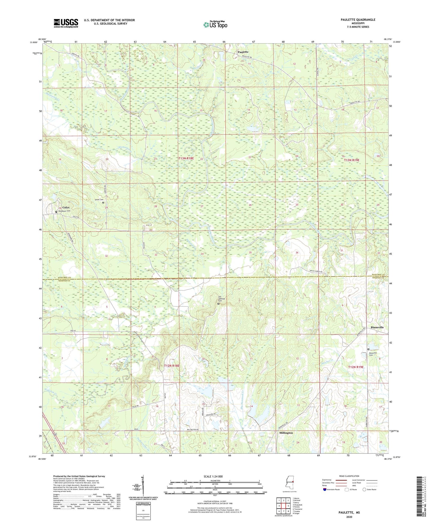
2024 topographic map quadrangle Paulette in the state of Mississippi. Scale: 1:24000. Based on the newly updated USGS 7.5' US Topo map series, this map is in the following counties: Noxubee, Kemper. The map contains contour data, water features, and other items you are used to seeing on USGS maps, but also has updated roads and other features. This is the next generation of topographic maps. Printed on high-quality waterproof paper with UV fade-resistant inks.
Quads adjacent to this one:
West: Shuqualak
Northwest: Macon
North: McLeod
Northeast: Dancy
East: Panola
Southeast: Geiger
South: Scooba
Southwest: Townsend
This map covers the same area as the classic USGS quad with code o32088h4.
Contains the following named places: Belmont Church, Binnsville, Binnsville Cemetery, Binnsville United Methodist Church, Brooklyn, Calyx, Dobbs Ferry, Eaves Cemetery, Field Plantation, Fort Terror, Frilloby Creek, Jordan Creek, Millington, Minor Lake Dam, Mohegan, Mount Ararat Church, Old Wahalak, Old Wahalak Cemetery, Paulette, Providence Church, Shuqualak Creek, Wahalak Creek, Woodlawn Cemetery, ZIP Code: 39358