MyTopo
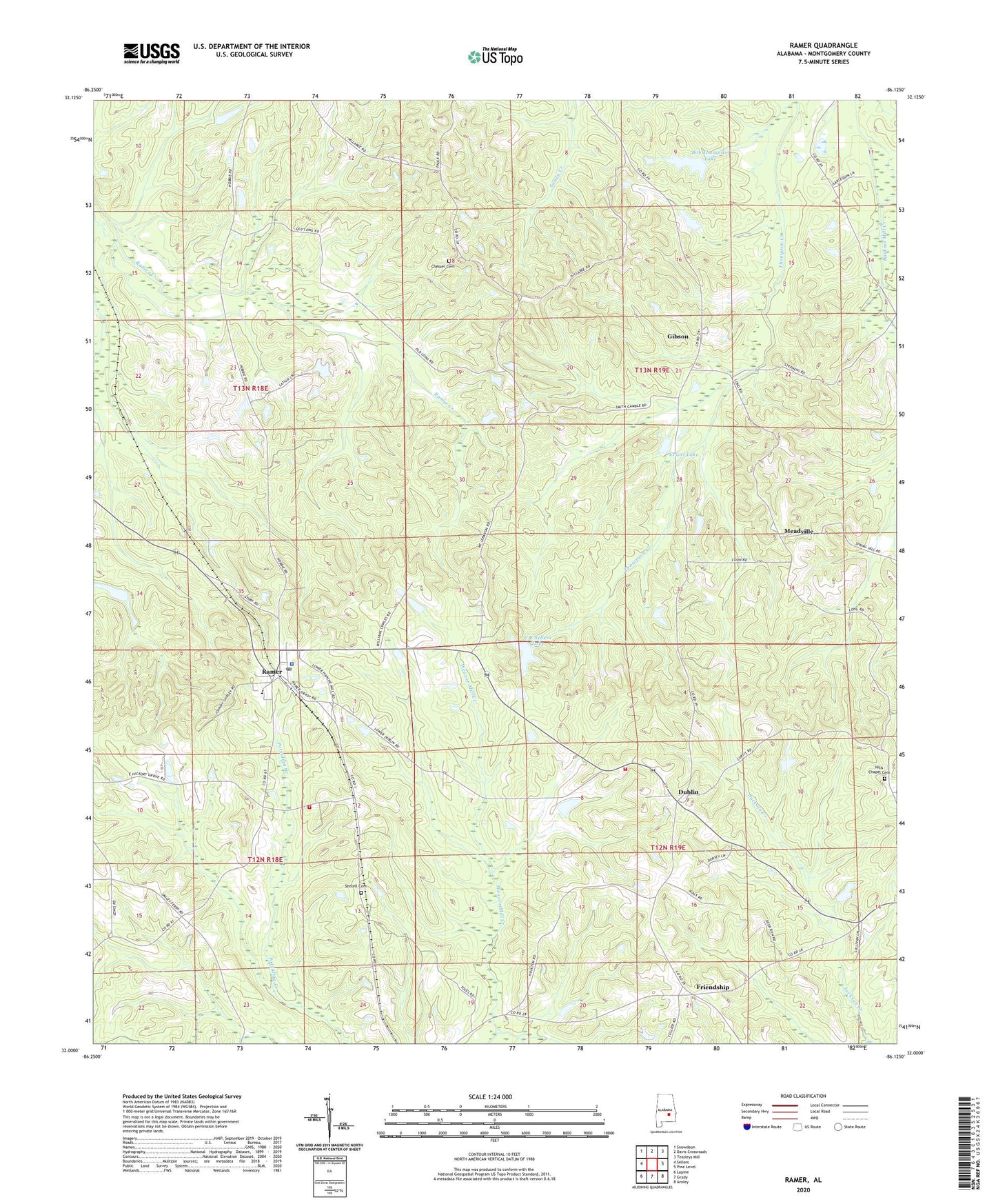
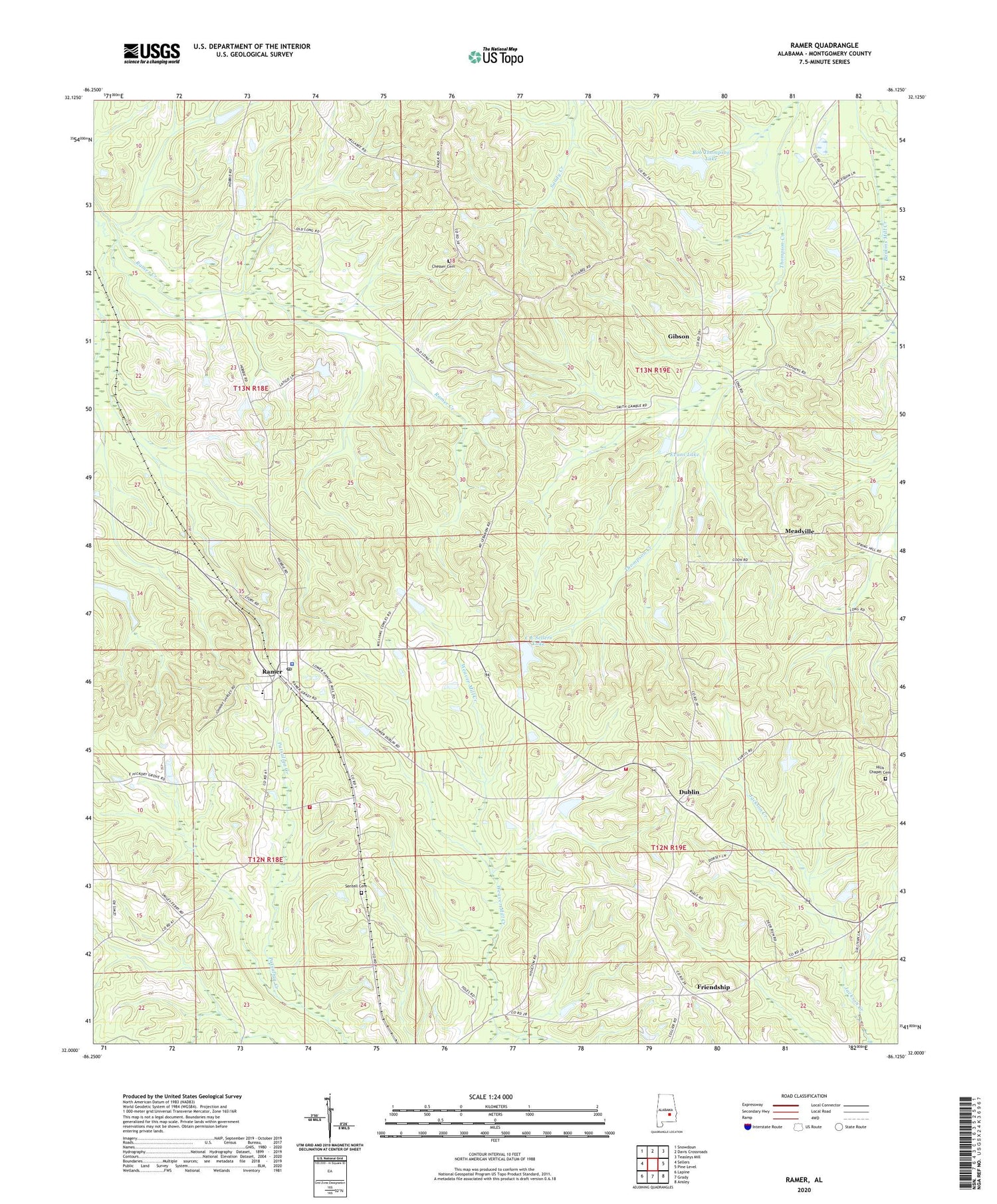
Ramer Alabama US Topo Map
Couldn't load pickup availability
2024 topographic map quadrangle Ramer in the state of Alabama. Scale: 1:24000. Based on the newly updated USGS 7.5' US Topo map series, this map is in the following counties: Montgomery. The map contains contour data, water features, and other items you are used to seeing on USGS maps, but also has updated roads and other features. This is the next generation of topographic maps. Printed on high-quality waterproof paper with UV fade-resistant inks.
Quads adjacent to this one:
West: Sellers
Northwest: Snowdoun
North: Davis Crossroads
Northeast: Teasleys Mill
East: Pine Level
Southeast: Ansley
South: Grady
Southwest: Lapine
This map covers the same area as the classic USGS quad with code o32086a2.
Contains the following named places: Bob Thompson Dam, Bob Thompson Lake, C E Neal Dam, C E Sellers Dam, C E Sellers Lake, Chesser Cemetery, Church of Christ, Dees Lake, Dublin, Dunbar High School, Ebenezer Church, Evans Dam, Evans Lake, Fannin Dam, Friendship, Friendship Church, Galilee Church, Gibson, Hickory Chapel, Hills Chapel, Hills Chapel Cemetery, Lebanon Church, Meadville, Mike Green Lookout Tower, Montgomery County High School, Montgomery County Sheriff's Office Ramer Subdivision, Morris Dees Dam, Neal Lake, Oak Wood School, Pilgrims Church, Ramer, Ramer Division, Ramer Post Office, Rushing Lake, Seek and Follow Church, Sentell Cemetery, South Montgomery County Volunteer Fire Department Station 1, Stoddard, Strickland Dam, Strickland Lake, Weeping Mary Church, ZIP Code: 36069