
MyTopo
Teasleys Mill Alabama US Topo Map
Couldn't load pickup availability
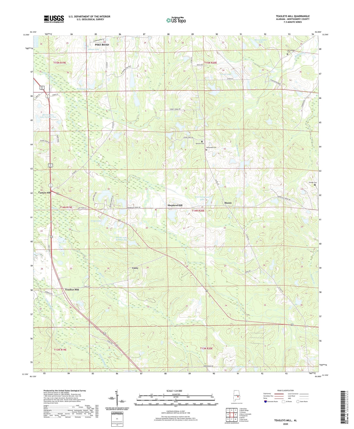
2024 topographic map quadrangle Teasleys Mill in the state of Alabama. Scale: 1:24000. Based on the newly updated USGS 7.5' US Topo map series, this map is in the following counties: Montgomery. The map contains contour data, water features, and other items you are used to seeing on USGS maps, but also has updated roads and other features. This is the next generation of topographic maps. Printed on high-quality waterproof paper with UV fade-resistant inks.
Quads adjacent to this one:
West: Davis Crossroads
Northwest: Barachias
North: Mount Meigs
Northeast: Chesson
East: Fitzpatrick
Southeast: China Grove
South: Pine Level
Southwest: Ramer
This map covers the same area as the classic USGS quad with code o32086b1.
Contains the following named places: Allison Dam, Allison Lake, Barnett Cemetery, Briar Hill Church, Briar Hill School, Brooks Lake Number Two, Brooks Number 2 Dam, Canty, Carters Hill, Chapel Gray School, Cherry Hill School, Clay Hill Church, Downing, Elizabeth Church, Grays Lake, Guy Pugh Dam, Jerusalem Church, Kirksey Dam, Kirksey Lake, Lake Pugh, Lee Merriweather Dam, Liberty Church, Mamie, McNear School, Meriwether Cemetery, Merriweather Lake, Morris Dees Lake Number Two, Morris Dees Number 2 Dam, Mount Olia Church, New Liberty Church, Orange Cemetery, Panhandle Cemetery, Pike Road Division, Pike Road Volunteer Fire Department Station 4, Pleasant Grove Church, Shepherd Hill, Sorrell Lake, T S Turnipseed Dam, T S Turnipseed Lake, Teasleys Mill, W C Gray Dam, W J Sorrell Dam, W R Turnipseed Dam, W R Turnipseed Lake, ZIP Code: 36052


