
MyTopo
Pine Level Alabama US Topo Map
Couldn't load pickup availability
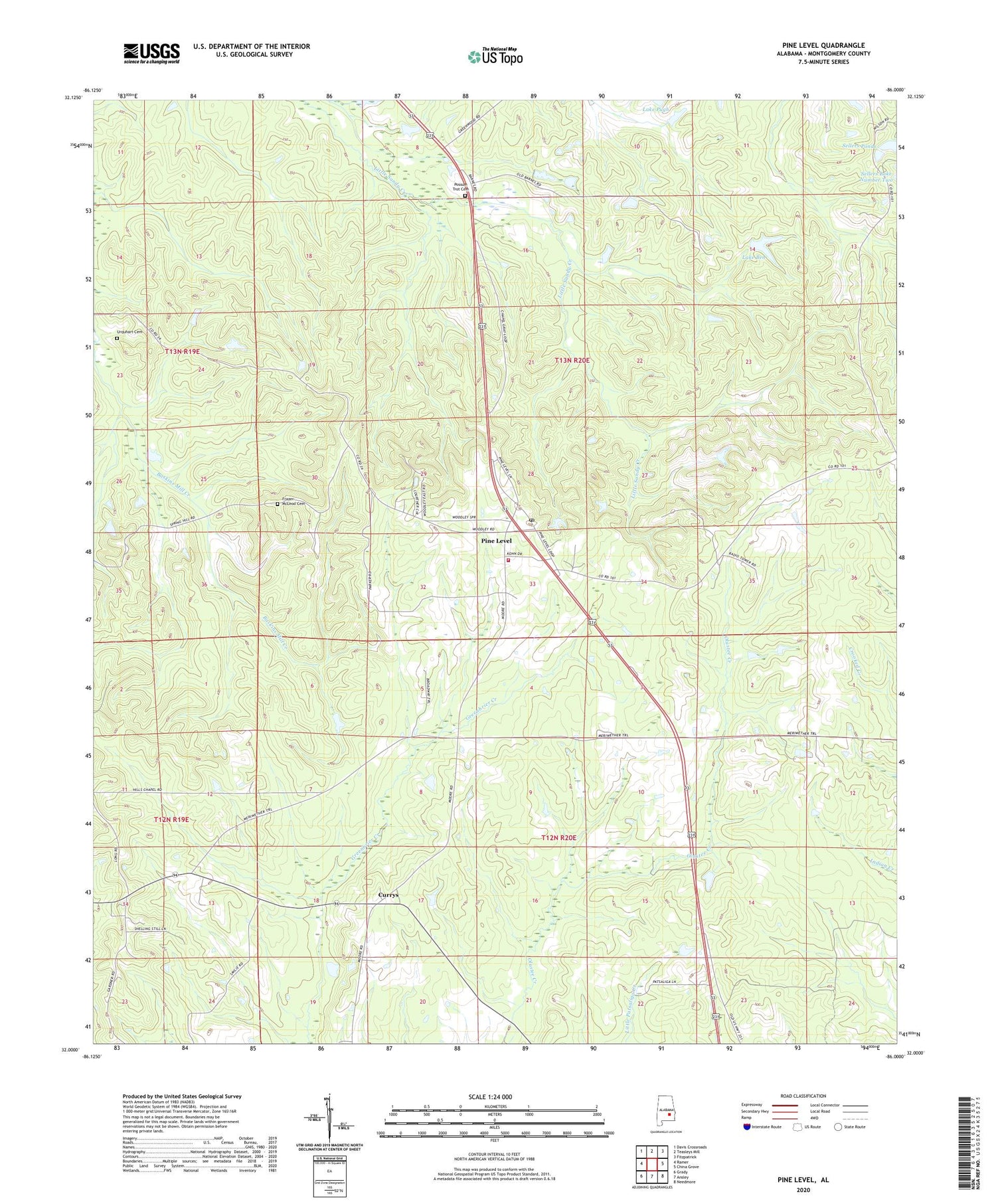
2024 topographic map quadrangle Pine Level in the state of Alabama. Scale: 1:24000. Based on the newly updated USGS 7.5' US Topo map series, this map is in the following counties: Montgomery. The map contains contour data, water features, and other items you are used to seeing on USGS maps, but also has updated roads and other features. This is the next generation of topographic maps. Printed on high-quality waterproof paper with UV fade-resistant inks.
Quads adjacent to this one:
West: Ramer
Northwest: Davis Crossroads
North: Teasleys Mill
Northeast: Fitzpatrick
East: China Grove
Southeast: Needmore
South: Ansley
Southwest: Grady
This map covers the same area as the classic USGS quad with code o32086a1.
Contains the following named places: Bethesda Church, C E Sellers Number 3 Dam, C E Sellers Number 4 Dam, Currys, Frazer-McLeod Cemetery, Hills Chapel School, I D McClurkin Number 1 Dam, I D McClurkin Number One Lake, Jack Wool Dam, Lake Ben, Liberty Church, Macedonia, Macedonia Church, Mount Pleasant Church, Mount Zion Church, Pine Level, Pine Level Church, Pine Level Division, Pine Level Post Office, Rehoba Church, Rehoba School, Sand Creek Cemetery, Sellers Lake Number Four, Sellers Lake Number Three, Sellers Ponds, Spring Hill Church, Urquhart Cemetery, Warrior Hill Church, WTSU-FM (Troy)


