
MyTopo
Red Hill Alabama US Topo Map
Couldn't load pickup availability
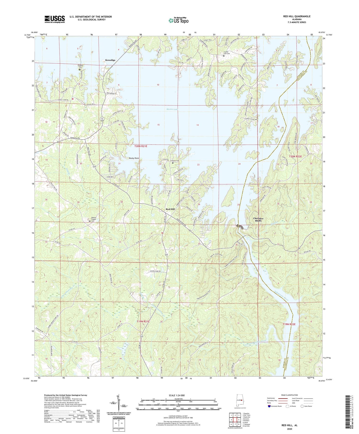
2024 topographic map quadrangle Red Hill in the state of Alabama. Scale: 1:24000. Based on the newly updated USGS 7.5' US Topo map series, this map is in the following counties: Elmore, Tallapoosa. The map contains contour data, water features, and other items you are used to seeing on USGS maps, but also has updated roads and other features. This is the next generation of topographic maps. Printed on high-quality waterproof paper with UV fade-resistant inks.
Quads adjacent to this one:
West: Eclectic
Northwest: Equality
North: Our Town
Northeast: Dadeville
East: Ponders
Southeast: Carrville
South: Tallassee
Southwest: Claud
This map covers the same area as the classic USGS quad with code o32085f8.
Contains the following named places: Asbury School, Bethlehem, Beulah Baptist Church, Camp Dixie, Camp Exchange, Channahatchee Creek, Channahatchee Hunting Club, Cherokee Bluffs, Church in the Pines, County Line Cemetery, Crystal Island Marina, Dixie Sailing Club, Double Bridges Ferry, Gold Branch, Irma, Kailaidshi, Kelsey School, Kowaliga, Kowaliga Marina, Kowaliga Volunteer Fire Department, Lovejoy Cemetery, Martin Dam, Martin Lake, McCarty Ferry, Meltons Mill, Pleasant Hill Church, Prospect Cemetery, Prospect Methodist Church, Red Hill, Red Hill School, Red Hill Volunteer Fire Department, Refuge Baptist Church, Rock Hill School, Rocky Point, Shiloh Baptist Church, Watson Chapel, Watson Chapel Cemetery, Whispering Springs Campground, Wind Creek


