MyTopo
Ponders Alabama US Topo Map
Couldn't load pickup availability
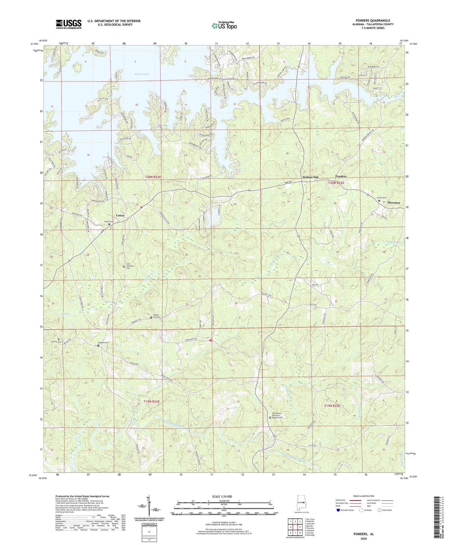
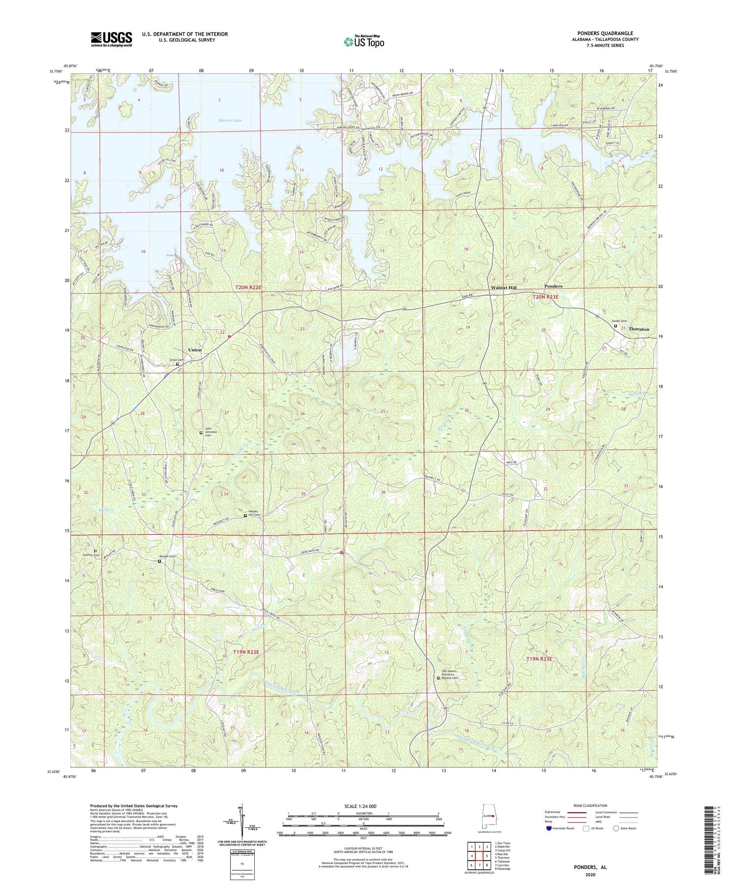
2024 topographic map quadrangle Ponders in the state of Alabama. Scale: 1:24000. Based on the newly updated USGS 7.5' US Topo map series, this map is in the following counties: Tallapoosa. The map contains contour data, water features, and other items you are used to seeing on USGS maps, but also has updated roads and other features. This is the next generation of topographic maps. Printed on high-quality waterproof paper with UV fade-resistant inks.
Quads adjacent to this one:
West: Red Hill
Northwest: Our Town
North: Dadeville
Northeast: Camp Hill
East: Thornton
Southeast: Notasulga
South: Carrville
Southwest: Tallassee
This map covers the same area as the classic USGS quad with code o32085f7.
Contains the following named places: Bama Park, Barnesville, Beulah Baptist Church, Beulah Cemetery, Blue Creek, Blue Creek Marina, Buck Creek, Copper Creek, Erie, Guthrie Cemetery, Harper Hill Cemetery, Harper Hill Church, John Johnston Cemetery, Ledbetter Creek, Maxwell-Gunter Recreation Area, Mitchell Creek, New Prospect Church, Old Sharon Primitive Baptist Cemetery, Pleasant Valley Church, Pleasant Valley School, Ponders, Sardis, Sardis Cemetery, Sardis Methodist Church, Sougahatchee Church, Sougahatchee Lookout Tower, Still Waters, Still Waters Marina, Union, Union Academy, Union Cemetery, Union Church, Union Volunteer Fire and Rescue Department, Walnut Hill