
MyTopo
Roba Alabama US Topo Map
Couldn't load pickup availability
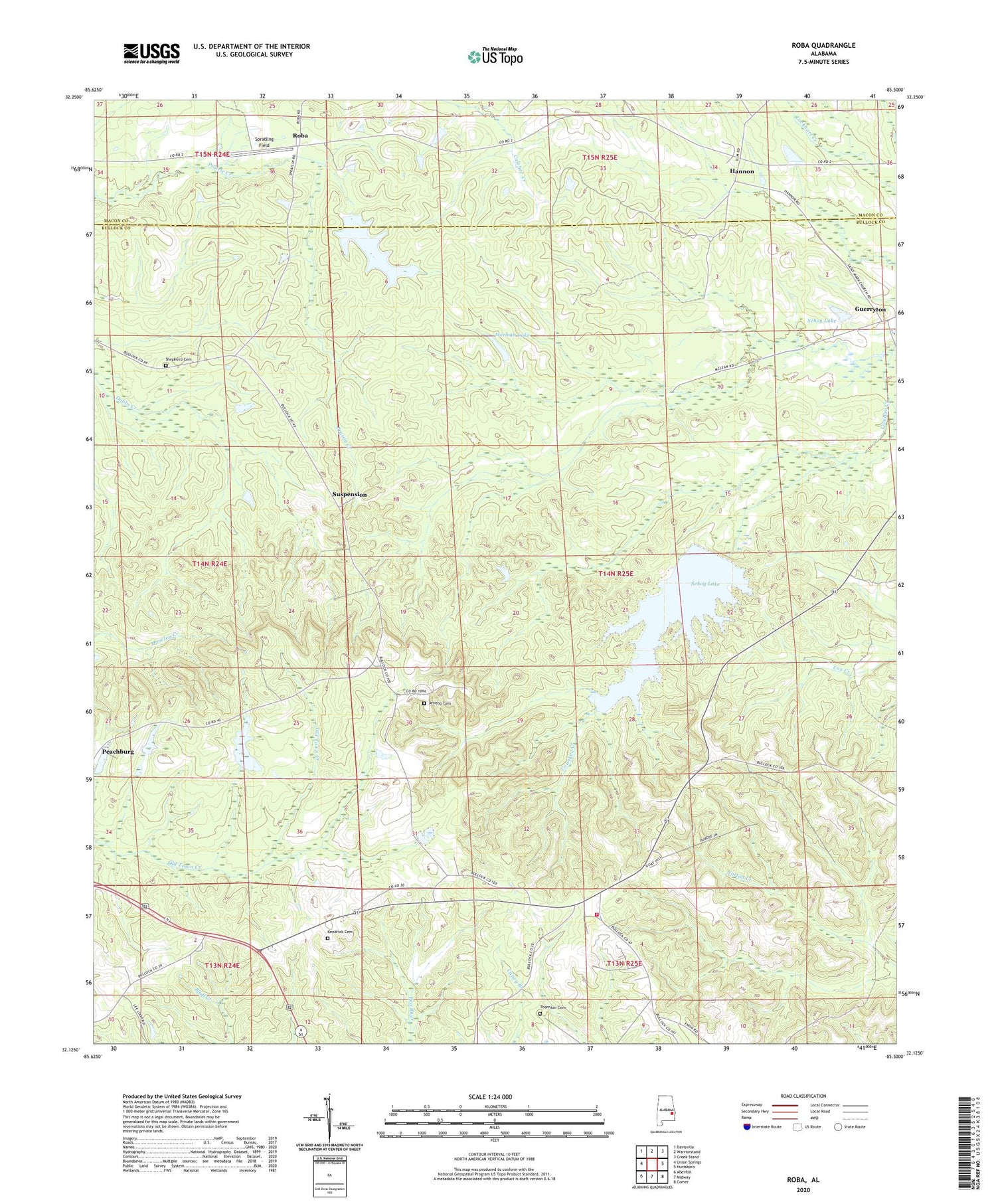
2024 topographic map quadrangle Roba in the state of Alabama. Scale: 1:24000. Based on the newly updated USGS 7.5' US Topo map series, this map is in the following counties: Bullock, Macon. The map contains contour data, water features, and other items you are used to seeing on USGS maps, but also has updated roads and other features. This is the next generation of topographic maps. Printed on high-quality waterproof paper with UV fade-resistant inks.
Quads adjacent to this one:
West: Union Springs
Northwest: Davisville
North: Warriorstand
Northeast: Creek Stand
East: Hurtsboro
Southeast: Comer
South: Midway
Southwest: Aberfoil
This map covers the same area as the classic USGS quad with code o32085b5.
Contains the following named places: Boswell Gin, Chananagi, Dawson Church, Guerryton, Hannon, Hannon School, Hardaway African Methodist Episcopal Church, Highway 51 North Volunteer Fire Department, Jericho Cemetery, Kendrick Cemetery, Mcclean Lake, Mcclean Lake Dam, Mount Canaan Church, Mount Canaan School, Mount Moriah Church, Mount Zion Church, Old Pine Grove Church, Peachburg, Roba, Roba Post Office, Sehoy Dam, Sehoy Lake, Sehoy Plantation Lake Dam, Shepherd Cemetery, Spratling Field, Suspension, Thornton Cemetery


