MyTopo
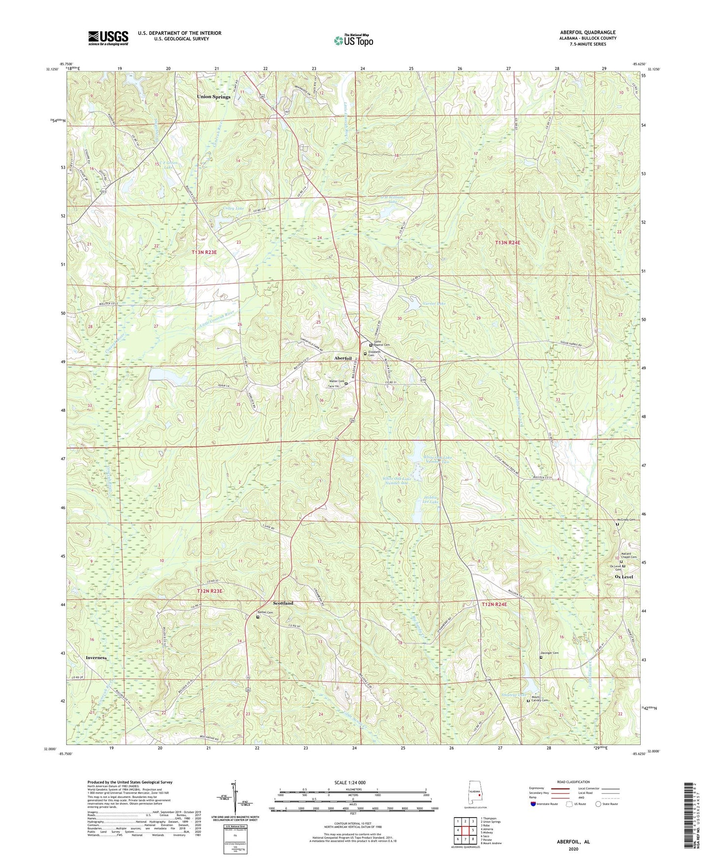
Aberfoil Alabama US Topo Map
Couldn't load pickup availability
2024 topographic map quadrangle Aberfoil in the state of Alabama. Scale: 1:24000. Based on the newly updated USGS 7.5' US Topo map series, this map is in the following counties: Bullock. The map contains contour data, water features, and other items you are used to seeing on USGS maps, but also has updated roads and other features. This is the next generation of topographic maps. Printed on high-quality waterproof paper with UV fade-resistant inks.
Quads adjacent to this one:
West: Almeria
Northwest: Thompson
North: Union Springs
Northeast: Roba
East: Midway
Southeast: Mount Andrew
South: Perote
Southwest: Saco
This map covers the same area as the classic USGS quad with code o32085a6.
Contains the following named places: Aberfoil, Aberfoil Junior High School, Bethel Cemetery, Bethel Presbyterian Church, Bethel School, Bullock County, C F Green Lake, C F Green Lake Dam, Carlisle Mill, Colley Lake, Colley Pond Dam, Cypress Pond, Dasinger Cemetery, Elizabeth Baptist Church, Elizabeth Cemetery, Gibson Dam, Gibson Lake, Green Lakes, Hawkins Chapel, High Ridge Church, Hobbie Lee Dam, Hobbie Lee Lake, Indian Creek, Indian Creek Elementary School, Indian Creek Post Office, Inverness, Inverness Baptist Church, Little Conecuh River, Lydia Baptist Cemetery, Mallard Chapel, Mallard Chapel Cemetery, McGrady Cemetery, Mount Calvary Cemetery, Mount Calvary Church, Neal Chapel African Methodist Episcopal Zion Church, O H Williams Lake, O H Williams Lake Dam, Ox Level, Ox Level Cemetery, Sand Hill Church, Scottland, Smiths Store, Smuteye Lake, Smuteye Pond Dam, Stavo, Tito, Varner Dam, Varner Lake, Walter Cemetery, Walter Chapel, White Oak Lake Number One, White Oak Lake Number Two, White Oak Lakes, White Oak Number One Dam, White Oak Number Two Dam