MyTopo
Midway Alabama US Topo Map
Couldn't load pickup availability
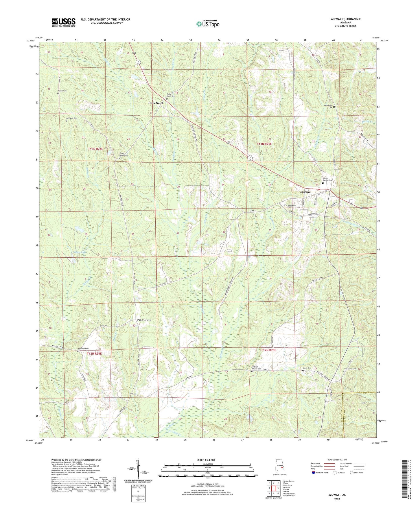
2024 topographic map quadrangle Midway in the state of Alabama. Scale: 1:24000. Based on the newly updated USGS 7.5' US Topo map series, this map is in the following counties: Bullock, Barbour. The map contains contour data, water features, and other items you are used to seeing on USGS maps, but also has updated roads and other features. This is the next generation of topographic maps. Printed on high-quality waterproof paper with UV fade-resistant inks.
Quads adjacent to this one:
West: Aberfoil
Northwest: Union Springs
North: Roba
Northeast: Hurtsboro
East: Comer
Southeast: Clayton North
South: Mount Andrew
Southwest: Perote
This map covers the same area as the classic USGS quad with code o32085a5.
Contains the following named places: Antioch Church Cemetery, Bluff Creek, Caney Branch, Chestnut Ridge School, Fairview Cemetery, Fairview School, Fellowship Cemetery, Fellowship Church, Fishers Lake, Hayes Hill Church, James, Jenks Store, Johnson Creek, Johnston Cemetery, Lewis Cemetery, Little Creek, Merritt High School, Midway, Midway Baptist Cemetery, Midway Division, Midway Post Office, Midway Station, Midway Volunteer Fire Department, Mount Asia Church, Mount Azure Baptist Church, Mount Azure Cemetery, Mount Coney Church, Oak Grove Cemetery, Oak Grove Church, Oliver Junior High School, Peniel Cemetery, Pine Grove, Posey Creek, Three Notch, Three Notch Cemetery, Town of Midway