
MyTopo
Sandy Ridge Alabama US Topo Map
Couldn't load pickup availability
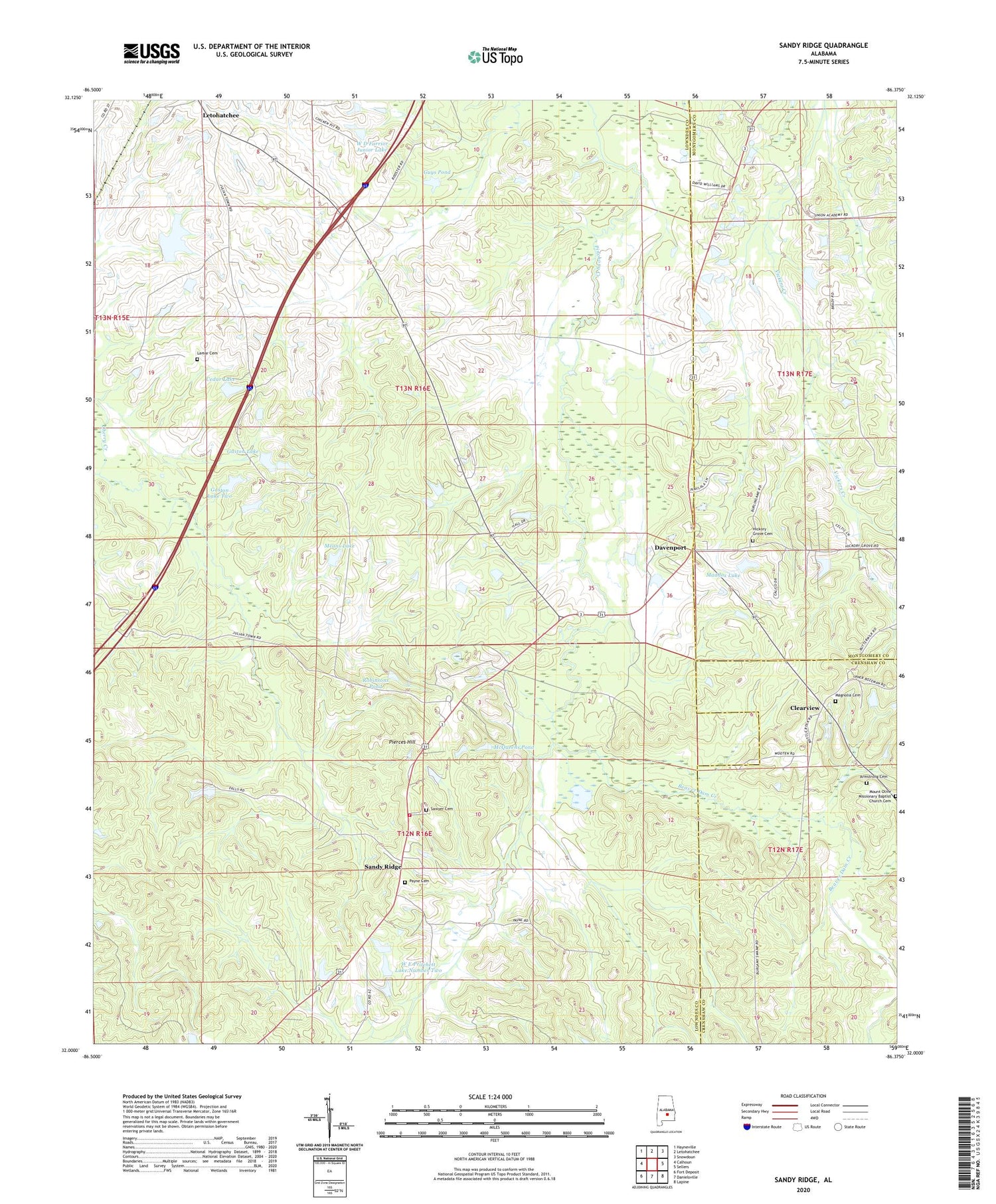
2024 topographic map quadrangle Sandy Ridge in the state of Alabama. Scale: 1:24000. Based on the newly updated USGS 7.5' US Topo map series, this map is in the following counties: Lowndes, Montgomery, Crenshaw. The map contains contour data, water features, and other items you are used to seeing on USGS maps, but also has updated roads and other features. This is the next generation of topographic maps. Printed on high-quality waterproof paper with UV fade-resistant inks.
Quads adjacent to this one:
West: Calhoun
Northwest: Hayneville
North: Letohatchee
Northeast: Snowdoun
East: Sellers
Southeast: Lapine
South: Danielsville
Southwest: Fort Deposit
This map covers the same area as the classic USGS quad with code o32086a4.
Contains the following named places: Armstrong Cemetery, Beautiful Zion African Methodist Episcopal Zion Church, Beaver Dam Creek, Big Zion Church, Big Zion School, Browns Dam, Calvary Church, Cedar Lake, Clearview, Davenport, E B and S L Payne Lake, E B and S L Payne Lake Dam, Flatwoods Creek, Gaston Lake, Gaston Lake Two, Gus Gaston Dam One, Gus Gaston Dam Two, Guys Pond, Guys Village Church, Guys Village School, Hazley School, Hickory Grove Cemetery, Lamar Cemetery, Lily Missionary Baptist Church, Lily School, Maddox Dam, Maddox Lake, Magnolia Cemetery, Magnolia Church, McQueens Pond, Means Lake, Mount Nebo Church, Payne Cemetery, Paynes Dam, Pierces Hill, Pintlala Volunteer Fire Department Station 2, Robinsons Pond, Sandy Ridge, Sandy Ridge Church, Sandy Ridge School, Sandy Ridge Volunteer Fire Department, Sawyer Cemetery, W D Farrior Junior Lake, W D Farrior Junior Lake Dam, W E Pritchett Lake Dam Number One, W E Pritchett Lake Dam Number Two, W E Pritchett Lake Number One, W E Pritchett Lake Number Two, White Cloud Church, Zion


