MyTopo
Hayneville Alabama US Topo Map
Couldn't load pickup availability
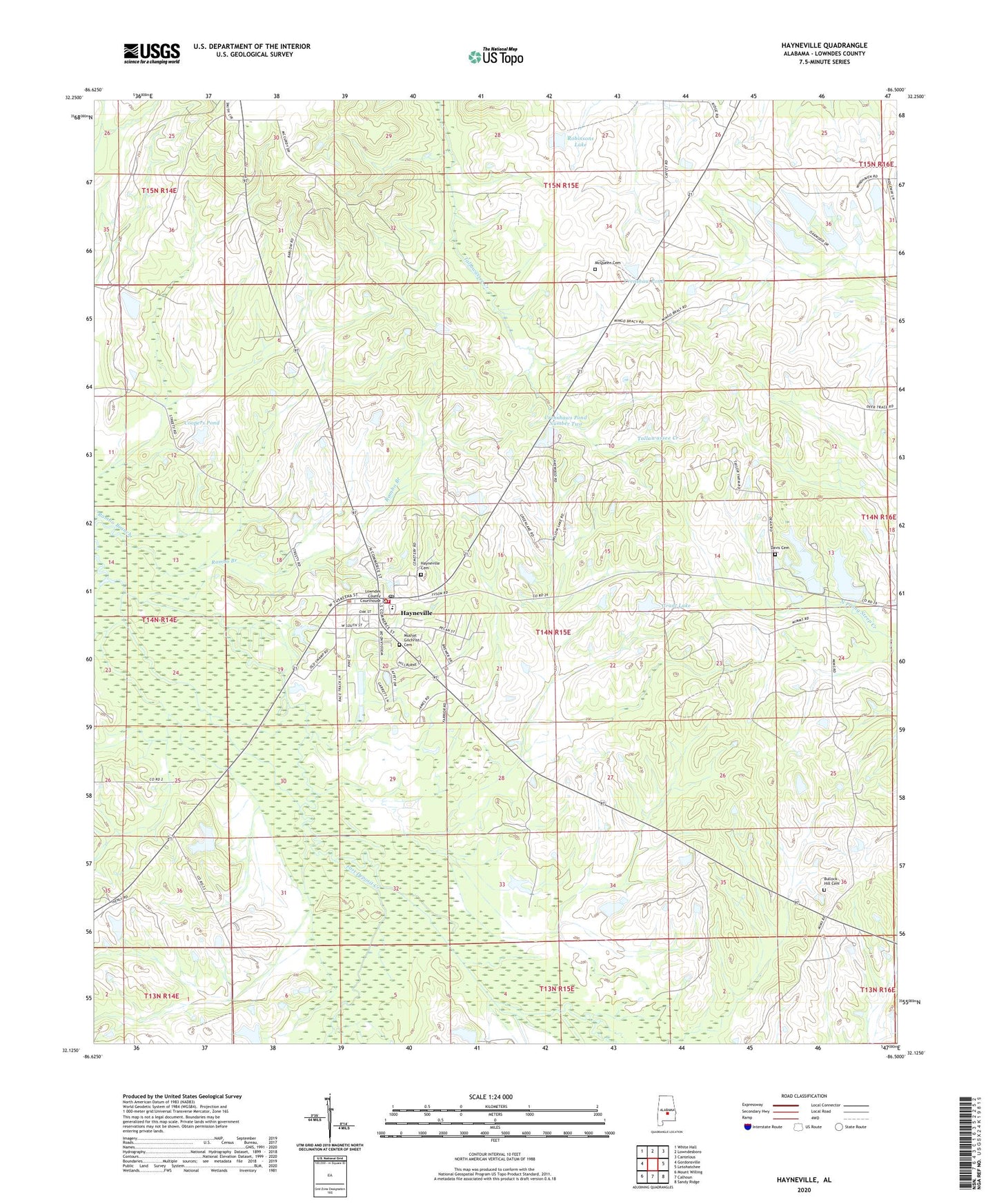
2024 topographic map quadrangle Hayneville in the state of Alabama. Scale: 1:24000. Based on the newly updated USGS 7.5' US Topo map series, this map is in the following counties: Lowndes. The map contains contour data, water features, and other items you are used to seeing on USGS maps, but also has updated roads and other features. This is the next generation of topographic maps. Printed on high-quality waterproof paper with UV fade-resistant inks.
Quads adjacent to this one:
West: Gordonsville
Northwest: White Hall
North: Lowndesboro
Northeast: Cantelous
East: Letohatchee
Southeast: Sandy Ridge
South: Calhoun
Southwest: Mount Willing
This map covers the same area as the classic USGS quad with code o32086b5.
Contains the following named places: Baptist Hill Church, Bricefield Church, Bullock Hill Cemetery, Coopers Pond, Crenshaw Pond, Crenshaws Pond Number Two, Davis Cemetery, Fort Deposit Creek, Friendship Church, Grant Dam, Grant Lake, Harrell Lake, Harrells Lake One, Hayneville, Hayneville Cemetery, Hayneville High School, Hayneville Post Office, Hayneville Volunteer Fire Department, J L Crenshaw Number 2 Dam, Lake Creek, Lowndes County Courthouse, Lowndes County Sheriff's Office, McQueen Cemetery, Mount Olive Church, Mount Sinai Church, Mushat Gilchrist Cemetery, Neil Robinson Dam, Possum Creek, Powell Station, Prairie Hill Post Office, Robinsons Lake, Russell School, Town of Hayneville, W B Woodall Lake, W B Woodall Lake Dam, Wynn and Harrell Number 1 Dam, Wynn and Harrell Number 2 Dam, Wynn and Harrell Pond