MyTopo
Fort Deposit Alabama US Topo Map
Couldn't load pickup availability
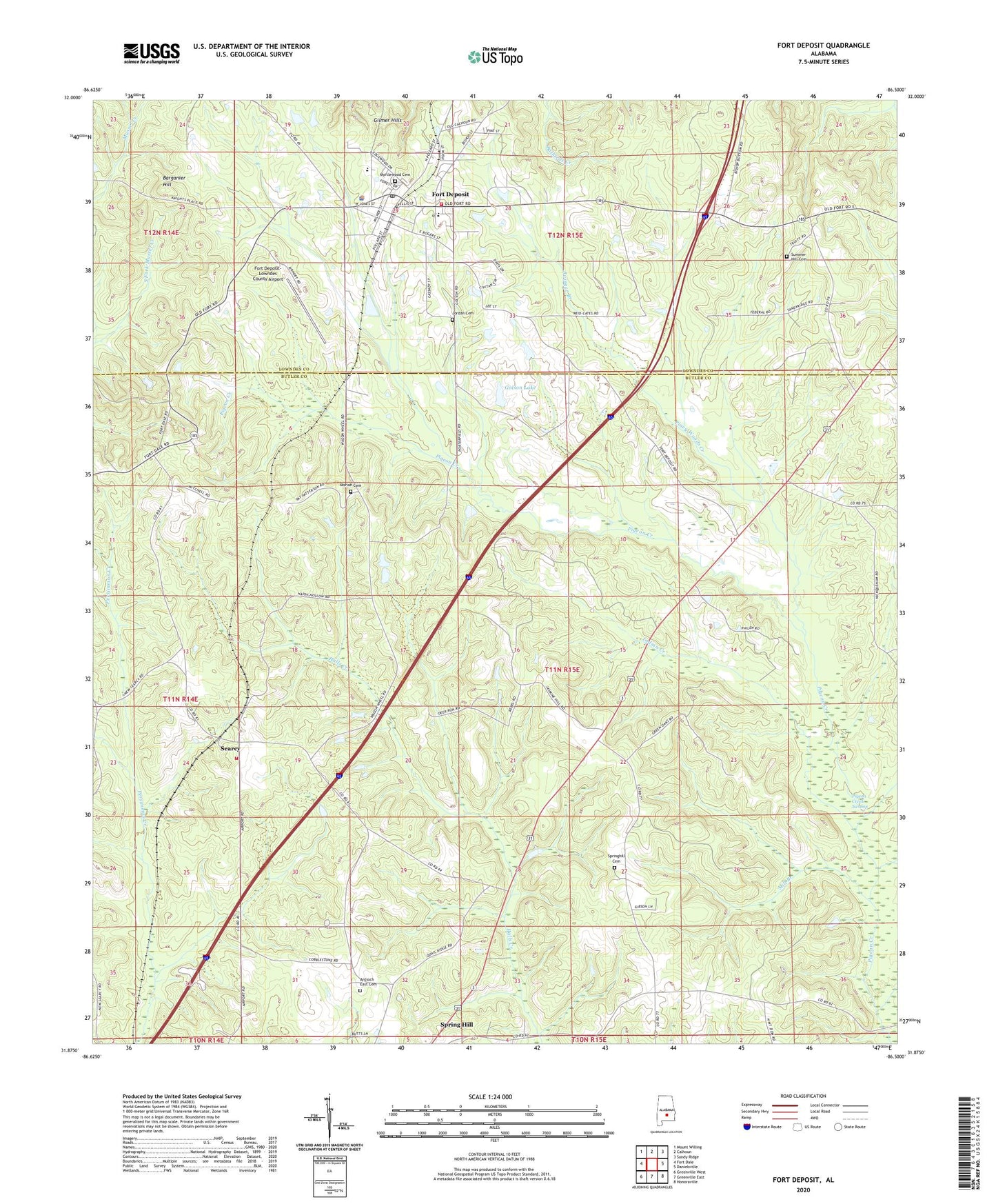
2024 topographic map quadrangle Fort Deposit in the state of Alabama. Scale: 1:24000. Based on the newly updated USGS 7.5' US Topo map series, this map is in the following counties: Butler, Lowndes. The map contains contour data, water features, and other items you are used to seeing on USGS maps, but also has updated roads and other features. This is the next generation of topographic maps. Printed on high-quality waterproof paper with UV fade-resistant inks.
Quads adjacent to this one:
West: Fort Dale
Northwest: Mount Willing
North: Calhoun
Northeast: Sandy Ridge
East: Danielsville
Southeast: Honoraville
South: Greenville East
Southwest: Greenville West
This map covers the same area as the classic USGS quad with code o31086h5.
Contains the following named places: Allen Chapel, Antioch East Cemetery, Antioch East Church, Avinger Branch, Barganier, Barganier Hill, Bethel Baptist Church, Bethlehem Christian Church, Fort Deposit, Fort Deposit Academy, Fort Deposit Elementary School, Fort Deposit Methodist Church, Fort Deposit Police Department, Fort Deposit Post Office, Fort Deposit Primitive Baptist Church, Fort Deposit Town Hall, Fort Deposit Volunteer Fire Department, Fort Deposit-Lowndes County Airport, Golson Lake, Golson Pond Dam, Honeycutt Institute, Hopewell Church, Indian Creek, Indian Hill Church, Jordan Cemetery, Little Sandy Ridge Presbyterian Church, Lowndes County High School, Macedonia Baptist Church, Mill Branch, Moriah Cemetery, Moriah Primitive Baptist Church, Myrtlewood Cemetery, New Hope Church, Piney Woods Creek, Searcy, Searcy Volunteer Fire Department, Spring Hill Methodist Church, Springhill Cemetery, Summer Hill Cemetery, Town of Fort Deposit, ZIP Code: 36032