
MyTopo
Tilden Alabama US Topo Map
Couldn't load pickup availability
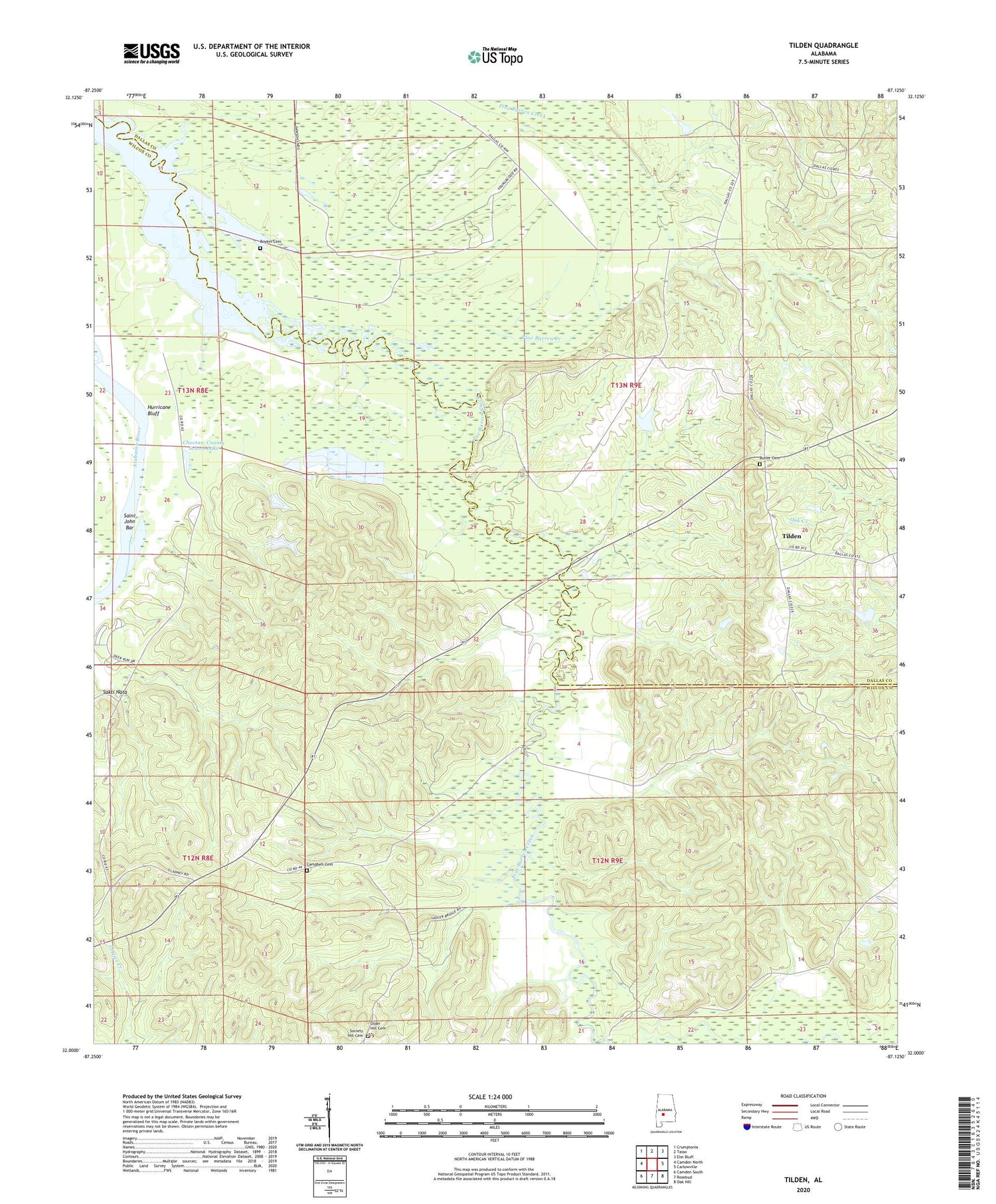
2024 topographic map quadrangle Tilden in the state of Alabama. Scale: 1:24000. Based on the newly updated USGS 7.5' US Topo map series, this map is in the following counties: Wilcox, Dallas. The map contains contour data, water features, and other items you are used to seeing on USGS maps, but also has updated roads and other features. This is the next generation of topographic maps. Printed on high-quality waterproof paper with UV fade-resistant inks.
Quads adjacent to this one:
West: Camden North
Northwest: Crumptonia
North: Tasso
Northeast: Elm Bluff
East: Carlowville
Southeast: Oak Hill
South: Rosebud
Southwest: Camden South
This map covers the same area as the classic USGS quad with code o32087a2.
Contains the following named places: Boykin Cemetery, Butler Cemetery, Campbell Cemetery, Choctaw County School Lake, Choctaw County School Lake Dam, County Line Church, County Line Church Number 2, Frank Cothran Dam, Frank Cothran Lake, Hawthornes Store, Hurricane Bluff, Little Rock Church, Mount Calvary School, New Hope Church, Oak Grove Church, Older Hill Cemetery, Proctor Landing, Roland Cooper State Park, Rosemary Church, Rosemary School, Saint John Bar, Saint Paul Church, Society Hill Cemetery, Tilden, Tilden School, Union Church, US Steel Lake, US Steel Lake Dam


