MyTopo
Tasso Alabama US Topo Map
Couldn't load pickup availability
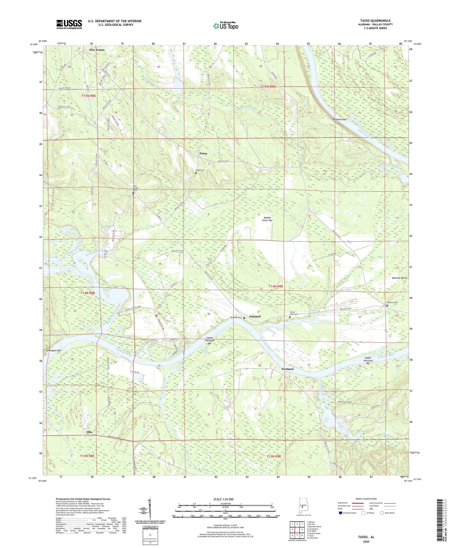
2024 topographic map quadrangle Tasso in the state of Alabama. Scale: 1:24000. Based on the newly updated USGS 7.5' US Topo map series, this map is in the following counties: Dallas. The map contains contour data, water features, and other items you are used to seeing on USGS maps, but also has updated roads and other features. This is the next generation of topographic maps. Printed on high-quality waterproof paper with UV fade-resistant inks.
Quads adjacent to this one:
West: Crumptonia
Northwest: Safford
North: Orrville
Northeast: Blackwell Bend
East: Elm Bluff
Southeast: Carlowville
South: Tilden
Southwest: Camden North
This map covers the same area as the classic USGS quad with code o32087b2.
Contains the following named places: Antioch Church, Bethel School, Bogue Chitto Creek, Bogue Chitto Public Use Area, Cambridge Church, Cheerful Church Number 2, Cheerful School, Ellis, Five Points, Five Points Elementary School, Halls Ferry, Lexington, Lexington Bar, Little Zion Church, Lower Portland Bar, Lutheran School, McMillan Cemetery, Meridith Lake, Meridith Lake Dam, Middle Sister Bar, Molette Bend School, Molette Cemetery, Mount Pleasant Church, New Bethel Cemetery, New Bethel Church, Oak Creek, Pine Belt Landing, Pinebelt, Portland, Portland Public Use Area, Providence Church, Providence School, Rifleman Bar, River Oaks Marina, River Oaks Volunteer Fire Department, Rocky Branch, Rocky Branch Church, Rocky Branch School, Rum Creek, Seale Cemetery, Southwest Dallas Division, Tasso, Turner Field Cemetery, Upper Portland Bar