MyTopo
Elm Bluff Alabama US Topo Map
Couldn't load pickup availability
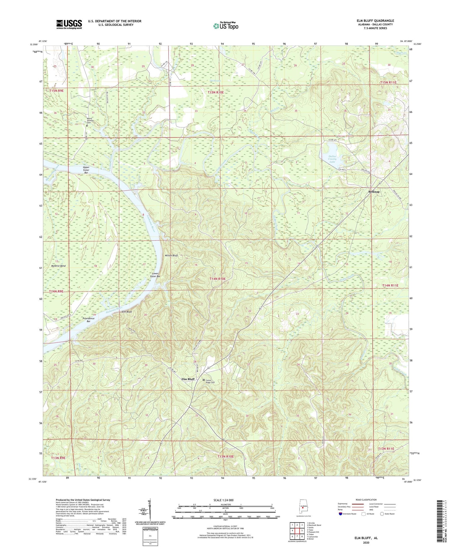
2024 topographic map quadrangle Elm Bluff in the state of Alabama. Scale: 1:24000. Based on the newly updated USGS 7.5' US Topo map series, this map is in the following counties: Dallas. The map contains contour data, water features, and other items you are used to seeing on USGS maps, but also has updated roads and other features. This is the next generation of topographic maps. Printed on high-quality waterproof paper with UV fade-resistant inks.
Quads adjacent to this one:
West: Tasso
Northwest: Orrville
North: Blackwell Bend
Northeast: Sardis
East: Pleasant Hill
Southeast: Minter
South: Carlowville
Southwest: Tilden
This map covers the same area as the classic USGS quad with code o32087b1.
Contains the following named places: Belknap, Berlin Branch, Big Swamp Creek, Campbell Chapel, Carlowville Division, Cedar Creek, Center Ridge Cemetery, Dallas County Lake, Dallas County Public Lake, Dallas County Public Lake Dam, Davis Landing, Elam Bluff Post Office, Elm Bluff, Elm Bluff Lookout Tower, Elm Bluff Public Use Area, Kaxa, Little Rock Church, Lower Sister Bar, Milton Bluff, Molette Bend, Mount Leveton Cemetery, Mount Leveton Church, Mount Leveton School, Mush Creek, New Bethany Church, New Bethel Church, Providence Bar, Providence Landing, Saffold Landing, Saint Stephens Church, Saint Stephens School, Salem Church, Titi Swamp, Upper Sister Bar, Watoolahakahatchee Scout Camp