MyTopo
Winn Alabama US Topo Map
Couldn't load pickup availability
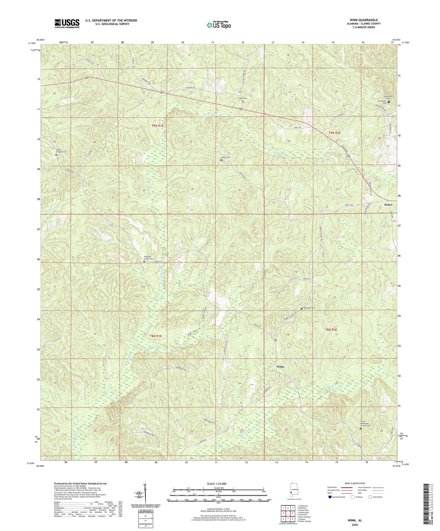
2024 topographic map quadrangle Winn in the state of Alabama. Scale: 1:24000. Based on the newly updated USGS 7.5' US Topo map series, this map is in the following counties: Clarke. The map contains contour data, water features, and other items you are used to seeing on USGS maps, but also has updated roads and other features. This is the next generation of topographic maps. Printed on high-quality waterproof paper with UV fade-resistant inks.
Quads adjacent to this one:
West: Tattlersville
Northwest: Coffeeville
North: McEntyre
Northeast: Fulton West
East: Grove Hill
Southeast: Walker Springs
South: Jackson
Southwest: Saint Stephens
This map covers the same area as the classic USGS quad with code o31087f8.
Contains the following named places: Austin Cemetery, Berry's Chapel African Methodist Episcopal Zion Church, Bethlehem Church, Bumpers Cemetery, Church of God, Clarkesville Cemetery, Clarksville, Clarksville Church, Cobb Cemetery, Community Holiness Church, Dodey Creek, Good Springs Baptist Church, Greater Ebenezer Church, Griffin Chapel Cemetery, New Clarksville Church, Pleasant Grove Cemetery, Pleasant Grove Church, Saint Lukes Cemetery, Saint Lukes Church, Tattilaba, Union Methodist Church Cemetery, Walter Mitchell Church, Wesley Chapel Methodist Church, Winn, Winn Fire Department, Zimco