MyTopo
Walker Springs Alabama US Topo Map
Couldn't load pickup availability
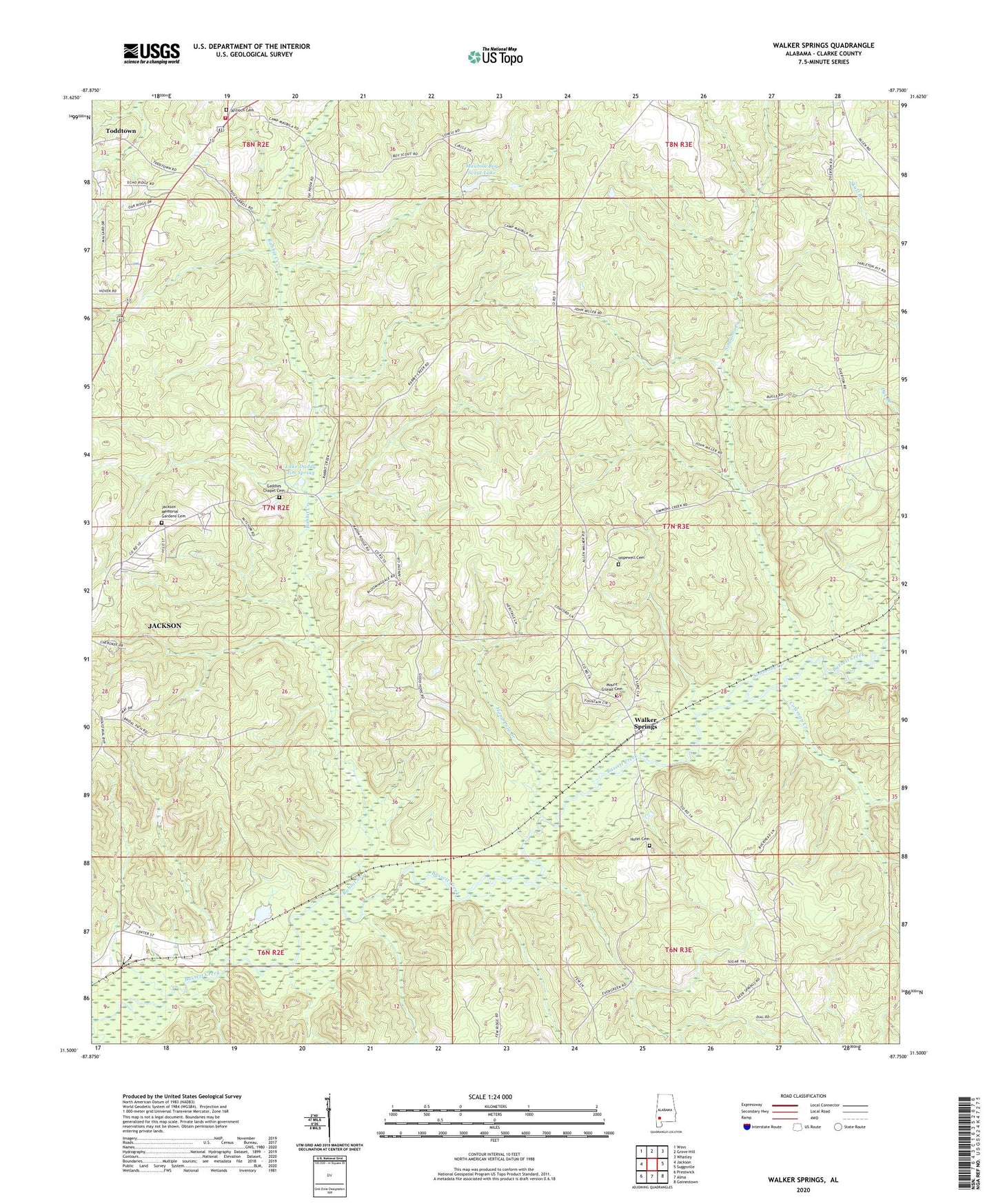
2024 topographic map quadrangle Walker Springs in the state of Alabama. Scale: 1:24000. Based on the newly updated USGS 7.5' US Topo map series, this map is in the following counties: Clarke. The map contains contour data, water features, and other items you are used to seeing on USGS maps, but also has updated roads and other features. This is the next generation of topographic maps. Printed on high-quality waterproof paper with UV fade-resistant inks.
Quads adjacent to this one:
West: Jackson
Northwest: Winn
North: Grove Hill
Northeast: Whatley
East: Suggsville
Southeast: Gainestown
South: Alma
Southwest: Prestwick
This map covers the same area as the classic USGS quad with code o31087e7.
Contains the following named places: Antioch Baptist Church, Antioch Cemetery, Antioch Fire Department, Coleman Creek, Evergreen Baptist Church, Gaddies Chapel, Gaddies Chapel Cemetery, Glendon, Good Hope Baptist Church, Greater Pilgrim Rest Church, Hand Pole Branch, Hopewell Cemetery, Hopewell Methodist Church, Hotel Cemetery, Jackson Industrial Park, Jackson Memorial Gardens Cemetery, Kirven, Lake Daddy Jim Spring, Liberty Hill Church, Maubila Boy Scout Lake, Maubila Boy Scout Lake Dam, Maubila Camp, Mount Gilead Baptist Church, Mount Gilead Cemetery, Nichola, Pilgrims Rest Church, Rabbit Creek, Saint Luke Church, Simmons Creek, Thomasville Sanitary Landfill, Union Methodist Church, Walker Springs, Walker Springs Road Baptist Church, WHOD-AM (Jackson), WHOD-FM (Jackson)