MyTopo
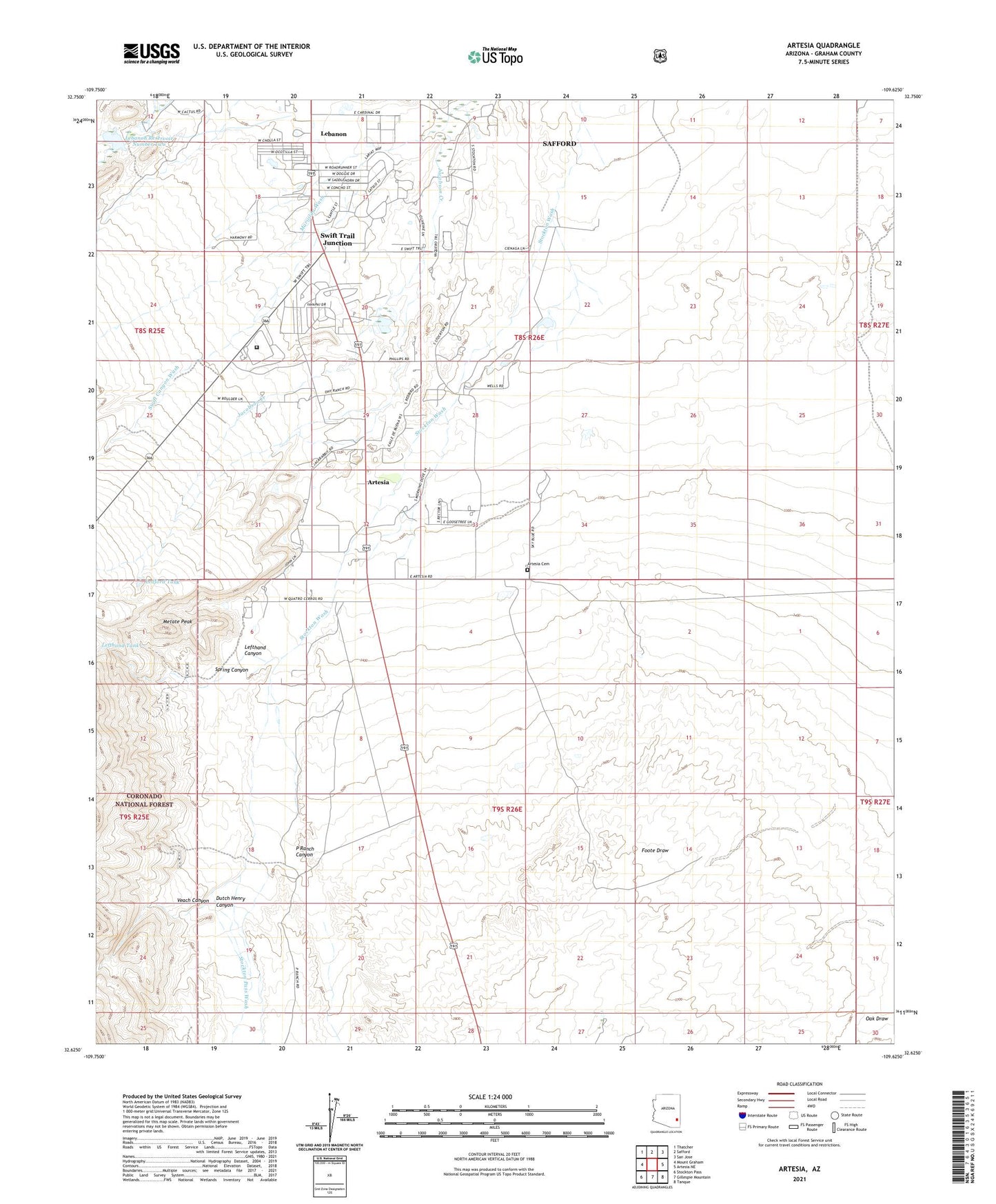
Artesia Arizona US Topo Map
Couldn't load pickup availability
Also explore the Artesia Forest Service Topo of this same quad for updated USFS data
2021 topographic map quadrangle Artesia in the state of Arizona. Scale: 1:24000. Based on the newly updated USGS 7.5' US Topo map series, this map is in the following counties: Graham. The map contains contour data, water features, and other items you are used to seeing on USGS maps, but also has updated roads and other features. This is the next generation of topographic maps. Printed on high-quality waterproof paper with UV fade-resistant inks.
Quads adjacent to this one:
West: Mount Graham
Northwest: Thatcher
North: Safford
Northeast: San Jose
East: Artesia NE
Southeast: Tanque
South: Gillespie Mountain
Southwest: Stockton Pass
This map covers the same area as the classic USGS quad with code o32109f6.
Contains the following named places: Artesia, Artesia Cemetery, Artesia School, Dankworth Pond, Dankworth Pond State Park, Dutch Henry Canyon, Federal Correctional Institution Safford, Jacobson Creek, Lebanon, Lebanon Reservoir Number Two, Lebanon Reservoir Number Two Dam, Ledford Tank, Lefthand Canyon, Lefthand Tank, Metate Peak, P Ranch, P Ranch Canyon, Spring Canyon, Stockton Pass Wash, Swift Canyon Wash, Swift Trail Junction, Swift Trail Junction Census Designated Place, Veach Canyon