MyTopo
Artillery Peak Arizona US Topo Map
Couldn't load pickup availability
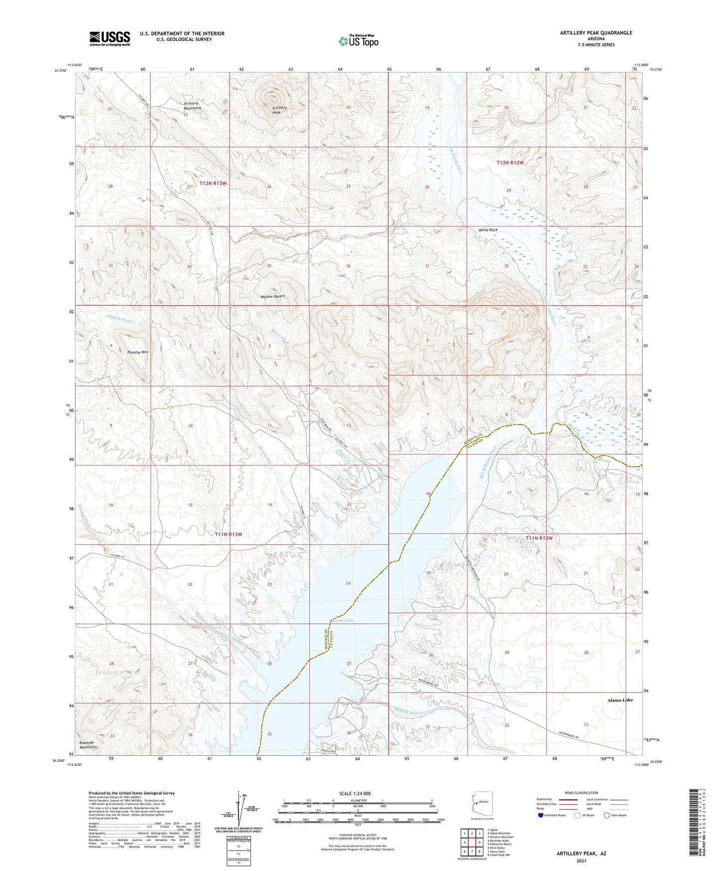
2021 topographic map quadrangle Artillery Peak in the state of Arizona. Scale: 1:24000. Based on the newly updated USGS 7.5' US Topo map series, this map is in the following counties: Mohave, La Paz. The map contains contour data, water features, and other items you are used to seeing on USGS maps, but also has updated roads and other features. This is the next generation of topographic maps. Printed on high-quality waterproof paper with UV fade-resistant inks.
Quads adjacent to this one:
West: Rawhide Wash
Northwest: Signal
North: Signal Mountain
Northeast: Arrastra Mountain
East: Palmerita Ranch
Southeast: Smith Peak NW
South: Alamo Dam
Southwest: Reid Valley
This map covers the same area as the classic USGS quad with code o34113c5.
Contains the following named places: Alamo Crossing, Alamo Lake, Alamo Lake Census Designated Place, Alamo Wildlife Area, American Mine, Artillery Mountains, Artillery Peak, Big Sandy River, Black Diamond Mine, Browns Crossing, Bullard Wash, Burro Wash, Chapin Wash, Lake Mine, Loves Camp, Loves Mine, Maggie Wash, Neeye Mine, Plancha Mountain, Priceless Mine, Rawhide Wash, Santa Maria River, White Rock