MyTopo
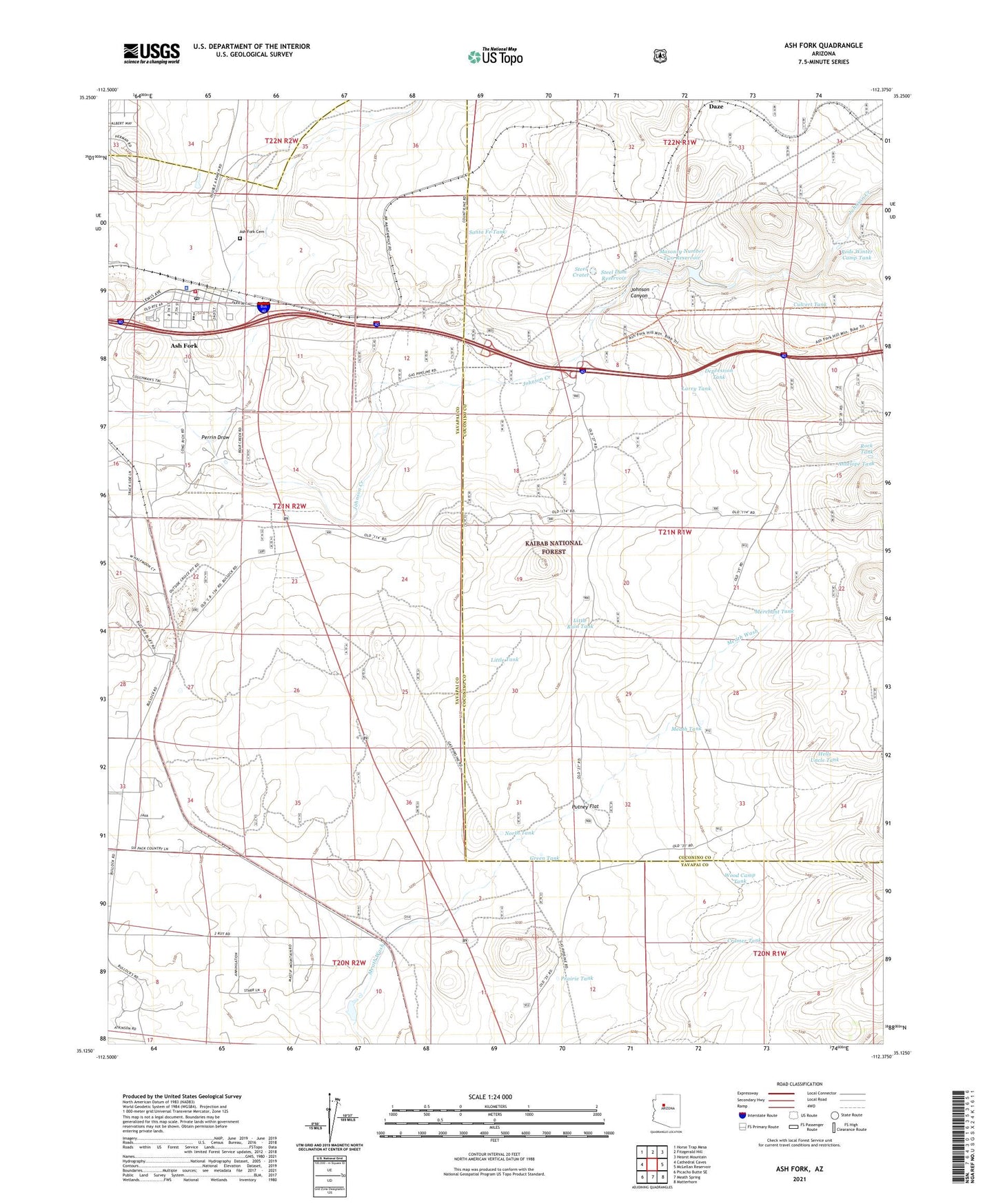
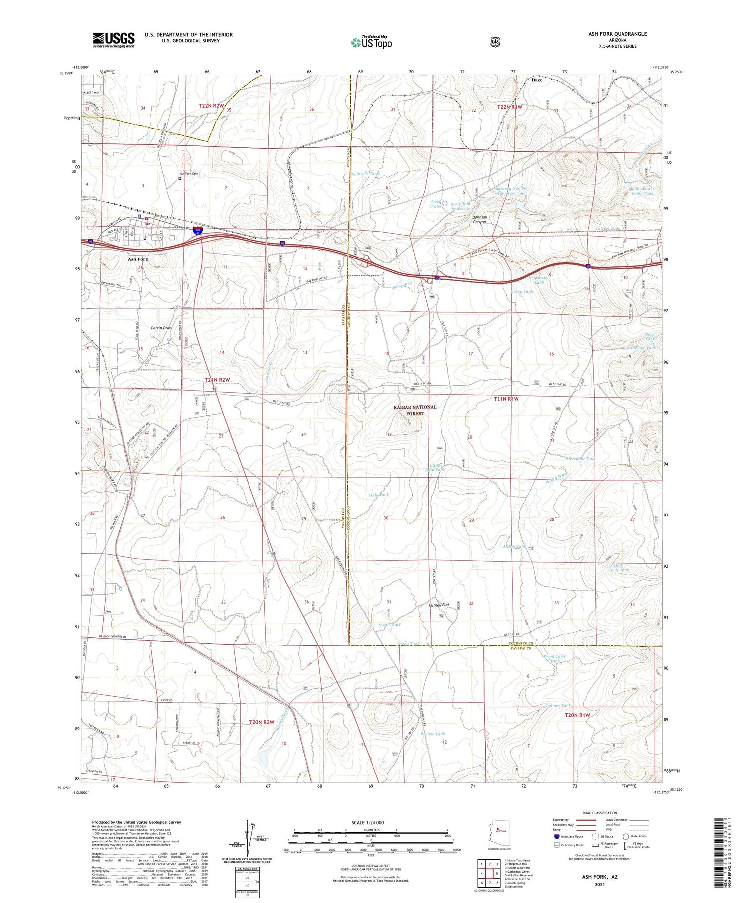
Ash Fork Arizona US Topo Map
Couldn't load pickup availability
Also explore the Ash Fork Forest Service Topo of this same quad for updated USFS data
2021 topographic map quadrangle Ash Fork in the state of Arizona. Scale: 1:24000. Based on the newly updated USGS 7.5' US Topo map series, this map is in the following counties: Yavapai, Coconino. The map contains contour data, water features, and other items you are used to seeing on USGS maps, but also has updated roads and other features. This is the next generation of topographic maps. Printed on high-quality waterproof paper with UV fade-resistant inks.
Quads adjacent to this one:
West: Cathedral Caves
Northwest: Horse Trap Mesa
North: Fitzgerald Hill
Northeast: Hearst Mountain
East: McLellan Reservoir
Southeast: Matterhorn
South: Meath Spring
Southwest: Picacho Butte SE
This map covers the same area as the classic USGS quad with code o35112b4.
Contains the following named places: Antelope Tank, Arizona Highway Maintenance Yard, Ash Fork, Ash Fork Cemetery, Ash Fork Census Designated Place, Ash Fork Elementary School, Ash Fork Fire Station, Ash Fork High School, Ash Fork Landing Strip, Ash Fork Middle School, Ash Fork Post Office, Ash Fork Public Library, Ash Fork Railroad Station, Ash Fork Santa Fe Railroad Company Water Tank, Ash Fork Substation, Bridge Tank, Cramer Tank, Cruice Railroad Station, Cruice Siding, Culvert Tank, Daze, Daze Railroad Station, Depression Tank, First Southern Baptist Church, Green Tank, Hat Ranch, Hells Uncle Tank, Irishman Dam, Johnson Canyon, Johnson Creek, Larry Tank, Little Rain Tank, Little Tank, Masonry Number Two Reservoir, Meath Dam, Meath Tank, Merchant Tank, North Tank, Perrin Draw, Perrin Tank, Prairie Tank, Putney Flat, Quarter Circle X X Ranch, Rock Tank, Rods Winter Camp Tank, Santa Fe Tank, Steel Crater, Steel Dam, Steel Dam Reservoir, Stone Dam, Wood Camp Tank