MyTopo
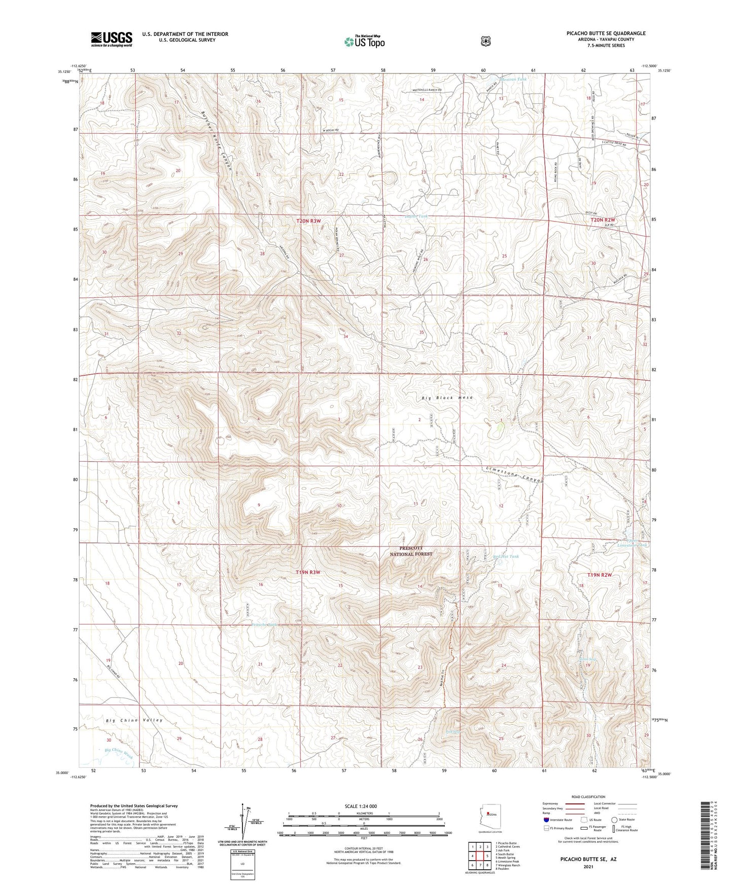
Picacho Butte SE Arizona US Topo Map
Couldn't load pickup availability
Also explore the Picacho Butte SE Forest Service Topo of this same quad for updated USFS data
2021 topographic map quadrangle Picacho Butte SE in the state of Arizona. Scale: 1:24000. Based on the newly updated USGS 7.5' US Topo map series, this map is in the following counties: Yavapai. The map contains contour data, water features, and other items you are used to seeing on USGS maps, but also has updated roads and other features. This is the next generation of topographic maps. Printed on high-quality waterproof paper with UV fade-resistant inks.
Quads adjacent to this one:
West: South Butte
Northwest: Picacho Butte
North: Cathedral Caves
Northeast: Ash Fork
East: Meath Spring
Southeast: Paulden
South: Wineglass Ranch
Southwest: Limestone Peak
This map covers the same area as the classic USGS quad with code o35112a5.
Contains the following named places: AGF Trick Tank, Big Black Mesa, Camp Cotton, Cotton Dam, Eddy Tank, Fritsche Tank, Indian Tank, Mexican Dam, Mexican Tank, Pool Seep, Pool Tank, Red Hat Tank, Storm Seep, Upper Limestone Tank, Upper Limestone Tank Dam