MyTopo
Cathedral Caves Arizona US Topo Map
Couldn't load pickup availability
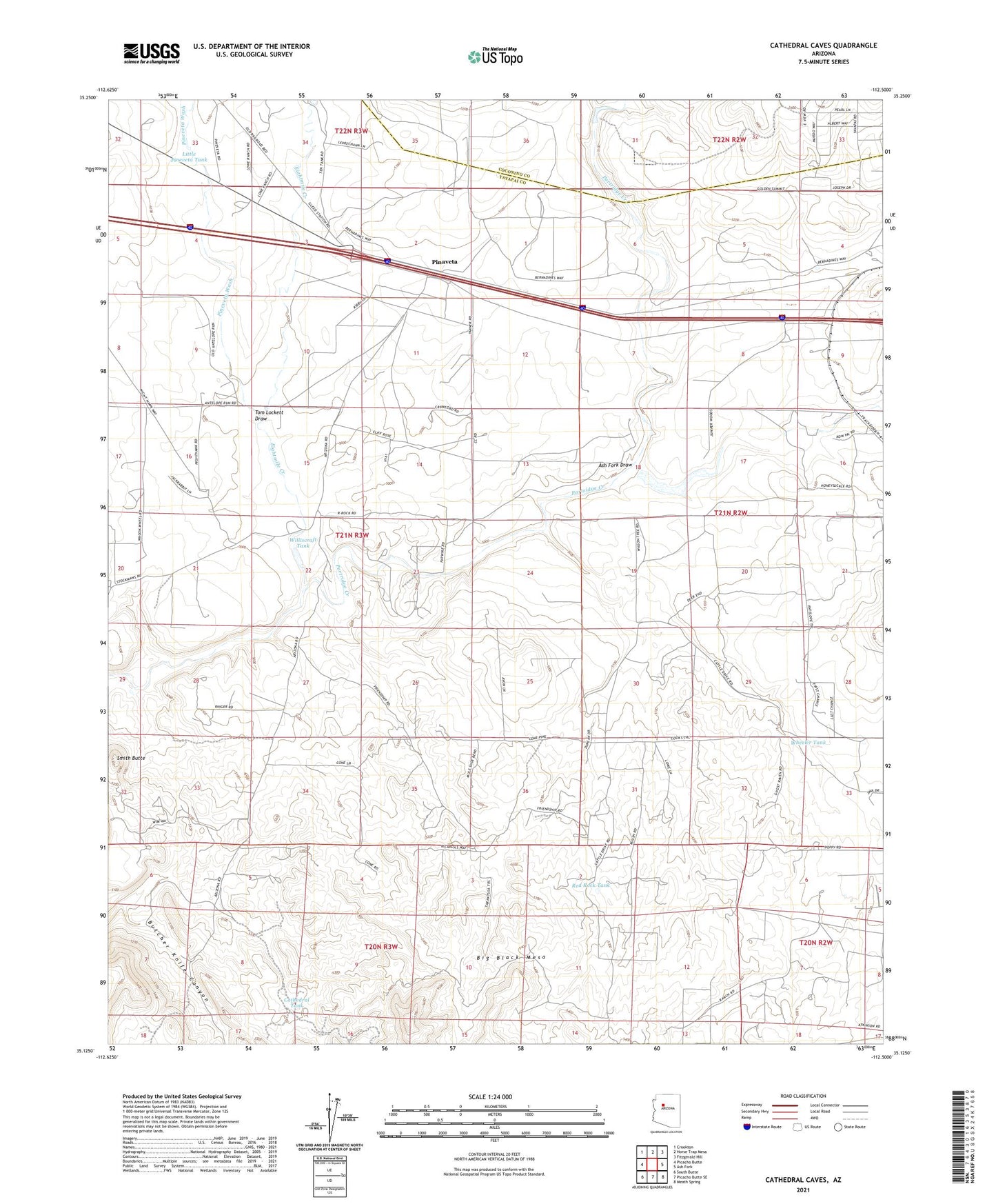
2021 topographic map quadrangle Cathedral Caves in the state of Arizona. Scale: 1:24000. Based on the newly updated USGS 7.5' US Topo map series, this map is in the following counties: Yavapai, Coconino. The map contains contour data, water features, and other items you are used to seeing on USGS maps, but also has updated roads and other features. This is the next generation of topographic maps. Printed on high-quality waterproof paper with UV fade-resistant inks.
Quads adjacent to this one:
West: Picacho Butte
Northwest: Crookton
North: Horse Trap Mesa
Northeast: Fitzgerald Hill
East: Ash Fork
Southeast: Meath Spring
South: Picacho Butte SE
Southwest: South Butte
This map covers the same area as the classic USGS quad with code o35112b5.
Contains the following named places: Ash Fork Draw, Cathedral Tank, Eightmile Creek, Foley Dam, Jumbo Tank, Little Pineveta Tank, Pinaveta, Pineveta Wash, Red Rock Tank, Seligman Junction Substation, Smith Butte, Tom Lockett Draw, Wheeler Tank, Williscraft Dam, Williscraft Tank