MyTopo
Avondale SW Arizona US Topo Map
Couldn't load pickup availability
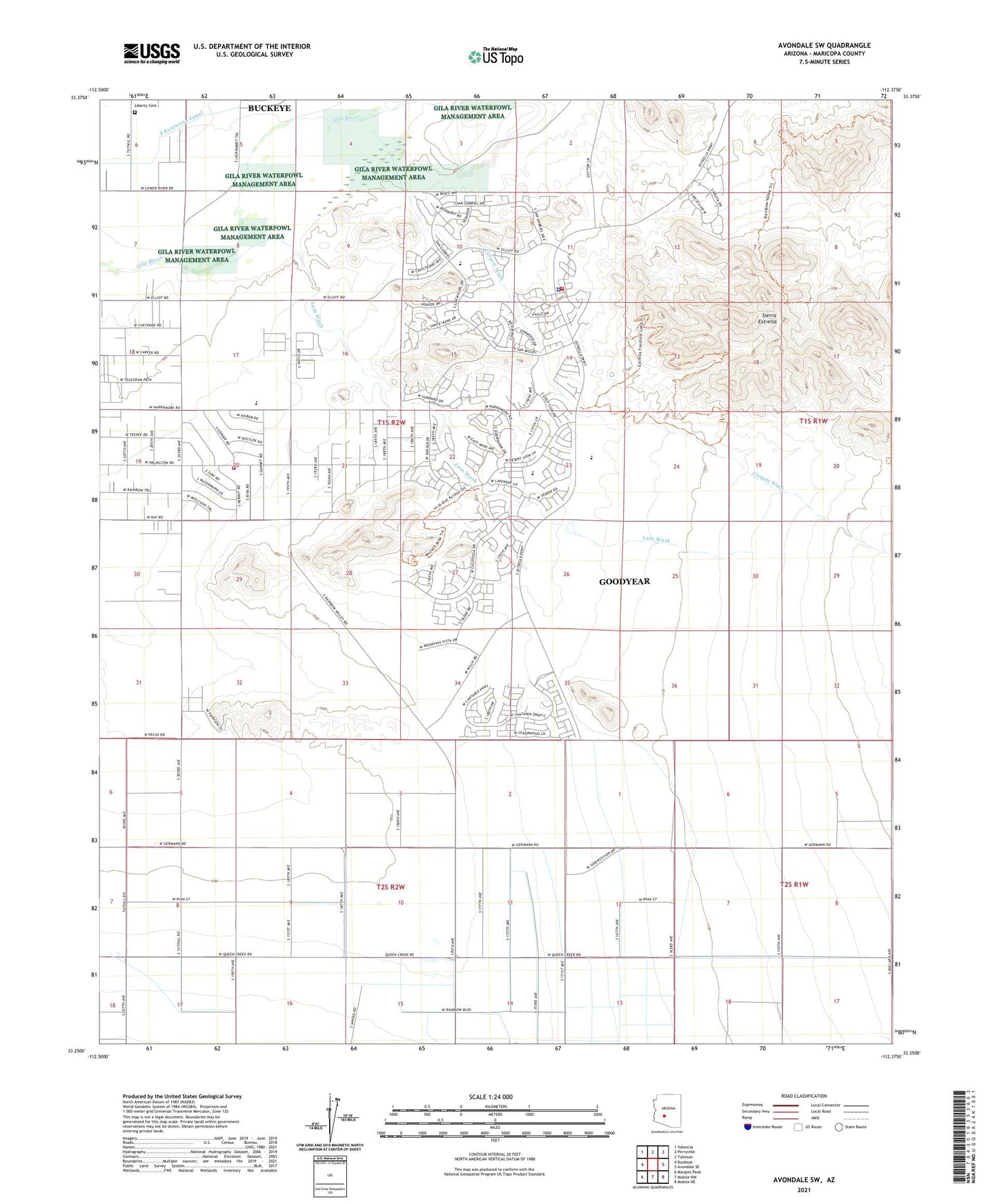
2021 topographic map quadrangle Avondale SW in the state of Arizona. Scale: 1:24000. Based on the newly updated USGS 7.5' US Topo map series, this map is in the following counties: Maricopa. The map contains contour data, water features, and other items you are used to seeing on USGS maps, but also has updated roads and other features. This is the next generation of topographic maps. Printed on high-quality waterproof paper with UV fade-resistant inks.
Quads adjacent to this one:
West: Buckeye
Northwest: Valencia
North: Perryville
Northeast: Tolleson
East: Avondale SE
Southeast: Mobile NE
South: Mobile NW
Southwest: Margies Peak
This map covers the same area as the classic USGS quad with code o33112c4.
Contains the following named places: Buckeye Valley Fire District Station 326, Casey Abbott Semi-Regional Park, City of Estrella Wastewater Treatment Plant, Corgett Wash, Estrella Foothills High School, Estrella Mountain Church, Estrella Mountain Elementary School, Goodyear Fire Department Station 182, Liberty Cemetery, Lum Wash, Maricopa County, Rainbow Valley Elementary School, Rainbow Valley Water Reclamation Facility, South Extension Canal, The Golf Club of Estrella, Victory Baptist Church, Westar Elementary School, ZIP Code: 85338