
MyTopo
Valencia Arizona US Topo Map
Couldn't load pickup availability
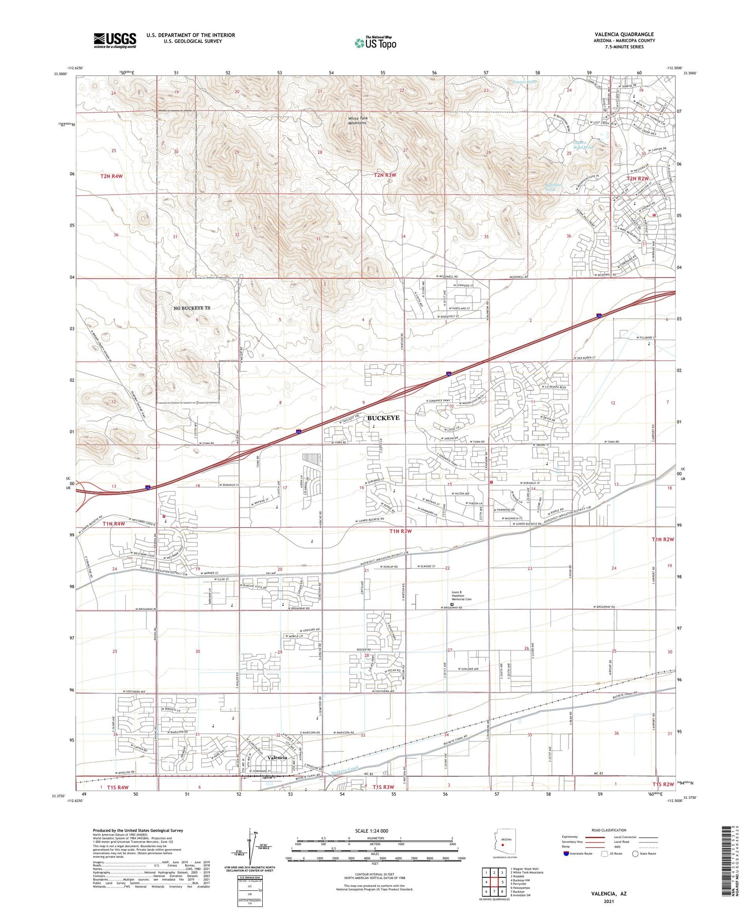
2021 topographic map quadrangle Valencia in the state of Arizona. Scale: 1:24000. Based on the newly updated USGS 7.5' US Topo map series, this map is in the following counties: Maricopa. The map contains contour data, water features, and other items you are used to seeing on USGS maps, but also has updated roads and other features. This is the next generation of topographic maps. Printed on high-quality waterproof paper with UV fade-resistant inks.
Quads adjacent to this one:
West: Buckeye NW
Northwest: Wagner Wash Well
North: White Tank Mountains
Northeast: Waddell
East: Perryville
Southeast: Avondale SW
South: Buckeye
Southwest: Hassayampa
This map covers the same area as the classic USGS quad with code o33112d5.
Contains the following named places: Bales Elementary School, Buckeye Canal, Buckeye Fire Department Station 702 Sundance, Buckeye Fire Department Station 703 Verrado, Buckeye Fire Department Station 706, Buckeye FRS Dam Number Three, Buckeye FRS Dam Number Two, Buckeye Substation, Buckeye Union High School, Buckeye Valley Fire District Station 327, Buena Vista Mobile Home Park, Country Home Mobile Village, Freedom Elementary School, Grace Fellowship Church, Inca Elementary School, Leaf Verde Recreational Vehicle Resort, Liberty Substation, Louis B Hazelton Memorial Cemetery, Raven Golf Club at Verrado, Steven R Jasinski Elementary School, Sundance Elementary School, Sundance Golf Club, The Odyssey Preparatory Academy - Buckeye Apache Campus, Valencia, Verrado Elementary School, Verrado Middle School, West Park Elementary School, White Tanks Proving Grounds, Youngker High School


