MyTopo
Buckeye Arizona US Topo Map
Couldn't load pickup availability
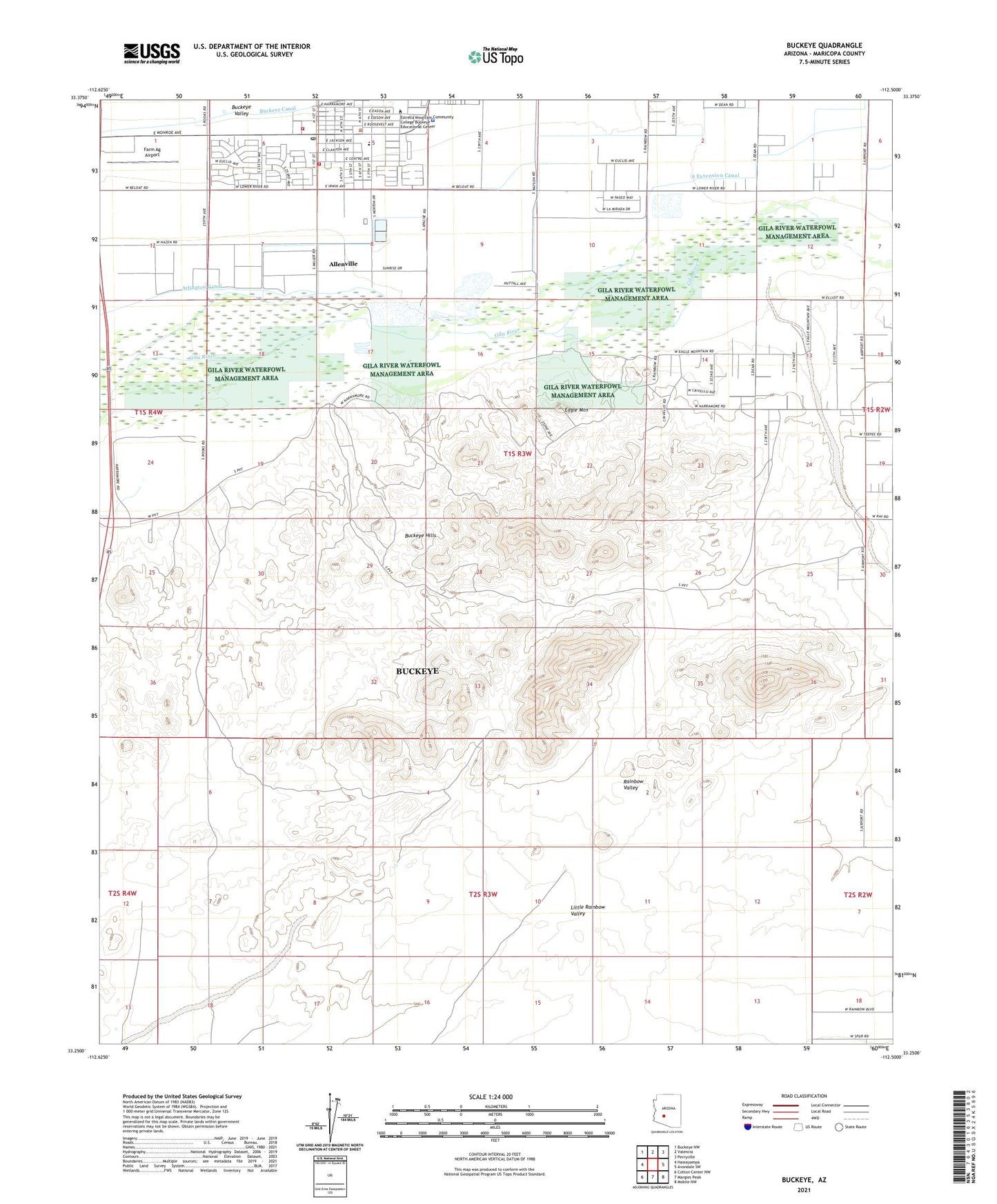
2021 topographic map quadrangle Buckeye in the state of Arizona. Scale: 1:24000. Based on the newly updated USGS 7.5' US Topo map series, this map is in the following counties: Maricopa. The map contains contour data, water features, and other items you are used to seeing on USGS maps, but also has updated roads and other features. This is the next generation of topographic maps. Printed on high-quality waterproof paper with UV fade-resistant inks.
Quads adjacent to this one:
West: Hassayampa
Northwest: Buckeye NW
North: Valencia
Northeast: Perryville
East: Avondale SW
Southeast: Mobile NW
South: Margies Peak
Southwest: Cotton Center NW
This map covers the same area as the classic USGS quad with code o33112c5.
Contains the following named places: Allenville, Buckeye, Buckeye City Hall, Buckeye Elementary School, Buckeye Fire Department Station 701 Downtown, Buckeye Light and Life Church, Buckeye Middle School, Buckeye Police Department, Buckeye Post Office, Buckeye Primary School, Buckeye Public Library, Buckeye Seventh Day Adventist Church, Buckeye Sports Field, Buckeye Town Park, Buckeye Valley Fire District Station 324, Buckeye Valley Museum, Cactus Plaza Shopping Center, Community United Methodist Church, Dr Robert A Saide Recreation Center, Eagle Mountain, Estrella Valley Mobile Home Park, Farm Ag Airport, First Southern Baptist Church in Buckeye, Maricopa County Sheriff's Office Buckeye, Mount Pleasant Church, Rainbow Valley, The Church of Jesus Christ of Latter Day Saints, Town of Buckeye Wastewater Treatment Plant, Waterman Wash, Westpark Elementary School, ZIP Code: 85326