MyTopo
Baldy Mountain Arizona US Topo Map
Couldn't load pickup availability
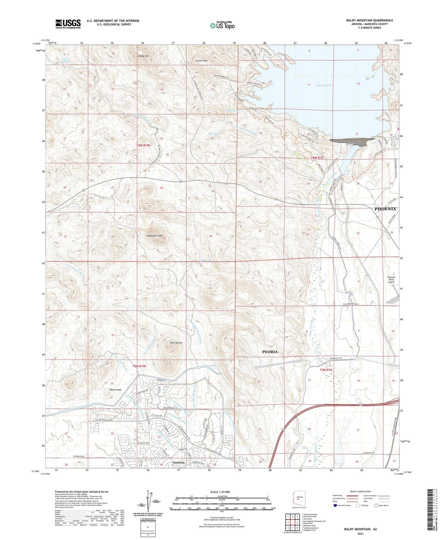
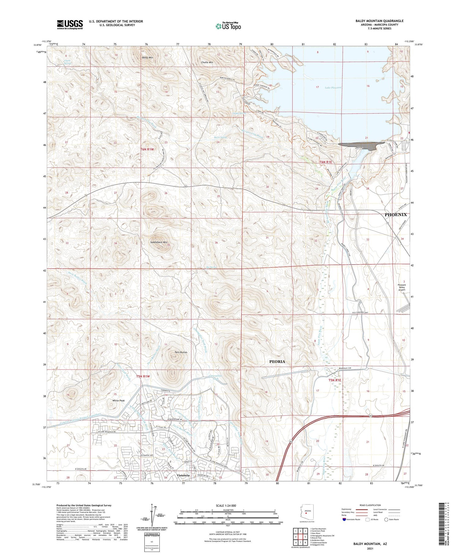
2021 topographic map quadrangle Baldy Mountain in the state of Arizona. Scale: 1:24000. Based on the newly updated USGS 7.5' US Topo map series, this map is in the following counties: Maricopa. The map contains contour data, water features, and other items you are used to seeing on USGS maps, but also has updated roads and other features. This is the next generation of topographic maps. Printed on high-quality waterproof paper with UV fade-resistant inks.
Quads adjacent to this one:
West: Hieroglyphic Mountains SW
Northwest: Garfias Mountain
North: Governors Peak
Northeast: New River
East: Biscuit Flat
Southeast: Hedgpeth Hills
South: Calderwood Butte
Southwest: McMicken Dam
This map covers the same area as the classic USGS quad with code o33112g3.
Contains the following named places: Baldy Mountain, Big Spring, Blackstone Country Club, Burro Spring, Camp Dyer Diversion Dam, Carl Pleasant Dam, Caterpillar Tank, Chalky Spring, Cholla Mountain, City of Peoria, Clementine Mine Airport, Coyote Springs, East Garambullo Wash, Garambullo Wash, Lake Carl Pleasant, Lake Pleasant, Lake Pleasant Inn, Lake Pleasant Landing Field, Lower Lake, Morgan City Wash, Morgan City Well, New Waddell Dam Heliport, Peoria Fire Department Station 199 Pleasant Harbor Marina, Pleasant Harbor Marina, Pleasant Harbor Recreational Vehicle Resort, Prince Mine, Saddleback Mountain, Twin Buttes, Vistancia, Vistancia Elementary School, West Fork White Peak Wash, West Garambullo Wash, White Peak, White Peak Mine, Windy Well, ZIP Code: 85383