MyTopo
Biscuit Flat Arizona US Topo Map
Couldn't load pickup availability
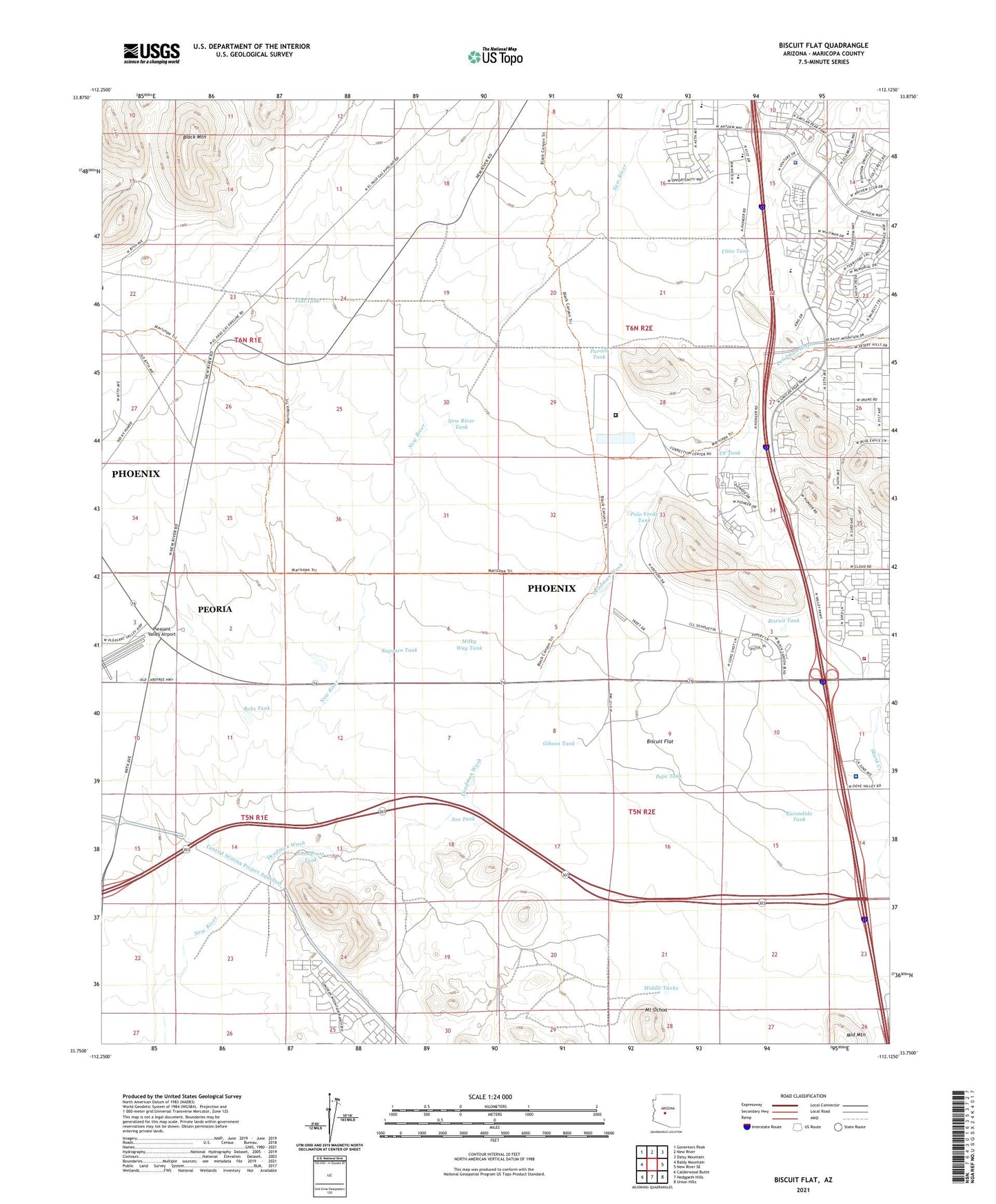
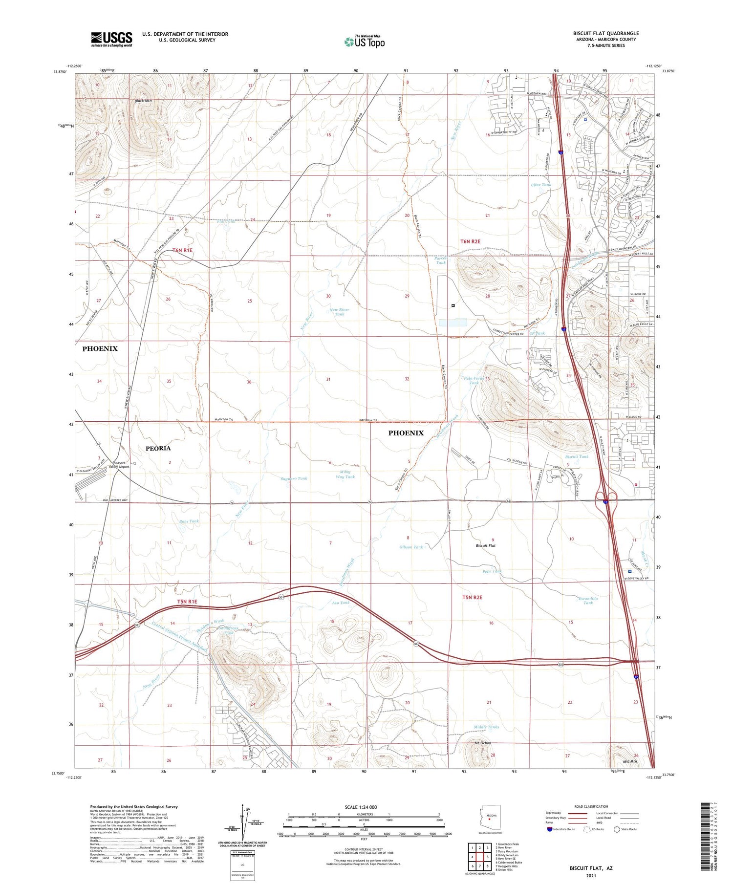
2021 topographic map quadrangle Biscuit Flat in the state of Arizona. Scale: 1:24000. Based on the newly updated USGS 7.5' US Topo map series, this map is in the following counties: Maricopa. The map contains contour data, water features, and other items you are used to seeing on USGS maps, but also has updated roads and other features. This is the next generation of topographic maps. Printed on high-quality waterproof paper with UV fade-resistant inks.
Quads adjacent to this one:
West: Baldy Mountain
Northwest: Governors Peak
North: New River
Northeast: Daisy Mountain
East: New River SE
Southeast: Union Hills
South: Hedgpeth Hills
Southwest: Calderwood Butte
This map covers the same area as the classic USGS quad with code o33112g2.
Contains the following named places: Anthem, Anthem School, Anthem Water Campus Water Treatment Plant, Aso Tank, Biscuit Flat, Biscuit Tank, Black Canyon Shooting Range, Black Mountain, Bobs Tank, Boulder Creek High School, Canyon Springs STEM Academy, CF Tank, Cline Tank, Cross of Christ Lutheran Church, Deadman Wash, Escondido Tank, Federal Correctional Institution Phoenix, Fellowship Church at Anthem, Flat Tank, Gibson Tank, Maricopa County Library District North Valley Regional Branch, Maricopa Tank, Middle Tanks, Milky Way Tank, Mount Ochoa, New River Tank, Palo Verde Tank, Pepe Tank, Phoenix Fire Department Station 56, Plaza de Alamos Shopping Center, Pleasant Valley Airport, Prime Outlets at New River Shopping Center, Purcell Tank, Saguaro Tank, Snodgrass Tank