MyTopo
Garfias Mountain Arizona US Topo Map
Couldn't load pickup availability
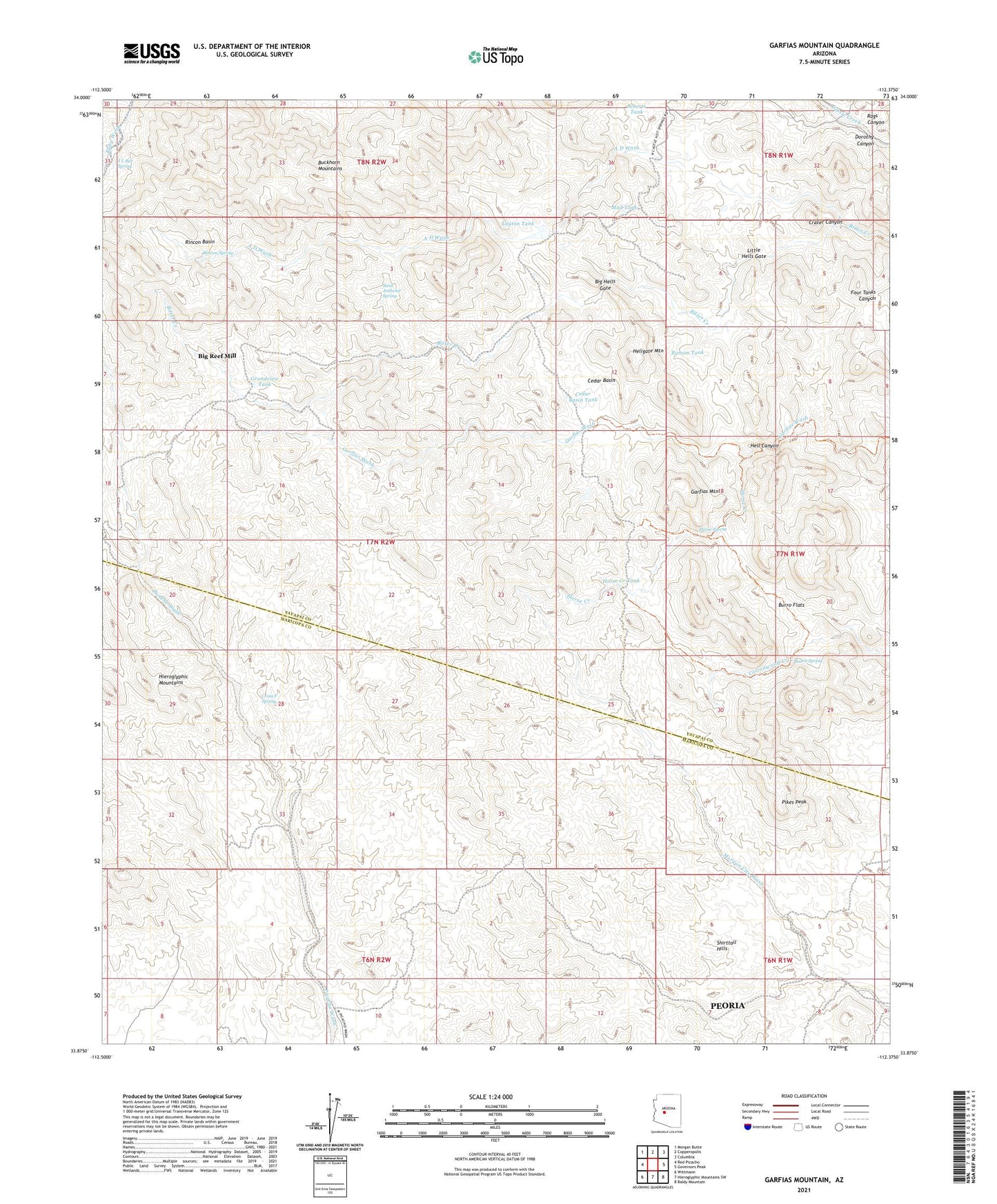
2021 topographic map quadrangle Garfias Mountain in the state of Arizona. Scale: 1:24000. Based on the newly updated USGS 7.5' US Topo map series, this map is in the following counties: Yavapai, Maricopa. The map contains contour data, water features, and other items you are used to seeing on USGS maps, but also has updated roads and other features. This is the next generation of topographic maps. Printed on high-quality waterproof paper with UV fade-resistant inks.
Quads adjacent to this one:
West: Red Picacho
Northwest: Morgan Butte
North: Copperopolis
Northeast: Columbia
East: Governors Peak
Southeast: Baldy Mountain
South: Hieroglyphic Mountains SW
Southwest: Wittmann
This map covers the same area as the classic USGS quad with code o33112h4.
Contains the following named places: A D Wash, Alberts Tank, Big Hells Gate, Big Reef Mill, Bog Ranch, Buckhorn Mountains, Burro Flats, Burro Spring, Cedar Basin, Cedar Basin Tank, Cross F Spring, Dorothy Canyon, Eleven L Ranch, Garfias Mountain, Grandview Tank, Hell Canyon, Hellgate Mountain, Hells Canyon Wilderness, Hieroglyphic Mountains, Horse Creek, Horse Creek Tank, Horse Spring, J L Bar Spring, Layton Tank, Little Hells Gate, Morgan City Mine, Mud Tank, Pikes Peak, Rags Canyon, Ramon Tank, Rincon Basin, Rincon Spring, Saint Anthony Mine, Saint Anthony Spring, Shirttail Hills, ZIP Code: 85342