MyTopo
Bright Angel Point Arizona US Topo Map
Couldn't load pickup availability
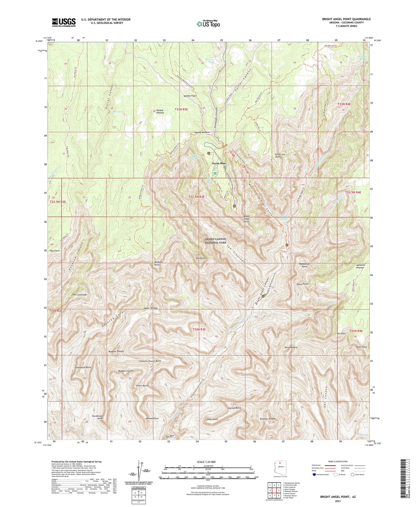
2021 topographic map quadrangle Bright Angel Point in the state of Arizona. Scale: 1:24000. Based on the newly updated USGS 7.5' US Topo map series, this map is in the following counties: Coconino. The map contains contour data, water features, and other items you are used to seeing on USGS maps, but also has updated roads and other features. This is the next generation of topographic maps. Printed on high-quality waterproof paper with UV fade-resistant inks.
Quads adjacent to this one:
West: Shiva Temple
Northwest: Kanabownits Spring
North: Little Park Lake
Northeast: Point Imperial
East: Walhalla Plateau
Southeast: Cape Royal
South: Phantom Ranch
Southwest: Grand Canyon
This map covers the same area as the classic USGS quad with code o36112b1.
Contains the following named places: Ariel Point, Brahma Temple, Bright Angel Point, Bright Angel Spring, Buddha Cloister, Buddha Temple, Clement Powell Butte, Cliff Dweller Spring, Cottonwood Camp, Deva Temple, Fuller Canyon, Grand Canyon Lodge, Greenland Spring, Harvey Meadow, Hattan Butte, Haunted Canyon, Hillers Butte, Johnson Point, Jones Point, Komo Point, Lower Thompson Spring, Manu Temple, Manzanita Creek, Manzanita Point, Marble Flats, North Kaibab Trail, North Rim, North Rim Inn, North Rim Post Office, Obi Point, Old Kaibab Trail, Outlet Canyon, Outlet Spring, Oza Butte, Ribbon Falls, Roaring Springs, Roaring Springs Campground, Roaring Springs Canyon, Schellbach Butte, Sturdevant Point, The Colonnade, The Transept, Thompson Canyon, Tiyo Point Trail, Transept Trail, Transept Trail Campgrounds, Uncle Jim Point, Wall Creek, Widforss Point, ZIP Code: 86052