MyTopo
Brooklyn Peak Arizona US Topo Map
Couldn't load pickup availability
Also explore the Brooklyn Peak Forest Service Topo of this same quad for updated USFS data
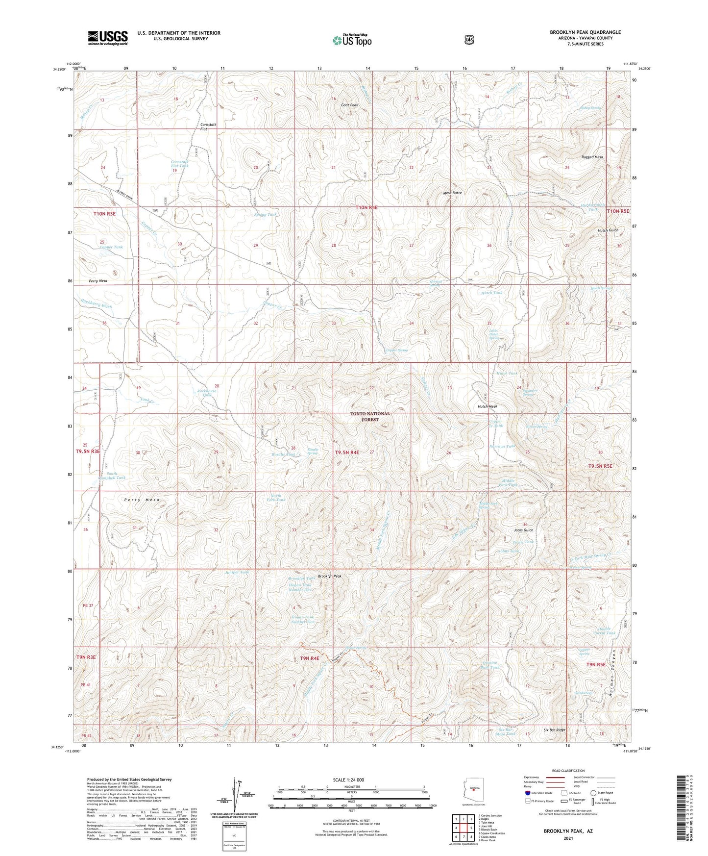
2023 topographic map quadrangle Brooklyn Peak in the state of Arizona. Scale: 1:24000. Based on the newly updated USGS 7.5' US Topo map series, this map is in the following counties: Yavapai. The map contains contour data, water features, and other items you are used to seeing on USGS maps, but also has updated roads and other features. This is the next generation of topographic maps. Printed on high-quality waterproof paper with UV fade-resistant inks.
Quads adjacent to this one:
West: Joes Hill
Northwest: Cordes Junction
North: Dugas
Northeast: Tule Mesa
East: Bloody Basin
Southeast: Rover Peak
South: Cooks Mesa
Southwest: Squaw Creek Mesa
This map covers the same area as the classic USGS quad with code o34111b8.
Contains the following named places: Bishop Spring, Brooklyn Mine, Brooklyn Peak, Brooklyn Tank, Brooklyn Well, Copper Creek Administrative Site, Copper Creek Cabin, Copper Creek Tank, Copper Spring, Copper Tank, Cornstalk Flat, Cornstalk Flat Tank, Crockett Cabin, Double Corral Tank, East Branch Squaw Creek, Goat Peak, Hardscrabble Tank, Hogan Cabin, Hogan Spring, Hogan Tank Number One, Hogan Tank Number Two, Hutch Mesa, Hutch Springs, Hutch Tank, Johns Tank, Juniper Spring, Juniper Tank, Little Hutch Spring, Mesa Butte, Middle Fork Spring, Middle Fork Tank, Narrows Tank, North Campbell Tank, North Fork Tank, Perry Mesa, Picnic Tank, Piedmont Well, Quinine Bush Tank, Rincon Spring, Rockhouse Tank, Rosalie Mine, Rosalie Spring, Rosalie Tank, Rugged Mesa, Rugged Well, Shirttail Spring, Six Bar Mesa Tank, Six Bar Ranch, Six Bar Ridge, South Campbell Tank, Spring Tank, Sycamore Spring, United Arizona Mine, Walnut Spring, Wanda Seep, Wood Camp Cabin, Wright Cabin