MyTopo
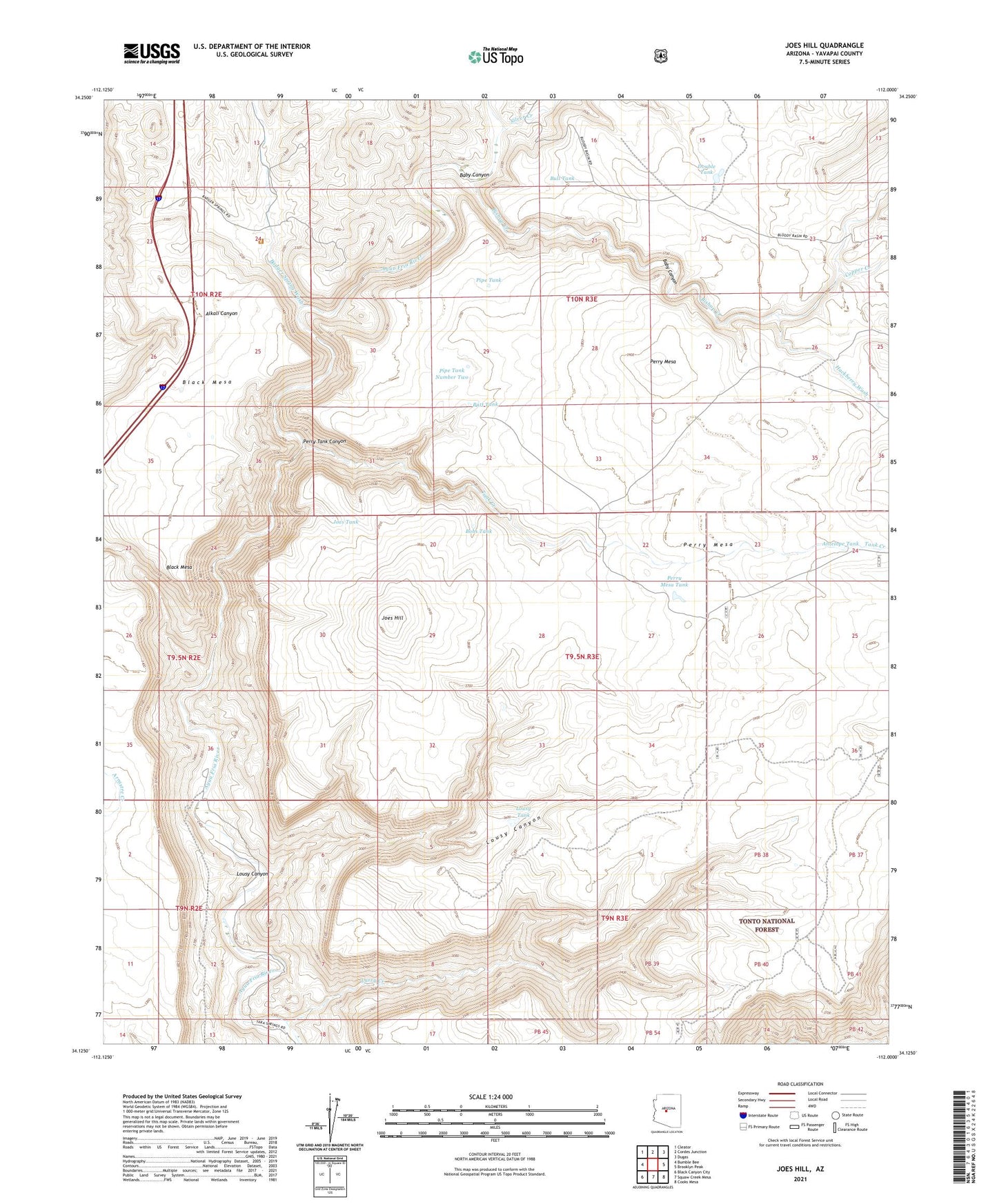
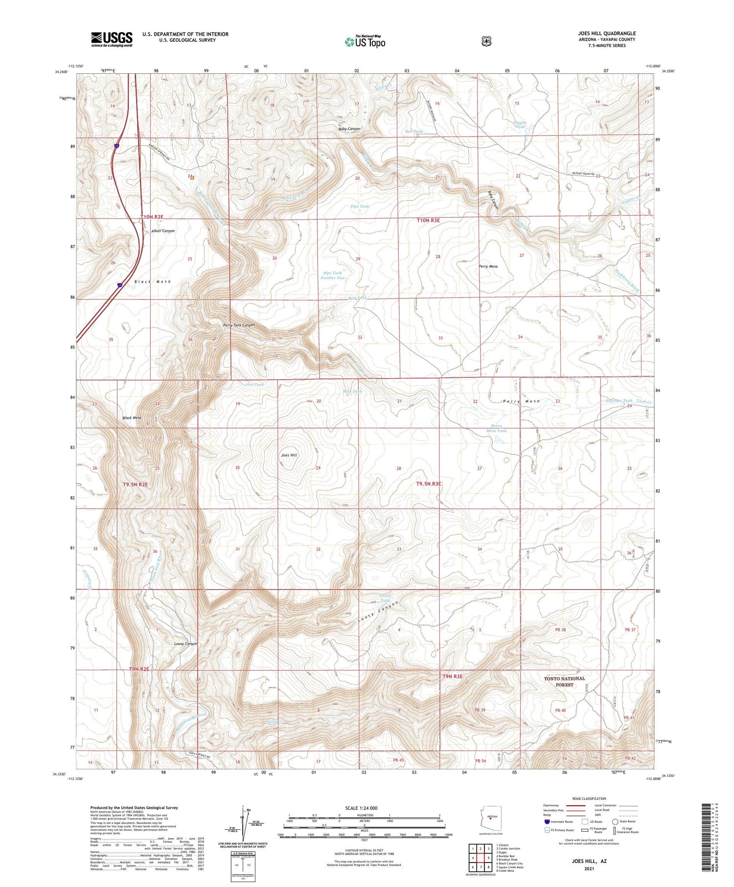
Joes Hill Arizona US Topo Map
Couldn't load pickup availability
Also explore the Joes Hill Forest Service Topo of this same quad for updated USFS data
2023 topographic map quadrangle Joes Hill in the state of Arizona. Scale: 1:24000. Based on the newly updated USGS 7.5' US Topo map series, this map is in the following counties: Yavapai. The map contains contour data, water features, and other items you are used to seeing on USGS maps, but also has updated roads and other features. This is the next generation of topographic maps. Printed on high-quality waterproof paper with UV fade-resistant inks.
Quads adjacent to this one:
West: Bumble Bee
Northwest: Cleator
North: Cordes Junction
Northeast: Dugas
East: Brooklyn Peak
Southeast: Cooks Mesa
South: Squaw Creek Mesa
Southwest: Black Canyon City
This map covers the same area as the classic USGS quad with code o34112b1.
Contains the following named places: Agua Fria National Monument, Antelope Tank, Baby Canyon, Badger Spring Wash, Batt Tank, Bishop Creek, Black Mesa, Bobs Tank, Bull Tank, Copper Creek, Double Tank, Hackberry Wash, Joes Hill, Joes Tank, Larry Creek, Lousy Canyon, Lousy Tank, New Windmill, North Fork Squaw Creek, Perry Mesa Tank, Perry Tank Canyon, Perry Windmill, Pipe Tank, Pipe Tank Number Two, Richinbar Mine, Ruins Tank, Silver Creek, Tank Creek