
MyTopo
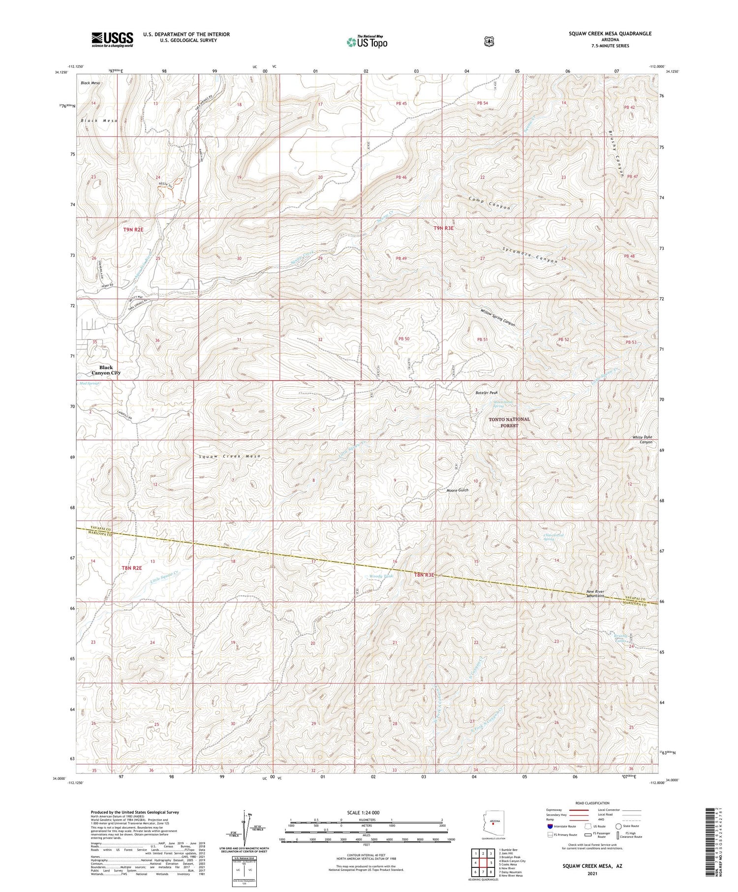
Squaw Creek Mesa Arizona US Topo Map
Couldn't load pickup availability
Also explore the Squaw Creek Mesa Forest Service Topo of this same quad for updated USFS data
2023 topographic map quadrangle Squaw Creek Mesa in the state of Arizona. Scale: 1:24000. Based on the newly updated USGS 7.5' US Topo map series, this map is in the following counties: Yavapai, Maricopa. The map contains contour data, water features, and other items you are used to seeing on USGS maps, but also has updated roads and other features. This is the next generation of topographic maps. Printed on high-quality waterproof paper with UV fade-resistant inks.
Quads adjacent to this one:
West: Black Canyon City
Northwest: Bumble Bee
North: Joes Hill
Northeast: Brooklyn Peak
East: Cooks Mesa
Southeast: New River Mesa
South: Daisy Mountain
Southwest: New River
This map covers the same area as the classic USGS quad with code o34112a1.
Contains the following named places: Black Canyon City Census Designated Place, Boteler Peak, Brushy Canyon, Brushy Tanks, Camp Canyon, Chino Corral Spring, Crizaba Mine, Cross Y Ranch Airport, Mud Springs, New Cabin Corral, New River Mountains, Orizaba Mine, Shortt Smith Spring, Squaw Creek, Squaw Creek Mesa, Sycamore Canyon, Trails End Airstrip, West Fork North Canyon Creek, Willow Spring Canyon, Woody Tank, ZIP Code: 85324


