MyTopo
Shonto NW Arizona US Topo Map
Couldn't load pickup availability
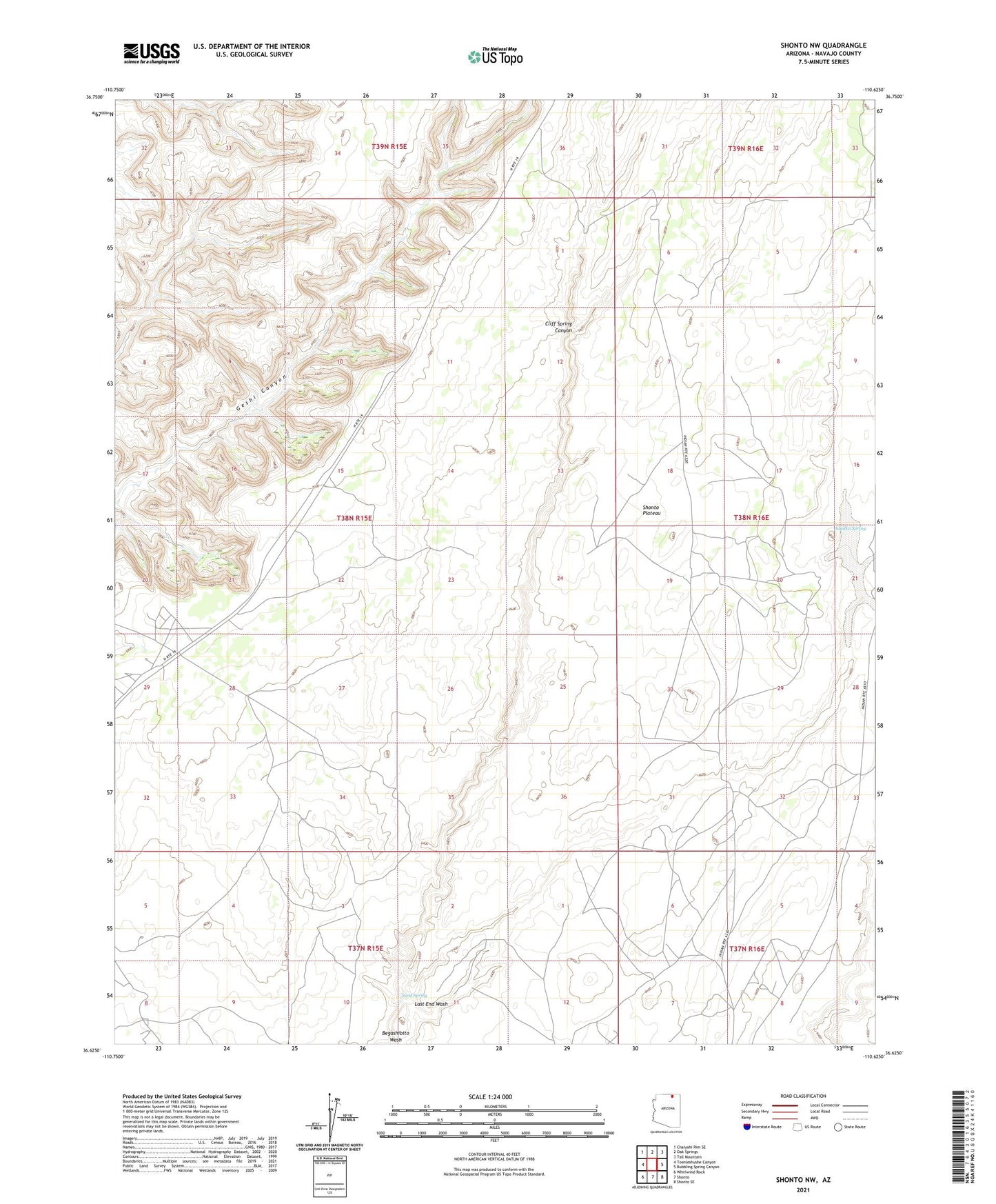
2021 topographic map quadrangle Shonto NW in the state of Arizona. Scale: 1:24000. Based on the newly updated USGS 7.5' US Topo map series, this map is in the following counties: Navajo. The map contains contour data, water features, and other items you are used to seeing on USGS maps, but also has updated roads and other features. This is the next generation of topographic maps. Printed on high-quality waterproof paper with UV fade-resistant inks.
Quads adjacent to this one:
West: Toenleshushe Canyon
Northwest: Chaiyahi Rim SE
North: Oak Springs
Northeast: Tall Mountain
East: Bubbling Spring Canyon
Southeast: Shonto SE
South: Shonto
Southwest: Whirlwind Rock
This map covers the same area as the classic USGS quad with code o36110f6.
Contains the following named places: Adadka Spring, Cliff Spring Canyon, Last End Wash, Sand Spring, Shonto Plateau